
8 routes · Hiking
One of the most scenic parts of the Tahoe Rim Trail, this section begins the visible transition from the arid slopes of the Carson Range to the lake-speckled glacial basins of the greater Sierra Nevada.
Also in California, United States of America
Hiking Difficult

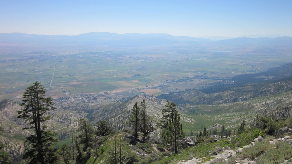
From the base of the ski runs near Kingsbury, the trail climbs steadily among impressively-large old-growth firs and pines, traversing the east aspect of Monument Peak. It crosses a few more ski runs, but they are barely noticeable when covered by shrubs and wildflowers instead of snow. As the trail ascends, the forest thins. Clearings open where trees are replaced by bushes and talus, and the views are simply jaw-dropping over Carson City below and Nevada’s mountains beyond.
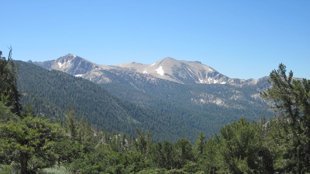
At Monument Pass, the trail crosses the spine of the range. Views remain equally as expansive as before, but now looking west toward the Sierras and Lake Tahoe. Dominating the horizon ahead is a huge craggy mountain with snow that remains throughout the summer. This is Freel Peak, the highest summit in the Tahoe Basin (10,886 feet).
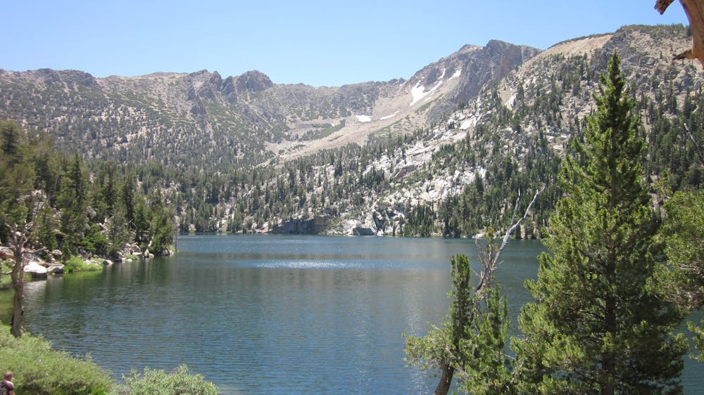
With this mountain and its neighbor, Jobs Sister, in your sights, continue southward through sunny forest to Star Lake. This picturesque pool sits beneath the imposing cliffs of Jobs Sister, collecting crisp meltwater from its perennial snowfields. Pause to enjoy an icy dip in the midday heat, or spend the night camping nearby.
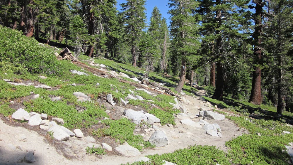
Beyond Star Lake comes a climb to the often-windy west shoulder of Freel Peak, with a commanding view of the mountains you have yet to cross. The following miles through boulder-strewn forest continue a gradual but noticeable progression into the rockier, granitic landscape of the Sierra Nevada, where more shimmering lakes and snowy peaks await.
Difficult
Hiking trails where obstacles such as rocks or roots are prevalent. Some obstacles can require care to step over or around. At times, the trail can be worn and eroded. The grade of the trail is generally quite steep, and can often lead to strenuous hiking.

The path is on completely flat land and potential injury is limited to falling over.

Away from help but easily accessed.
8 routes · Hiking