MTB Traverse Italian Alps

MTB traverse from Nauders to Garda and back to Bressanone
Difficult Mountain Biking
- Distance
- 773 km
- Ascent
- 24 km
- Descent
- 25 km
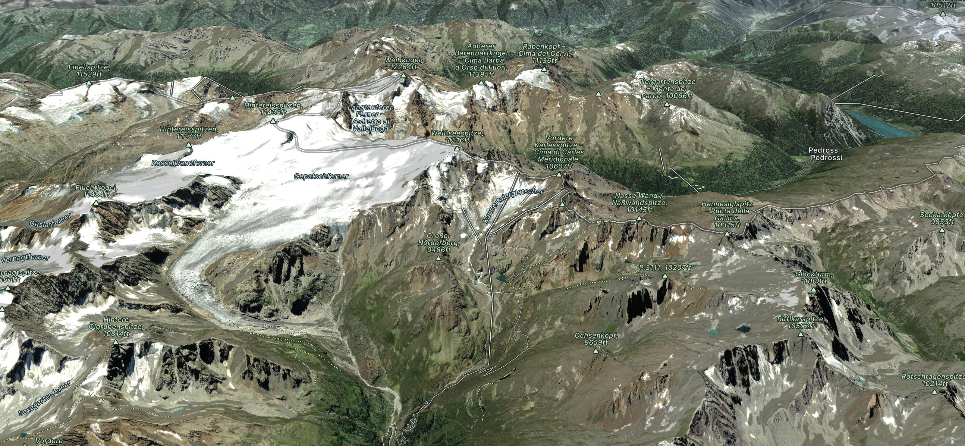
Explore Kaunertaler Gletscher with curated guides of the best routes. With over 4 3D trail maps in FATMAP, you can easily discover and navigate the best trails in Kaunertaler Gletscher.
No matter what your next adventure has in store, you can find a guide on FATMAP to help you plan your next epic trip.
Get a top trail recommendation in Kaunertaler Gletscher, or get inspired by the 4 local adventures uploaded by the FATMAP community. Start exploring now!
MTB traverse from Nauders to Garda and back to Bressanone
Difficult Mountain Biking

One slightly left is also doable but - depending on conditions - can be more rocky.
Difficult Freeride Skiing

Weissseespitze is a must, the north face is steep and a true pleasure to ride
Difficult Freeride Skiing

Weissseespitze is a must, the north face is steep and a true pleasure to ride
Difficult Freeride Skiing