Traversée de la Savoie

Traversée de la Haute-Savoie et de la Savoie par l'Est, de Saint-Gingolph à Modane
Severe Hiking
- Distance
- 245 km
- Ascent
- 14 km
- Descent
- 13 km
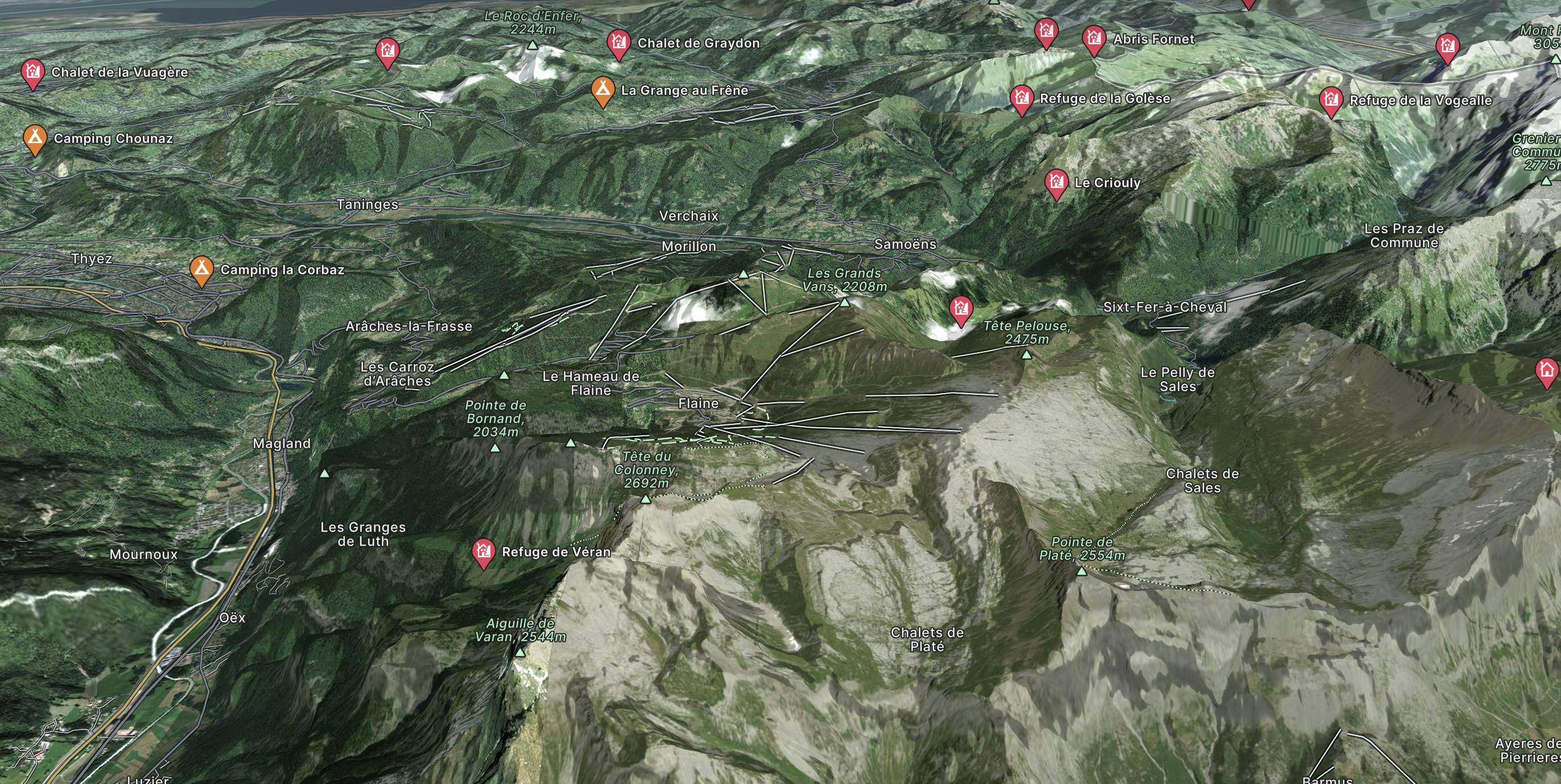
Go hiking in Flaine with curated guides of the best hikes across the region. With over 17 3D trail maps in FATMAP, you can easily discover and navigate the best trails in Flaine.
No matter what your next adventure has in store, you can find a guide on FATMAP to help you plan your next epic trip.
Get a top hiking trail recommendation in Flaine from one of our 1 guidebooks, or get inspired by the 17 local adventures uploaded by the FATMAP community. Start exploring now!
Traversée de la Haute-Savoie et de la Savoie par l'Est, de Saint-Gingolph à Modane
Severe Hiking
The trek back from the refuge de Sales back down to the Chalet du Lignon
Moderate Hiking

Hike up from the Gers car park to the Refuge du Lac de Gers
Moderate Hiking