Noshaq Hiking Trail
CLIMBING HISTORY At 7492m Noshaq is the fourth highest peak of the Hindukush range and the highest in Afghanistan. The mountain has four separate peaks . The main peak was climbed in 1960 along the south east ridge from the Qadzi Deh glacier by a Japanese expedition led by Professor Sakato. Other members of the expedition were G. Iwatsabo and T. Sakai. The second highest peak in this range is Noshaq East at 7480m climbed in 1963 by Dr Gerald Gruber and Rudolf Pischinger from Austria. The third highest peak of the range Noshaq Central is 7400m . The Austrian expedition of 1963 of Dr Gerald Gruber and Rudolf Pischinger are also credited with climbing the fourth peak of Noshaq range called Noshaq West at 7250m. The Afghan route follows the west ridge from where it is a relatively straightforward ascent and a polish expedition in 1973 made the first winter ascent successfully. During the Russian war the low Sad Istragah pass was used as a mujahedin supply route and some of the adjoining areas around Qazi Deh was heavily mined which does somewhat make it a risky. The Pakistan route has now considerably eased out permit regulations techinically this is the difficult route. CLIMBING ROUTE The peak is accessible through both Pakistan & Afghanistan as it is right on the border. Logistically the route through Pakistan is more convenient as things are more organized from this end. You follow the Tirich Mir route through the Lower & upper Tirich glaciers to Babu camp From here you branch out from the upper Tirich glacier towards Noshaq base camp. The climb involves crossing a moraine between two icefalls then a scree slope to the south ridge. The two ice falls flowing from Noshaq make it a technically difficult ascent from this side , three camps are established before final ascent is made. Alternately the other route through Afghanistan is from Badakshan & Wakhan. Though we have been organizing things in this area for the last 12 year but logistically its quite demanding. Approaching the peak through Afghanistan cost wise is more expensive as the area is still in the process of settling down and stabilizing, one has to " constantly relocate connection” over there !.
Also in K.P., Pakistan
Hiking Extreme
- Distance
- 36 km
- Ascent
- 5.2 km
- Descent
- 382 m
- Duration
- 1 day +
- Low Point
- 2.6 km
- High Point
- 7.4 km
- Gradient
- 43˚
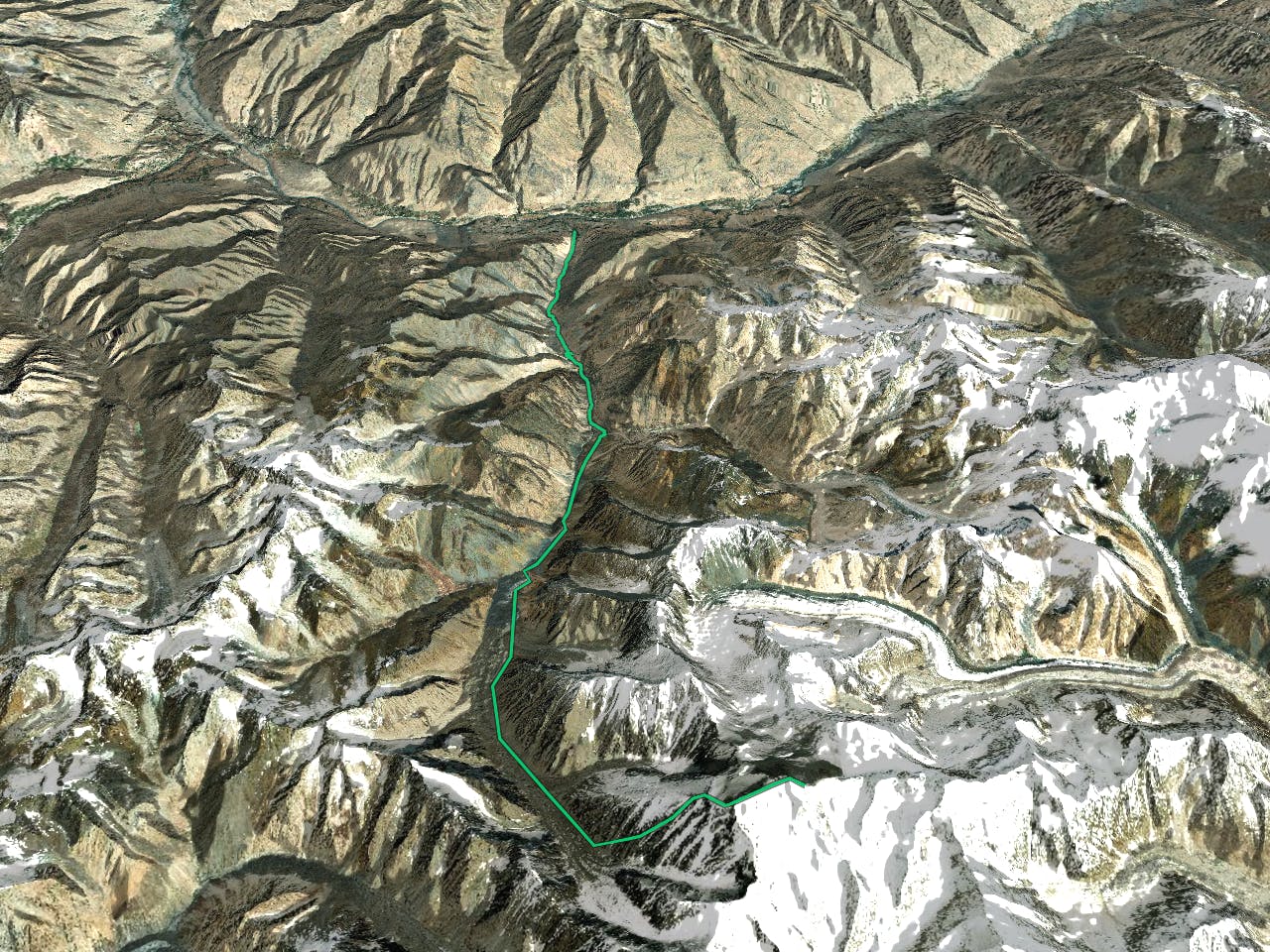
CLIMBING HISTORY At 7492m Noshaq is the fourth highest peak of the Hindukush range and the highest in Afghanistan. The mountain has four separate peaks . The main peak was climbed in 1960 along the south east ridge from the Qadzi Deh glacier by a Japanese expedition led by Professor Sakato. Other members of the expedition were G. Iwatsabo and T. Sakai. The second highest peak in this range is Noshaq East at 7480m climbed in 1963 by Dr Gerald Gruber and Rudolf Pischinger from Austria. The third highest peak of the range Noshaq Central is 7400m . The Austrian expedition of 1963 of Dr Gerald Gruber and Rudolf Pischinger are also credited with climbing the fourth peak of Noshaq range called Noshaq West at 7250m.
Description
The Afghan route follows the west ridge from where it is a relatively straightforward ascent and a polish expedition in 1973 made the first winter ascent successfully. During the Russian war the low Sad Istragah pass was used as a mujahedin supply route and some of the adjoining areas around Qazi Deh was heavily mined which does somewhat make it a risky. The Pakistan route has now considerably eased out permit regulations techinically this is the difficult route. CLIMBING ROUTE The peak is accessible through both Pakistan & Afghanistan as it is right on the border. Logistically the route through Pakistan is more convenient as things are more organized from this end. You follow the Tirich Mir route through the Lower & upper Tirich glaciers to Babu camp From here you branch out from the upper Tirich glacier towards Noshaq base camp. The climb involves crossing a moraine between two icefalls then a scree slope to the south ridge. The two ice falls flowing from Noshaq make it a technically difficult ascent from this side , three camps are established before final ascent is made.
Alternately the other route through Afghanistan is from Badakshan & Wakhan. Though we have been organizing things in this area for the last 12 year but logistically its quite demanding. Approaching the peak through Afghanistan cost wise is more expensive as the area is still in the process of settling down and stabilizing, one has to " constantly relocate connection” over there !.
Difficulty
Extreme
Scrambling up mountains and along technical trails with moderate fall exposure. Handholds are necessary to navigate the trail in its entirety, although they are not necessary at all times. Some obstacles can be very large and difficult to navigate, and the grades can often be near-vertical. The challenge of the trail and the steepness of the grade results in very strenuous hiking. Hikes of this difficulty blur the lines between "hiking" and "climbing".
Low Exposure

The path is on completely flat land and potential injury is limited to falling over.
Remoteness

In the high mountains or remote conditions, all individuals must be completely autonomous in every situation.
Best time to visit
Features
- Alpine
- Wildlife
- Historical
- Picturesque
- Summit Hike
- Wild flowers
- Water features
- Forestry or heavy vegetation