Goranxi-Delvine
Hiking South Albania
Also in Vlorë, Albania
Hiking Difficult
- Distance
- 21 km
- Ascent
- 1.5 km
- Descent
- 1.5 km
- Duration
- 6-7 hrs
- Low Point
- 205 m
- High Point
- 1.6 km
- Gradient
- 20˚
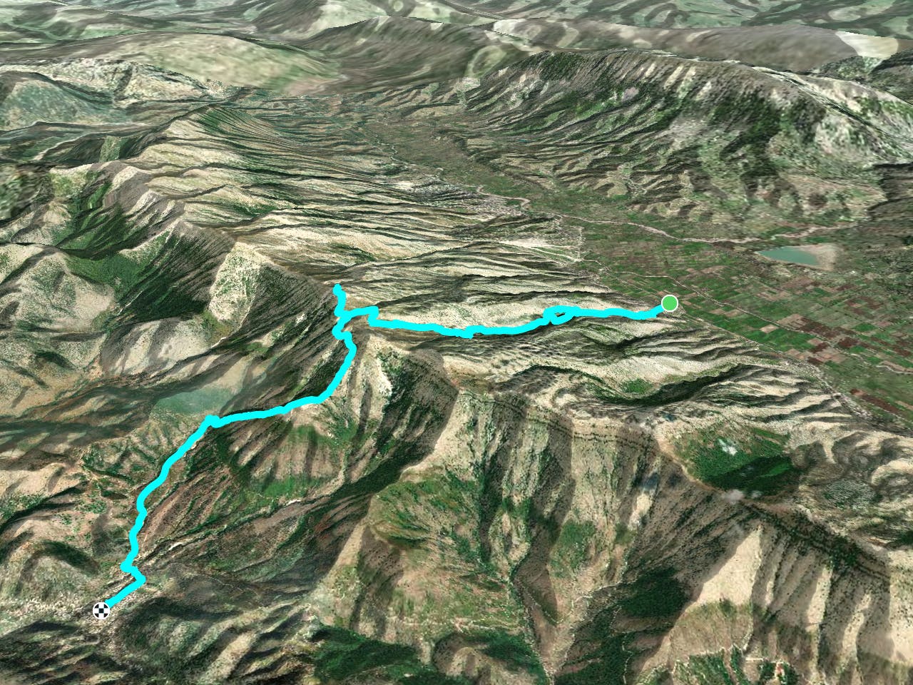
This is a popular hiking route which is generally considered to be difficult. It's remote, it features high exposure and is typically done all year round. From a low point of 205 m to the maximum altitude of 1.6 km, the route covers 21 km, 1509 vertical metres of ascent and 1504 vertical metres of descent.
Description
For more detailed information, contact the website address: https://hiking-south-albania.business.site or the official Instagram address: @hiking.south.albania
Difficulty
Difficult
Hiking trails where obstacles such as rocks or roots are prevalent. Some obstacles can require care to step over or around. At times, the trail can be worn and eroded. The grade of the trail is generally quite steep, and can often lead to strenuous hiking.
High Exposure

Some trail sections have exposed ledges or steep ascents/descents where falling could cause serious injury.
Remoteness

Away from help but easily accessed.
Best time to visit
Features
- Picturesque
- Summit Hike
- Wild flowers