Laluci Summit (2155m) "Hiking South Albania"
Hiking guide by "Hiking South Albania", (Top of Laluci)
Hiking Difficult
- Distance
- 4.6 km
- Ascent
- 1.3 km
- Descent
- 116 m
- Duration
- 3-4 hrs
- Low Point
- 969 m
- High Point
- 2.1 km
- Gradient
- 27˚

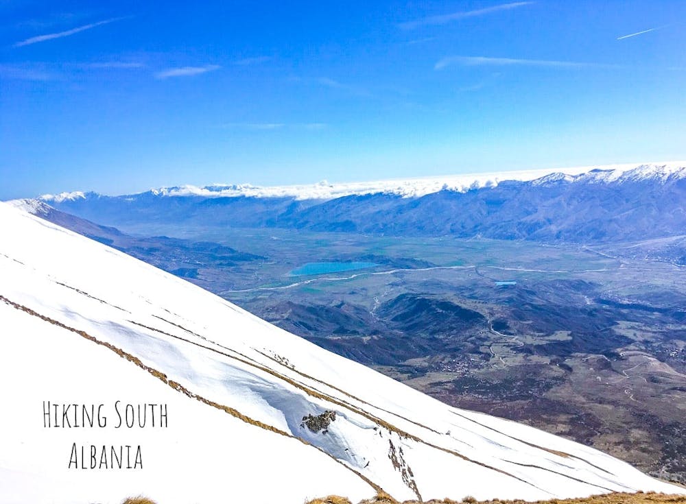
Laluc Peak is located on Lunxherisa Mountain east of the city of Gjirokastra and is the highest point of this mountain. At the top of the mountain you can see the beautiful landscape that nature offers, where the whole valley of Drinos, the city of Gjirokastra and the surrounding villages are clearly visible. The terrain is rocky and with low vegetation.For more detailed information, contact the website address: https://hiking-south-albania.business.site or the official Instagram address: @hiking.south.albania
- •
- •
Difficulty
Difficult
Hiking trails where obstacles such as rocks or roots are prevalent. Some obstacles can require care to step over or around. At times, the trail can be worn and eroded. The grade of the trail is generally quite steep, and can often lead to strenuous hiking.
High Exposure

Some trail sections have exposed ledges or steep ascents/descents where falling could cause serious injury.
Remoteness

Away from help but easily accessed.
Best time to visit
Features
- Alpine
- Historical
- Picturesque
- Summit Hike