Maja Kollates 2555m in Winter
Maja Kollates 2555m in Winter
Alpine Climbing Difficult
- Distance
- 17 km
- Ascent
- 1.7 km
- Descent
- 1.7 km
- Low Point
- 932 m
- High Point
- 2.5 km
- Gradient
- 21˚

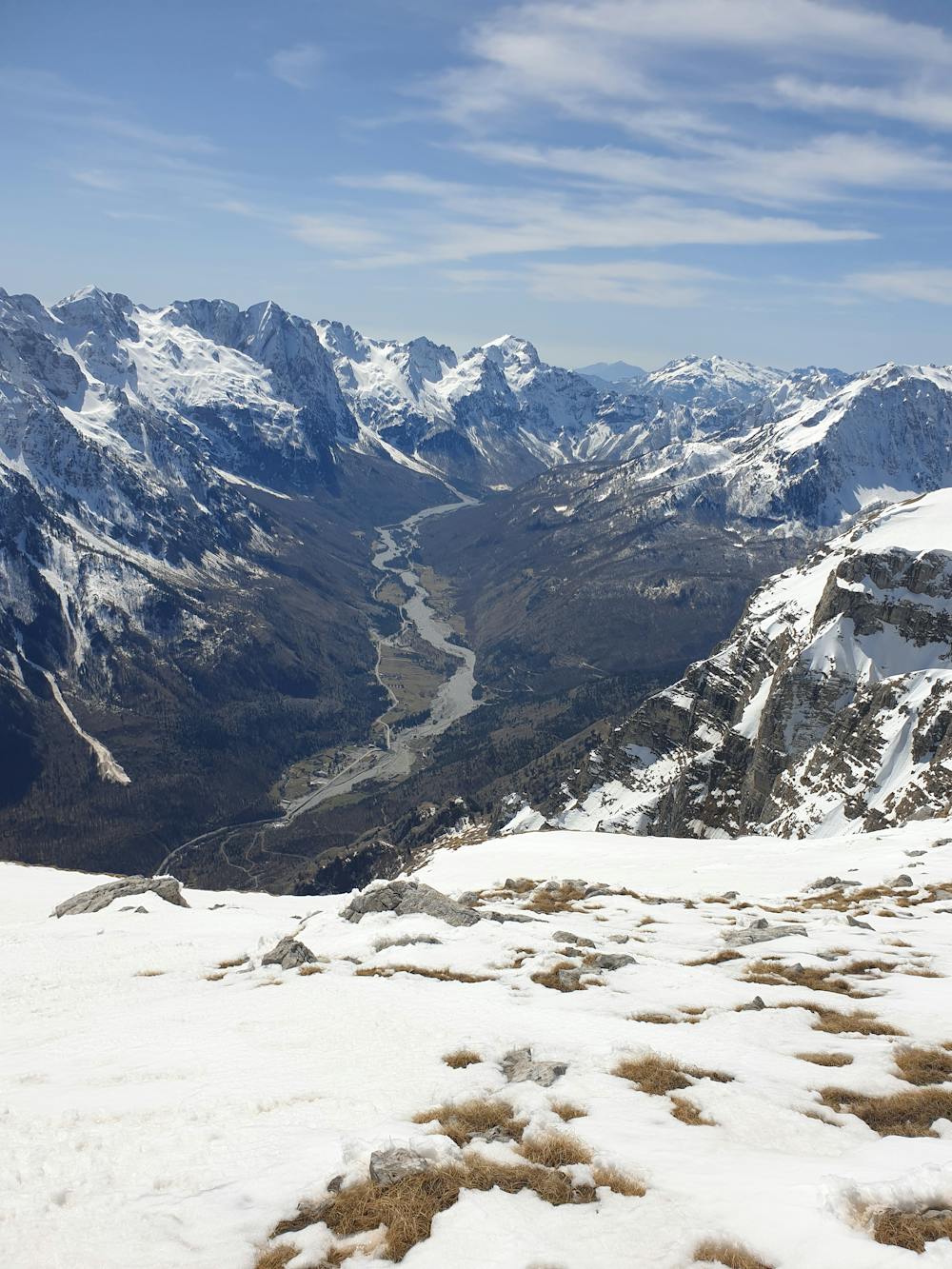
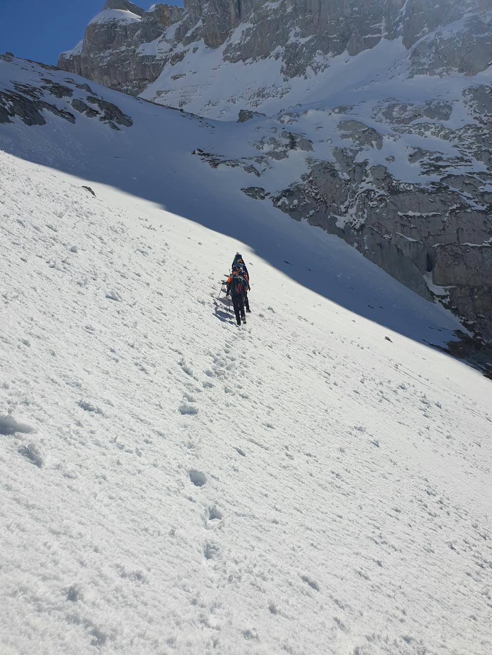
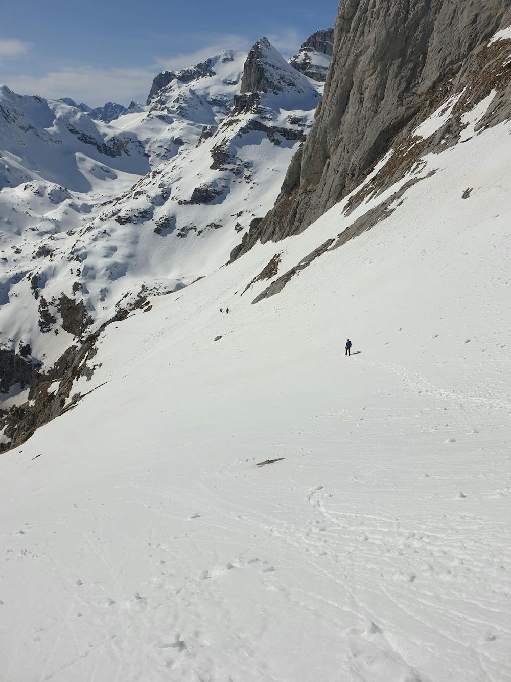
Maja e Kollates is one of many summits in Valbone valley and is located on the border between Albania and Montenegro.Trail to Kollata is the same with Maja e Thate and at the hut, 4,63km/1814m, trail deviate on the right. This part is very steep and it is better with snow. In winter it is mandatory to have ICE AXE, CRAMPONS and ROPE. During this trail there is one point 50-70m long which is very dangerous in winter if the trail is cover with ice. This point is located 5.66km and altitude 2026m. This point is very exposed, and a rope is mandatory in case there is ice. After this part we continued up on the direction of north. The view from Rodi I Kollates is magnificent. On the way back at altitude 2484m we cut it short and this bypass is evident on the map. You are pleased to not follow this route during the ascend as in same parts it is very steep and dangerous. Some data recorded with Garmin Fenix 7 Pro Distance to summit 8.67 km ascended in 6 h 25 min Elevation gain 1747 m Total Distance 16.83 km Elapsed time 10 h 23 min
- •
- •
- •
Difficulty
Difficult
The beginning of truly technical terrain which might involve pitched climbing on rock and/or ice, exposed terrain and complex route finding in ascent and descent. Equivalent to AD, AD+
High Exposure

Much of the route is difficult to protect and a fall could be disastrous at certain points.
Remoteness
Little chance of being seen or helped in case of an accident.
Best time to visit
Equipment required
- Ice axe
- Crampons
- 2 Ice Axes