Maja Thate 2541m, Boge
Maja Thate in Boge is located between Maja Livadhit and Maja Radohimes
Hiking Difficult
- Distance
- 17 km
- Ascent
- 1.5 km
- Descent
- 1.5 km
- Duration
- 5-6 hrs
- Low Point
- 1.1 km
- High Point
- 2.5 km
- Gradient
- 20˚

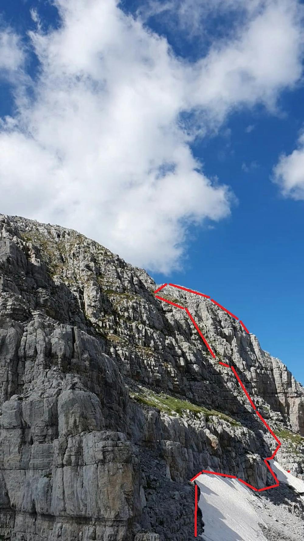
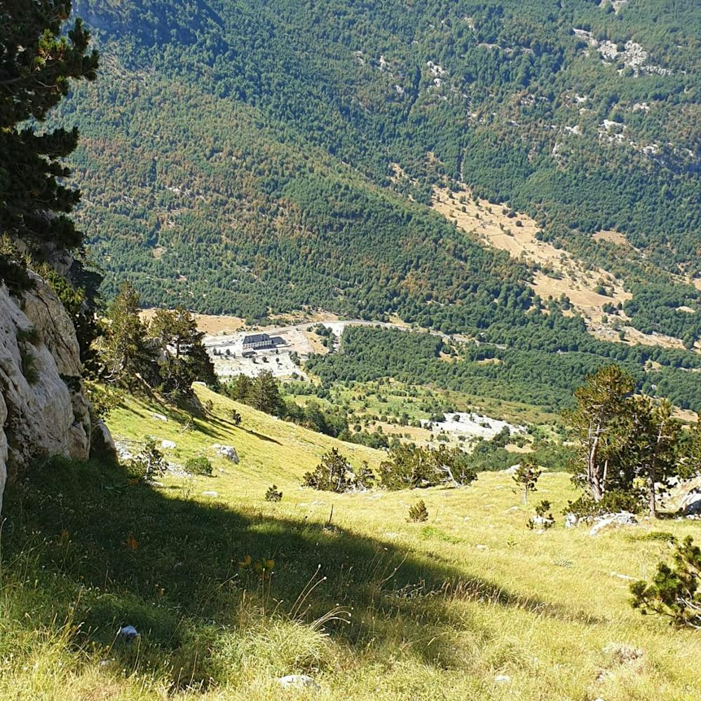
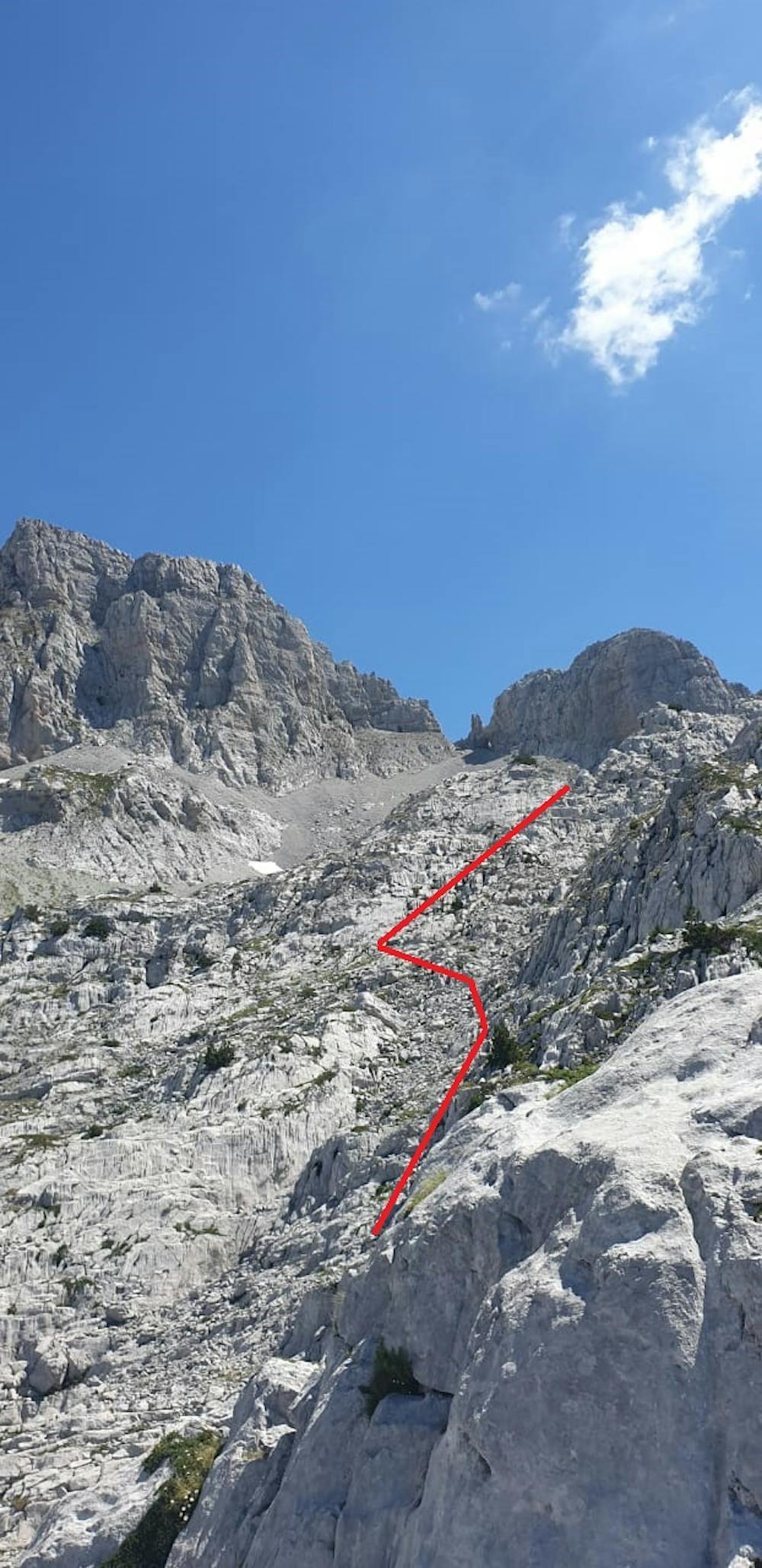
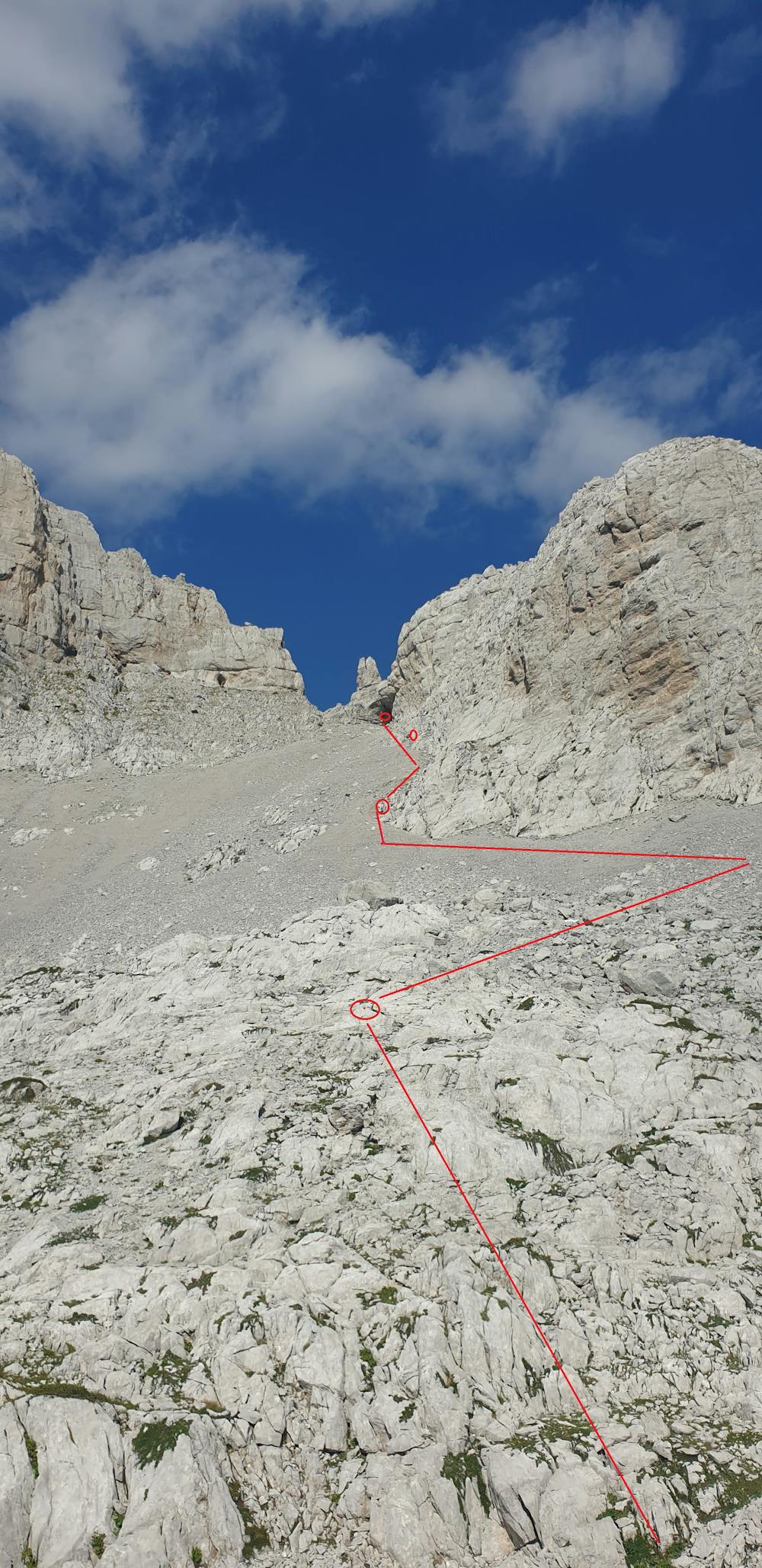
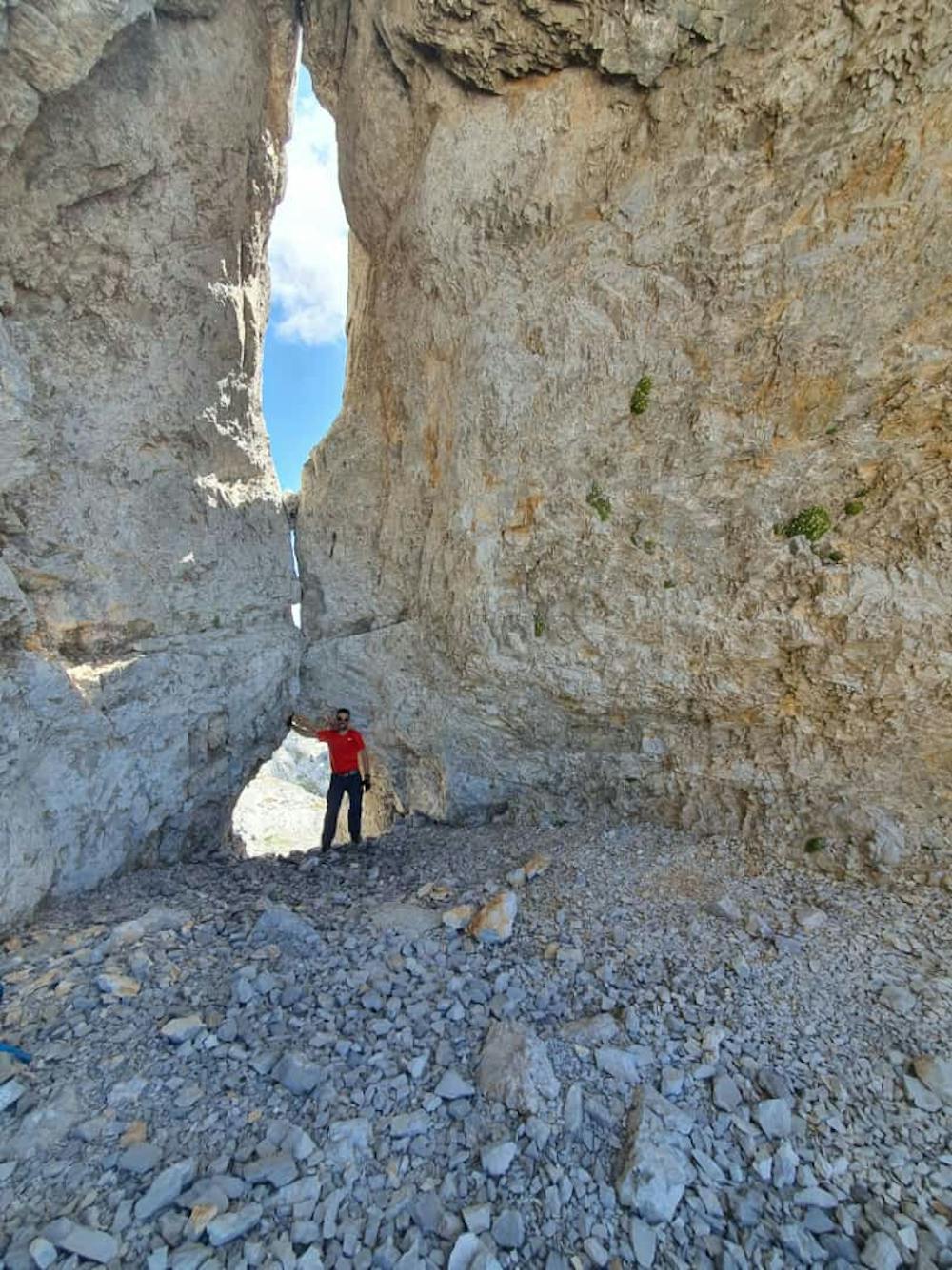
Maja Thate in Boge is located between Maja Livadhit and Maja Radohimes. Actually there is not any path there except some short path of Mountain Goats. As we did not have any reference GPX trail we started this route as exploration to reach the summit so there are some parts on the route where we have deviated. The trailhead start from Fushe-Okol in Boge at altitude 1100m. We proceeded for 950m till we reached a wide road and at 1.2km deviated on the left through a mountain path. At the point where we reached the valley between Maja Omekut on the left and the other mountain on right (without name), roughly 2km from trailhead, started to go up the valley. Check Path 1. Path through the valley is covered with grass and is roughly 1.5km with a slope that start at 20% and goes up to 60%. After the valley we walked on a path with stones till at the Rock with Hole which is roughly 4.8 km from the trailhead at an altitude 2300m. Check photo Path 2 and Path 3. We walked according to red lines on the photo. We have put red signs all over the trail so you can have them as reference. Before reaching the Rock with hole we deviated on the left to find any path. At Rock with Hole you have to go through the hole and turn left. Then you proceed according to red signs. At roughly 6.5km, 2370m, we found the only path that goes up. Check photo Path 4. This section part of the path is roughly 150 m and it is very dangerous, you should have very good climbing skills and need to have a rope. We have put red circle signs all over the trail and does not mean that there is no other route. You can use them, free charge, as reference or try any other path. So the ascending trail up to the summit is roughly 6.5km and we did it for 6h15min with an elevation gain of 1660m. From the summit the view is as always magnificent.
- •
- •
- •
- •
- •
Difficulty
Difficult
Hiking trails where obstacles such as rocks or roots are prevalent. Some obstacles can require care to step over or around. At times, the trail can be worn and eroded. The grade of the trail is generally quite steep, and can often lead to strenuous hiking.
High Exposure

Some trail sections have exposed ledges or steep ascents/descents where falling could cause serious injury.
Remoteness

Close to help in case of emergency.
Best time to visit
Features
- Alpine
- Wildlife
- Picturesque
- Summit Hike
- Dog friendly
- Wild flowers