Mount Warning
Mount Warning offers a challenging, but the trail to the top is well worth the effort for the views of the surrounding countryside.
Hiking Moderate
- Distance
- 8.5 km
- Ascent
- 657 m
- Descent
- 657 m
- Duration
- 2-3 hrs
- Low Point
- 442 m
- High Point
- 1.1 km
- Gradient
- 11˚

Mount Warning, also known as Wollumbin, is a mountain located in the Tweed Range in northeastern New South Wales, Australia. It is the central peak of the Tweed Volcano, the remains of which form the caldera that includes the Tweed Valley. The mountain is a popular hiking destination and offers a challenging 8.5km / 3-4 hour hike to the summit.
Description
The hike to the top of Mount Warning begins at the base of the mountain, where there is a car park and visitor center. From there, the trail follows a well-marked path through dense rainforest, passing by cascading streams and waterfalls along the way. The trail then begins to climb more steeply, gaining elevation as it makes its way up the mountain.
As hikers ascend, they will encounter a variety of vegetation, including tall eucalyptus trees and a variety of ferns and other rainforest plants. The trail is rocky in places, with some steep sections that require careful footing.
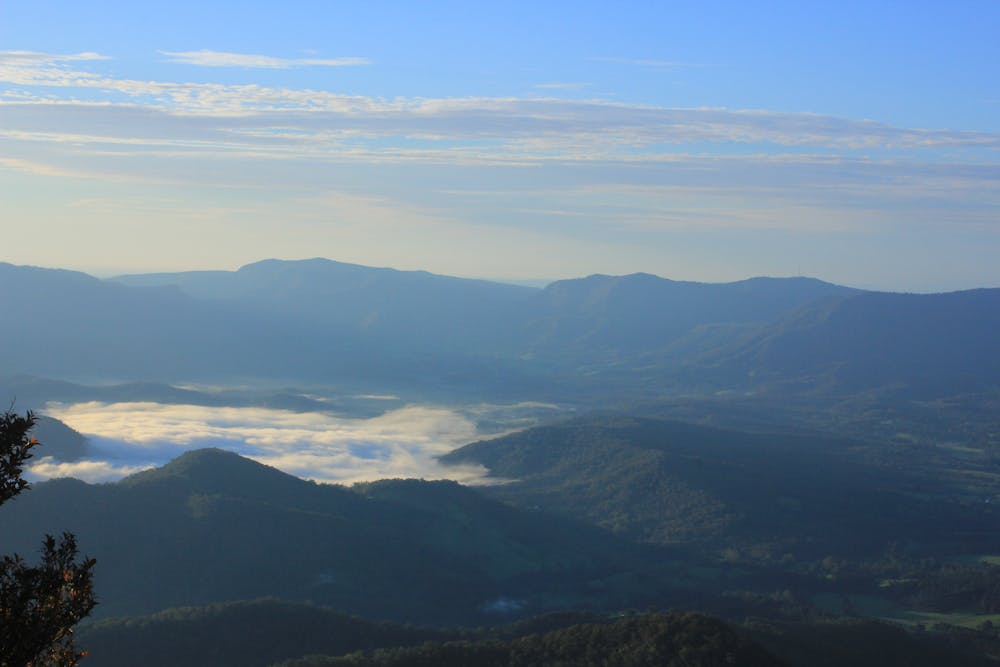
At the summit, hikers are rewarded with breathtaking views of the surrounding landscape, including the Tweed Valley and the Gold Coast hinterland. The summit also features a rock cairn, which marks the highest point on the mountain.
Overall, the hike to the top of Mount Warning is a challenging but rewarding experience, offering a chance to experience the beauty of the rainforest and take in stunning views of the surrounding landscape. It is recommended for experienced hikers in good physical condition, as it is a strenuous hike that requires a good level of fitness.
Difficulty
Moderate
Hiking along trails with some uneven terrain and small hills. Small rocks and roots may be present.