Big Bend Walk
Carnarvon Gorge Walk
Hiking Moderate
- Distance
- 19 km
- Ascent
- 531 m
- Descent
- 531 m
- Duration
- 4-5 hrs
- Low Point
- 413 m
- High Point
- 550 m
- Gradient
- 8˚
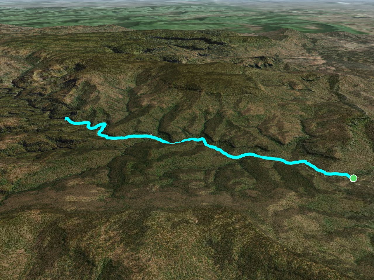
This is a popular hiking route which is generally considered to be moderate. It's very remote, it features medium exposure and is typically done in an unknown time of year. From a low point of 413 m to the maximum altitude of 550 m, the route covers 19 km, 531 vertical metres of ascent and 531 vertical metres of descent.
- •
- •
- •
Description
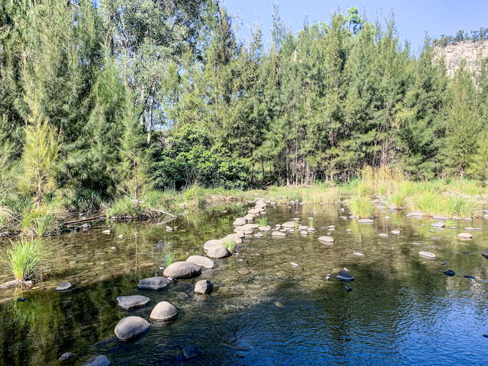
The walk follows the Carnarvon Creek and is relatively flat. The side trips can be steep. Be ready for plenty of creek crossings
Difficulty
Moderate
Hiking along trails with some uneven terrain and small hills. Small rocks and roots may be present.
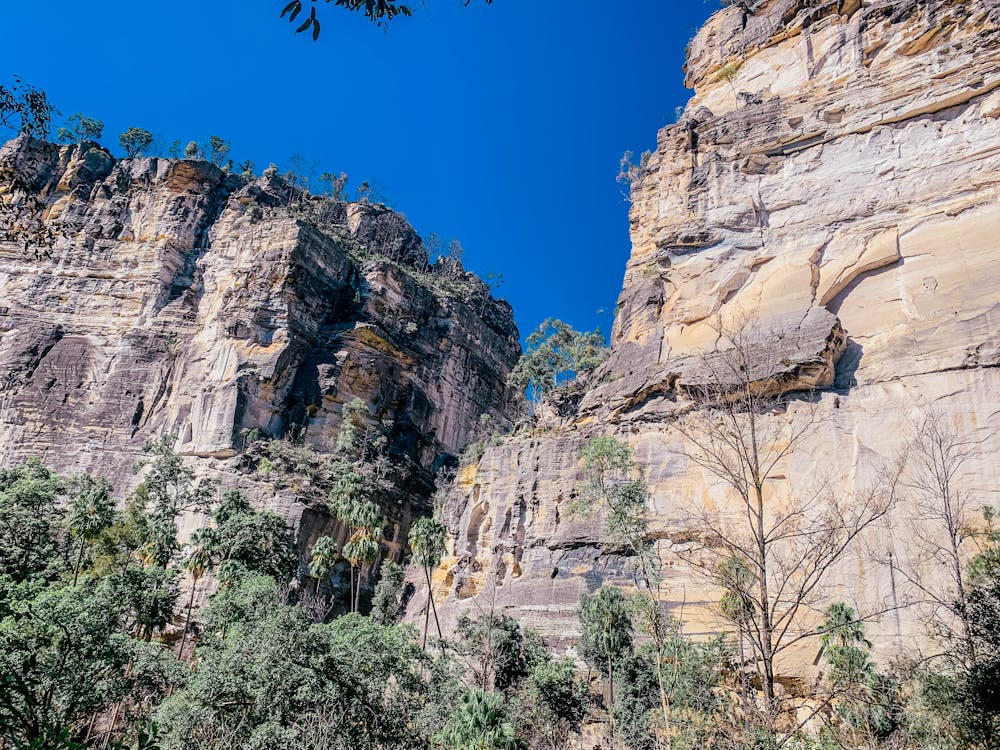
Medium Exposure

The trail contains some obstacles such as outcroppings and rock which could cause injury.
Remoteness

Little chance of being seen or helped in case of an accident.
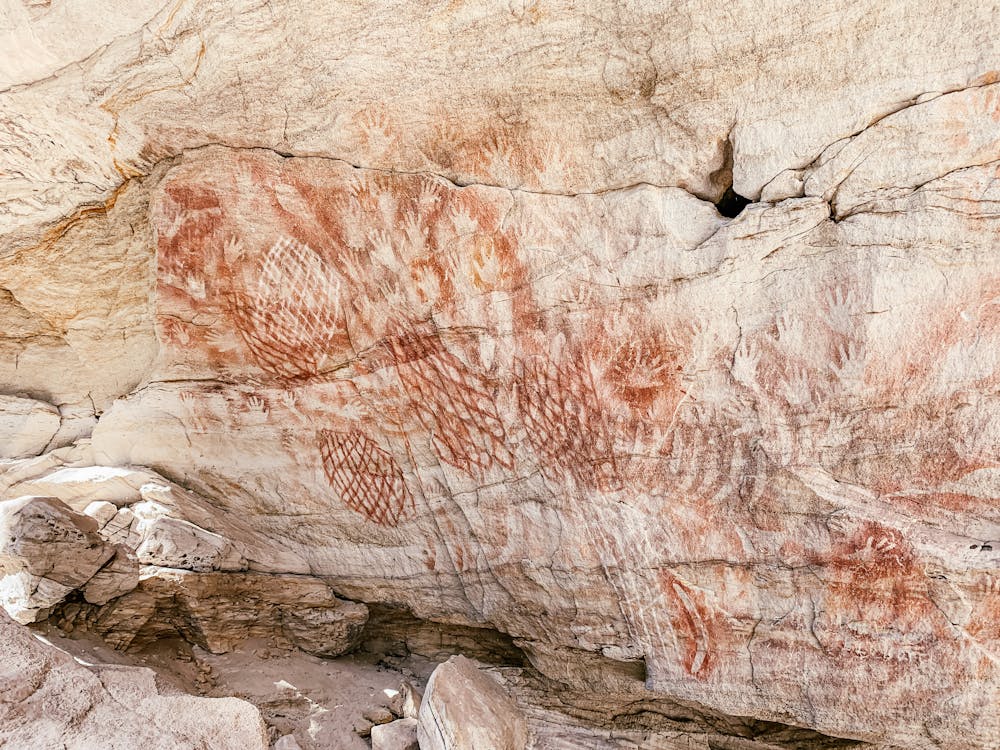
Features
- Wildlife
- Historical
- Picturesque
- Forestry or heavy vegetation