Lesmurdie Falls
The walk to Lesmurdie Falls is a family-friendly hike that follows a series of cascades up through the Lesmurdie Brook.
Hiking Easy
- Distance
- 2.5 km
- Ascent
- 116 m
- Descent
- 117 m
- Duration
- 0-1 hrs
- Low Point
- 71 m
- High Point
- 182 m
- Gradient
- 7˚

Lesmurdie Falls is a popular bushwalking and hiking destination located in the Perth Hills area of Western Australia, about a 45-minute drive from the city of Perth. The hike to Lesmurdie Falls is a family-friendly 2.5km walk that takes about an hour, depending on your pace and how long you spend at the falls.
Description
The hike begins at the Lesmurdie Falls car park, which is located off of Falls Road in the suburb of Lesmurdie. From the car park, follow the well-marked trail through the bushland of the Perth Hills. The trail is mostly flat, but there are some steep sections with stairs and uneven terrain.
As you walk, you'll pass through a variety of vegetation including eucalyptus trees, banksias, and wildflowers. The trail winds through the bushland and passes by several small creeks before reaching the falls.
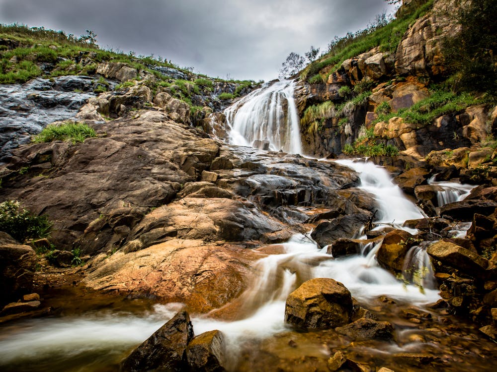
The falls themselves are a series of cascades that flow over a rocky outcropping and into a deep pool at the base. The falls are most impressive after heavy rain, but they are worth visiting at any time of year. There are several viewing platforms and lookout points along the trail that offer stunning views of the falls and the surrounding bushland.
After enjoying the falls, you can return the way you came to complete the hike or choose to follow a loop through the Lesmurdie Falls National Park. It's a good idea to bring plenty of water, a hat, and sunscreen, as the sun can be intense in the Perth Hills.
Difficulty
Easy
Walking along a well-kept trail that’s mostly flat. No obstacles are present.
Remoteness

Close to help in case of emergency.
Best time to visit
Features
- Dog friendly
- Water features
- Family friendly