Goisererhütte und Hoher Kalmberg
Dachstein Salzkammergut
From Bad Goisern at Hallstättersee to the Goisererhütte and Hohen Kalmberg
Hiking Difficult
- Distance
- 5.9 km
- Ascent
- 1.2 km
- Descent
- 2 m
- Duration
- 3-4 hrs
- Low Point
- 634 m
- High Point
- 1.8 km
- Gradient
- 16˚

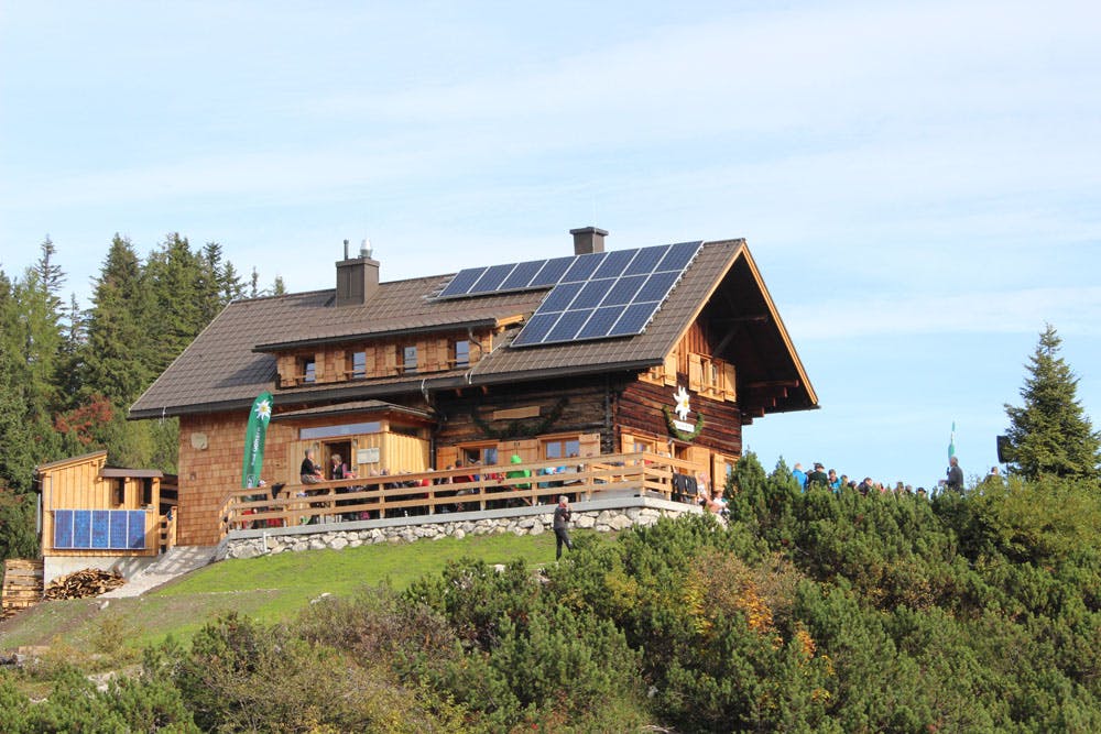
The three hour hike starts at the parking lot "Trockentann" (Nordic centre, village Ramsau). From here you can already see the exposed hut at the Ramsaugebirge. First follow the markings along the forest road, which serves as a popular toboggan run in winter, up to the alpine huts of Trockentann. Passing the "Wallman-Poldl-Rast" and the "Dichtlerin" (spring), which is about 15 minutes below the hut, you arrive at the Goiserer hut. After a short rest we continue in the direction of Hohen Kalmberg. The path leads past the "Kalmooskirche", an impressive cave. At the time of the Counter-Reformation Protestant church services were secretly held here. In addition, one of the lucky places of the Dachstein Salzkammergut region is located here.
Description
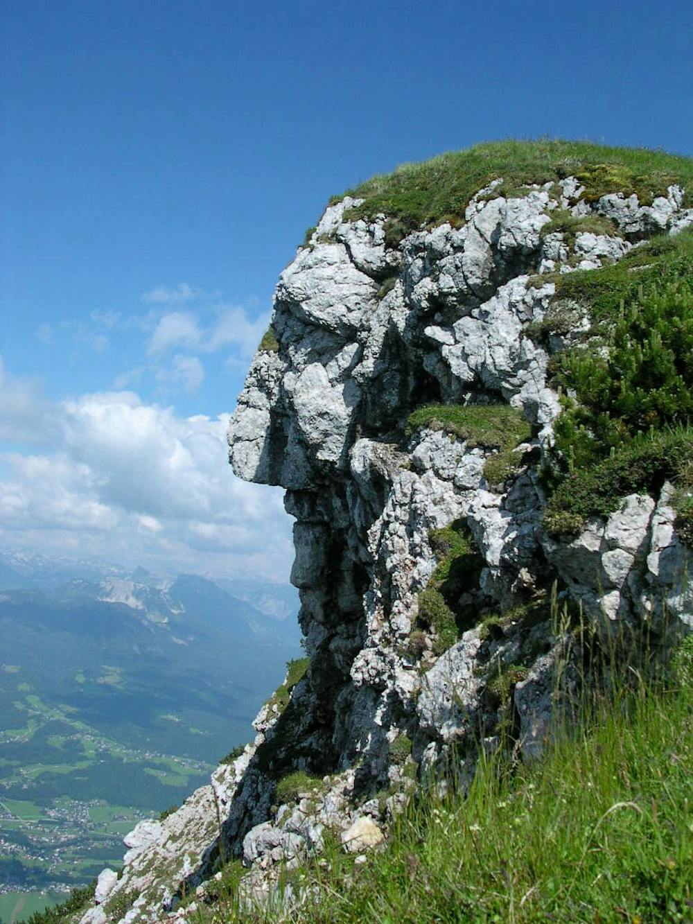
The 45-minute walk meanders through rocks and rocks up to the Hohe Kalmberg. From here you have a breathtaking panorama over the whole Dachstein Salzkammergut World Heritage Region. This panoramic view from the Goiserertal over Bad Ischl to the Traunsee on one side and over the Gosautal, the Dachstein to the Ausseerland on the other side is worthwhile. Even the Großglockner can be spotted from here in good mountain weather.
Back to the Goisererhütte you now descend via the so-called "Knie" into the valley. Walk along the path past Hochmuth to the village of Steinach and Bad Goisern on Lake Hallstättersee. Walking time approx. 2.5 to 3 hours.
One also gets from Gosau in approx. 3 hours to the Goisererhütte, the way is longer, but also flatter. Here you can also enjoy a magnificent view and wonderful impressions.
Order hiking maps to the Dachstein Salzkammergut region ... ( http://dachstein.salzkammergut.at/kartenbestellung.html )
To the 360° panorama tour through Bad Goisern ... ( https://www.dachstein-panorama.at/?s=pano57984&utmsource=tourdata&utmmedium=textlink&utmcampaign=tourdata360tour )
Mountain rescue: 140
equipment
Difficulty
Difficult
Hiking trails where obstacles such as rocks or roots are prevalent. Some obstacles can require care to step over or around. At times, the trail can be worn and eroded. The grade of the trail is generally quite steep, and can often lead to strenuous hiking.