Karl Pilz Rundwanderweg
Dachstein Salzkammergut
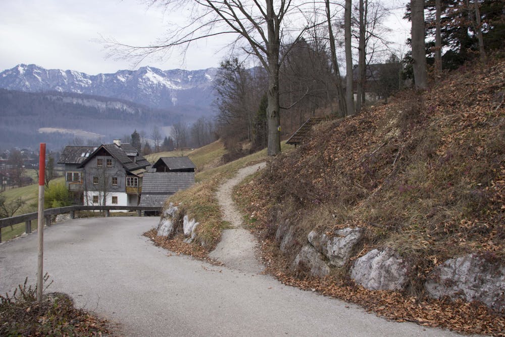
Walking time approx. 3-4 hoursThis hiking trail is dedicated to the honorary citizen and long-time spa director Karl Pilz.Karl Pilz (1909-1993) worked from 1957-1974 as spa director in Bad Goisern and created lasting merits through his great commitment to the development of tourism.the circular hiking trail was newly signposted in 2017!
Hiking Moderate
- Distance
- 12 km
- Ascent
- 226 m
- Descent
- 229 m
- Duration
- 2-3 hrs
- Low Point
- 485 m
- High Point
- 590 m
- Gradient
- 4˚

At the suggestion of the chairman of the Ramsau Karl Rainer Road Improvement Association, the market town of Bad Goisern has signposted a circular hiking trail on existing footpaths (yellow signs). He is named after the well-deserved former spa director and honorary citizen Karl Pilz. As a starting point we take the village Weißenbach in the north of Bad Goisern, where we first walk past the Sulzstube along the "http://dachstein.salzkammergut.at/oesterreich/tour/100355/soleleitungsweg-von-hallstatt-ueber-bad-goisern-nach-bad-ischl: http://dachstein.salzkammergut.at/oesterreich/tour/100355/soleleitungsweg-von-hallstatt-ueber-bad-goisern-nach-bad-ischl.html "brine pipeline path to Wildpfad. Below us lies a branch of the Traun, where wild ducks and swans like to stay, so that there is something to see right away. Behind it flows the Traun, which we meet again and again. When we step out of the rock path which was beaten out of the western slope of the Hammerberg, the Goiserer basin opens in front and is bordered in the southeast by the 1976m "http://dachstein.salzkammergut.at/oesterreich/tour/100362/sarsteinueberquerung-bad-goisern-bis-obertraun: http://dachstein.salzkammergut.at/oesterreich/tour/100362/sarsteinueberquerung-bad-goisern-bis-obertraun.html "Hohen Sarstein. Under the Jochwand we continue and see the Kalmberge (Hoher Kalmberg 1.833m), the western border of our municipality. On the sunny side you can see the new spa centre and above it the impressive Höhenweg / Ewige Wand (high-level path). We continue past the Hanuschhof, a spa of the Gebietskrankenkasse, to the "http://dachstein.salzkammergut.at/oesterreich/gastronomie/102129/gasthaus-rassingmuehle: http://dachstein.salzkammergut.at/oesterreich/gastronomie/102129/gasthaus-rassingmuehle.html "Rassingmühle, an old traditional guesthouse on the river Traun, where we are already close to the market in Bad Goisern. The path over the Sophien bridge would lead us there, but we climb up over the corn forest, past the rest hut, where several paths merge, to the shooting range of the crossbowmen Unterjoch. There we leave the two complexes of the "http://dachstein.salzkammergut.at/oesterreich/unterkunft/101026/alpenhotel-dachstein: http://dachstein.salzkammergut.at/oesterreich/unterkunft/101026/alpenhotel-dachstein.html "Alpenhotel Dachstein at the top right and walk over the Langfeldweg and the Rastlhochfeld to the Schüttbach bridge. There we cross the path leading to the Nordic Winter Sports Centre (ski jump, http://dachstein.salzkammergut.at/detail/article/rodeln-und-schlittenfahren.html "toboggan run, cross-country ski run) or to the Goiserer hut. Coming from a small piece of forest, we reach the idyllic village of Ramsau via the Ramsaufelder. We go down a little bit then turn right to the "http://dachstein.salzkammergut.at/oesterreich/poi/401338/giselawarte-aussichtsplatz: http://dachstein.salzkammergut.at/oesterreich/poi/401338/giselawarte-aussichtsplatz.html "Giselawarte; she is named after a daughter of Emperor Franz Josef, the wife of Prince Leopold of Bavaria, who spent several summers in Ischl. In former times there used to be a "Lusthaus", a forest hut (built in 1896), from where you could enjoy a beautiful view to the "http://dachstein.salzkammergut.at/detail/article/der-hallstaettersee: http://dachstein.salzkammergut.at/detail/article/der-hallstaettersee.html "Hallstättersee, Sandling, Sarstein, Krippenstein and Ramsaugebirge. Today a memorial stone from 1904 commemorates the head hatman Josef Neubacher, three benches invite you to linger. Over the Protzweg it goes down over the village of Gschwandt to the Görbbrücke bridge. A little bit we have to walk along the main road, turn off at the Schneiderwirt in Stambach towards Wiesen, before the underpass of the B145 we walk along an old church path to the Stambach bridge. Along the Stambach we follow a road to Lasern. There we turn right into Feuerbachweg. We are now on one of the most beautiful places of the "Sunnseiten", from which one has a worthwhile view of the village Goisern. Over which the two Kalmberge rise. The cars down on the federal highway look like busy little beetles from up here. (There are also people who find it entertaining to watch what happens on the street when they freak out on one of the many bankers.) We then pass the village of Primesberg, the Feuerbachvilla Konrad Deublers and the spa centre. Via the Eidenbergerweg (a memorial stone commemorates the important Poser-born painters and graphic artists) we reach the Anzenau. Cross the road and come to the railway station "Goisern Jodschwefelbad", cross the Traunbrücke and return to the starting point in Weißenbach. Text guest newspaper "Der Goiserer" Siegfried Pramesberger "Order hiking maps of the Dachstein Salzkammergut region ..." "To the 360° panorama tour through Bad Goisern ...
Difficulty
Moderate
Hiking along trails with some uneven terrain and small hills. Small rocks and roots may be present.