Niederer Rumpler
Dachstein Salzkammergut
Hike to an exposed point above the Gjald Alm Hut.
Hiking Severe
- Distance
- 4.3 km
- Ascent
- 283 m
- Descent
- 283 m
- Duration
- 1-2 hrs
- Low Point
- 1.7 km
- High Point
- 2 km
- Gradient
- 11˚

Glaciated mountain peaks soar above the Gjald Alm Hut in Dachstein, beckoning the adventurous to climb high into the alpine, challenging themselves on lofty, rugged mountain peaks.
- •
- •
Description
But what if you’re not interested in quite such an epic hike?
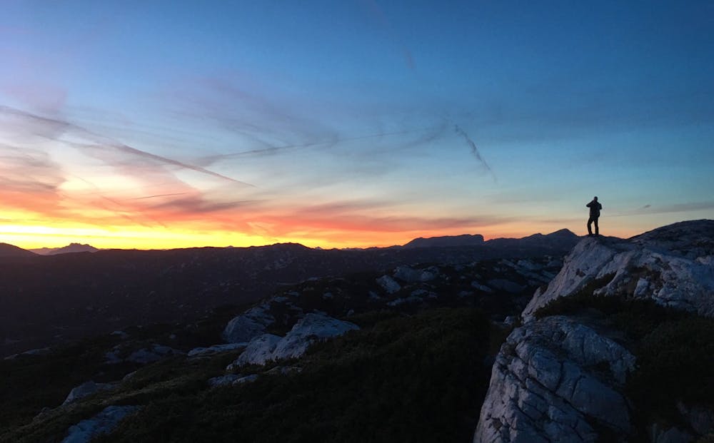
For a short jaunt from the Gjald Alm Hut with an impressive finish, consider this hike to the Niederer Rumpler. This viewpoint sits atop an upthrust ledge of rock and affords incredible vistas of the Dachstein region. Thanks to its east-facing aspect, this point provides a great spot to watch the sun slowly rise over the alps, gradually illuminating the deep valleys far, far below you.
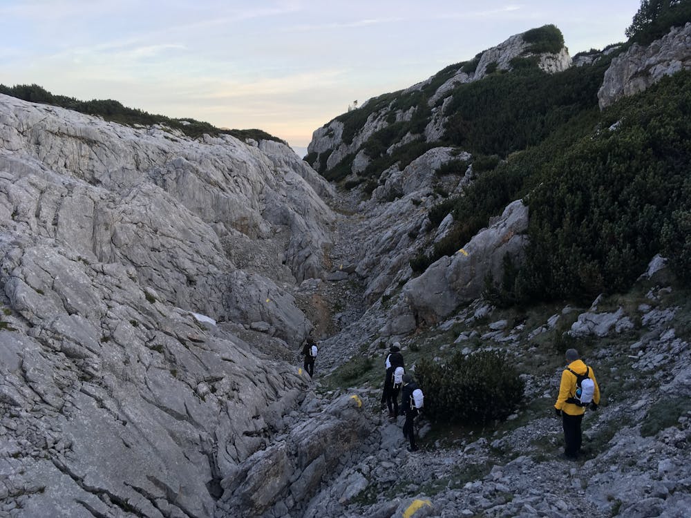
At 2.7 miles round trip, this hike is quite short, meaning you won’t have to leave too long before dawn in order to catch a sunrise. However, despite being short, this trail can be quite rough in places. Sections of the main climb up the mountain follow faint stretches of singletrack that can sometimes be quite difficult to follow in the dark. Toward the top, the going gets a bit rougher, with some rock scrambling through a narrow valley, and some scrambling required to gain the top of the ledge and reach the lookout. Despite being a relatively short hike, the technicality earns this route a “Severe” FATMAP rating.
Once on top of the ledge, take time to soak in the stunning vista, or the sunrise if you arrived early enough. Then, prepare to head back down.
There are a few different ways to descend the mountain, and one route variant is mapped here. You can, of course, descend by the same trail you climbed, but a bit of variety is always appreciated! There’s also a much steeper scramble that ascends and descends the front of the rocky outcropping, but that route is quite faint and very exposed. Only attempt this route if you’re confident in your scrambling and route finding abilities.
Difficulty
Severe
Hiking challenging trails where simple scrambling, with the occasional use of the hands, is a distinct possibility. The trails are often filled with all manner of obstacles both small and large, and the hills are very steep. Obstacles and challenges are often unexpected and can be unpredictable.
Medium Exposure

The trail contains some obstacles such as outcroppings and rock which could cause injury.
Remoteness
Away from help but easily accessed.
Best time to visit
Features
- Alpine
- Picturesque
- Summit Hike