7 routes · Hiking
The number one in view! Exhausting and sometimes quite steep, but not particularly difficult mountain tour to one of the most beautiful vantage points in the Salzkammergut.
Hiking Difficult

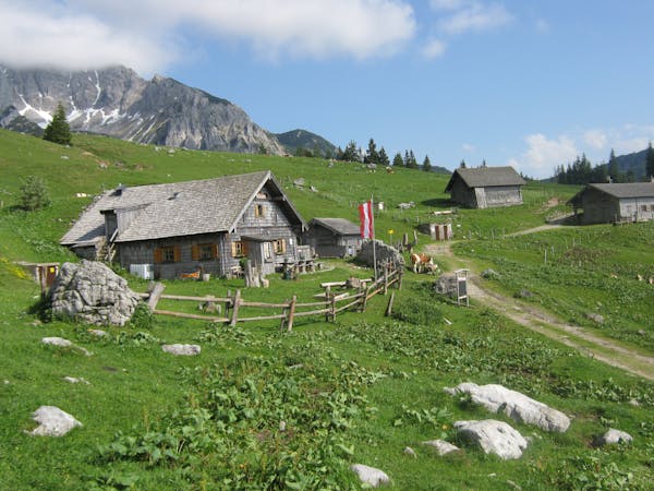
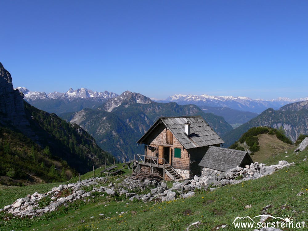
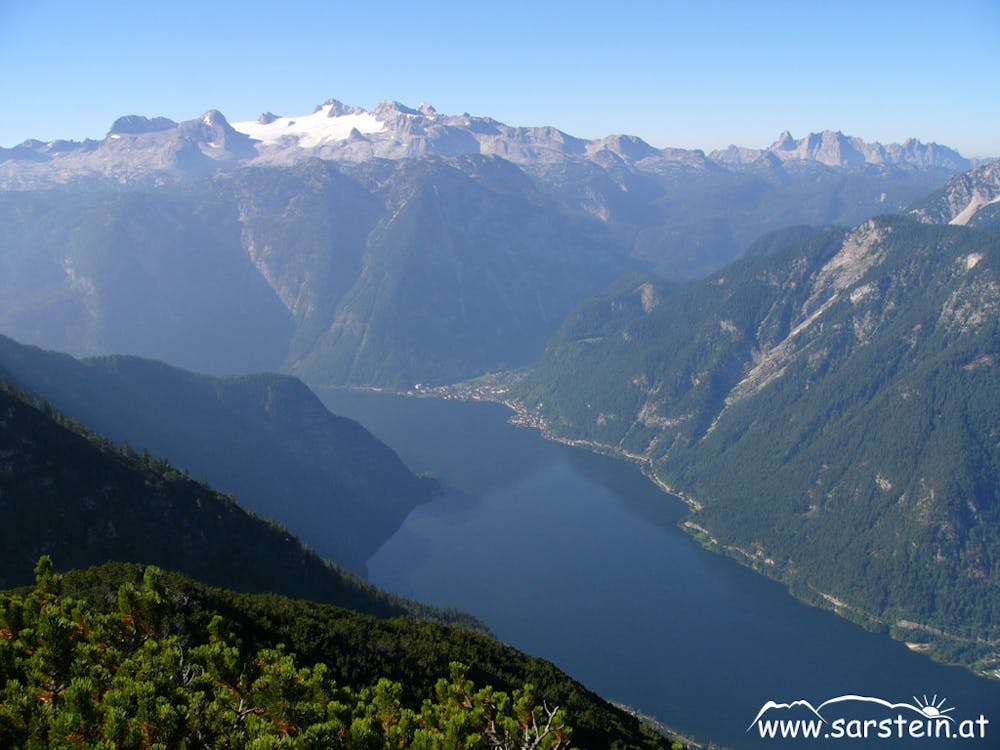
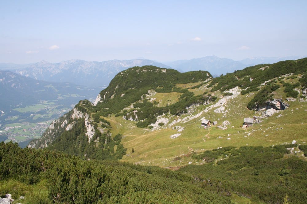
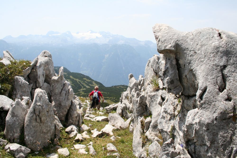
Alpin-Feinspitze agree: Hohe Sarstein is the most beautiful panoramic mountain in the Inner Salzkammergut. Up there you have the only chance to see the Dachstein glaciers and Hallstätter See at a glance - not to mention the rest of the panorama, the Ausseerland lakes, the Totes Gebirge mountains and the distant Wiesbachhorn (Hohe Tauern). The accompanying music is provided by the resolute Koppentraun, which rushes up from its 1400 m deep notch to the summit cross. And the most beautiful thing about it: When descending towards Obertraun you can enjoy what you have offered for almost 2 km! From Steeg-Gosau railway station we go to the nearby railway crossing: turn left and follow the main road to the nearby village of Au. After Gasthof Zur Post turn right and follow Erlenstraße to St. Agatha. Turn right onto the main road, after the bridge turn left over the roadway and up the old, in places steep and cobbled Pötschenstraße through the village of Sarstein. At the junction next to a memorial stone turn left, through the hamlet of Wiesleben. Soon afterwards we turn right onto the signposted and marked path no. 690 to the Sarstein and cross the Pötschenstraße again (if you descend again on the following route, you can also start here at the car park). On the marked forest path uphill. From the former "Simony view" we cross into the deeply torn Rotengraben, next to which we climb very steeply and in many serpentines up to the Lower Sarsteinalm. Shortly to a saddle, turn right onto path no. 692 and zigzag through a rocky flank up to a small gate. Finally over the lawn slopes of the summit ridge to the summit cross. In the descent we continue to follow path no. 692, which descends south along the 2 km long Sarstein ridge. Via alpine meadows we reach the Sarsteinhütte. Soon after, we descend over a steep forest depression. Then left through the slope and finally in many bends steeply next to the Brettsteingraben down to Obertraun.
Order hiking maps to the Dachstein Salzkammergut region ...
( http://dachstein.salzkammergut.at/kartenbestellung.html ) To the 360° panorama tour through Bad Goisern ... ( https://www.dachstein-panorama.at/?s=pano57984&utmsource=tourdata&utmmedium=textlink&utmcampaign=tourdata360tour ) ( http://dachstein.salzkammergut.at/kartenbestellung.html )
Mountain rescue: 140
equipment
Difficult
Hiking trails where obstacles such as rocks or roots are prevalent. Some obstacles can require care to step over or around. At times, the trail can be worn and eroded. The grade of the trail is generally quite steep, and can often lead to strenuous hiking.
7 routes · Hiking