7 routes · Hiking
A very rewarding mountain hike to a magnificent vantage point! Good, but sometimes steep paths and paths.
Hiking Moderate

From the car park in Gosau, near Ramsau, we walk along the forest road for a few minutes until a path branches off to the left, on which we reach the marked forest path no. 880 above the Kreuzgraben. This leads directly through dense forest to another forest road, which we follow a few steps and then turn left. After a bend, we return to the hiking trail at the crossroads of the forest road, from where we reach the signpost to the nearby Iglmoosalm.
Now our path climbs steeply through the forest; then we follow the forest road into a high valley. Soon we leave the path to the right and walk along the old high trail through the rustic forest to the Schartenalm and up to a small saddle.
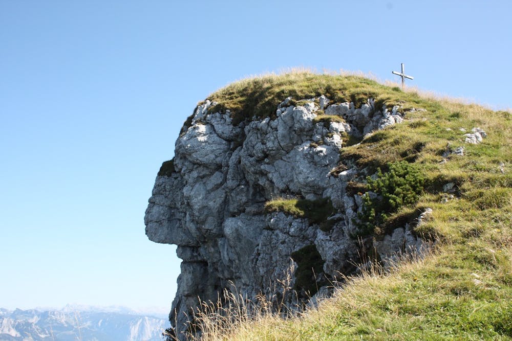
On the left side you will reach the Goisererhütte in a few minutes. On the right side of the saddle, we cross the summit platform no. 888. We follow the path south past the Kalmos church and then climb the Hochkalmberg over a mountain pine ridge - past the face of the "Kalmberg Indian". This is a special rock formation that created our nature. The summit lies above the Kalming Indian.
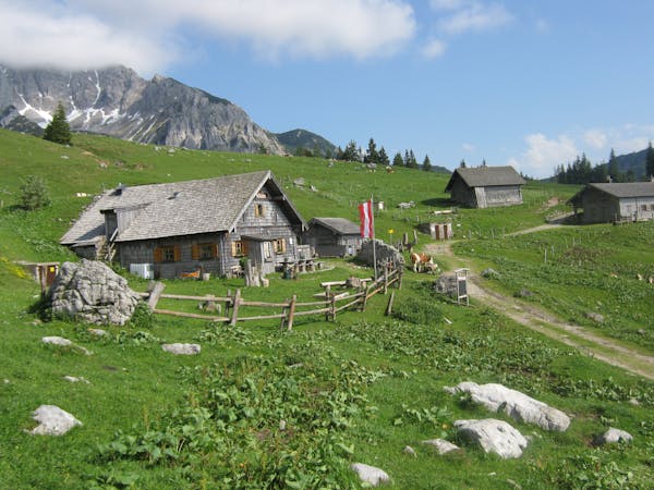
Descent on the same route. Cabins: Iglmoosalm, Goiserer hut Mountain rescue: 140
To the 360° Panorama Tour through the Gosautal ... ( https://www.dachstein-panorama.at/?s=pano68545&utmsource=tourdata&utmmedium=textlink&utmcampaign=tourdata360tour )
equipment
Moderate
Hiking along trails with some uneven terrain and small hills. Small rocks and roots may be present.
7 routes · Hiking