Weg zur Ebenalm
Dachstein Salzkammergut
An easy hiking trail for the whole family.
Hiking Moderate
- Distance
- 2.2 km
- Ascent
- 245 m
- Descent
- 19 m
- Duration
- 0-1 hrs
- Low Point
- 928 m
- High Point
- 1.2 km
- Gradient
- 12˚

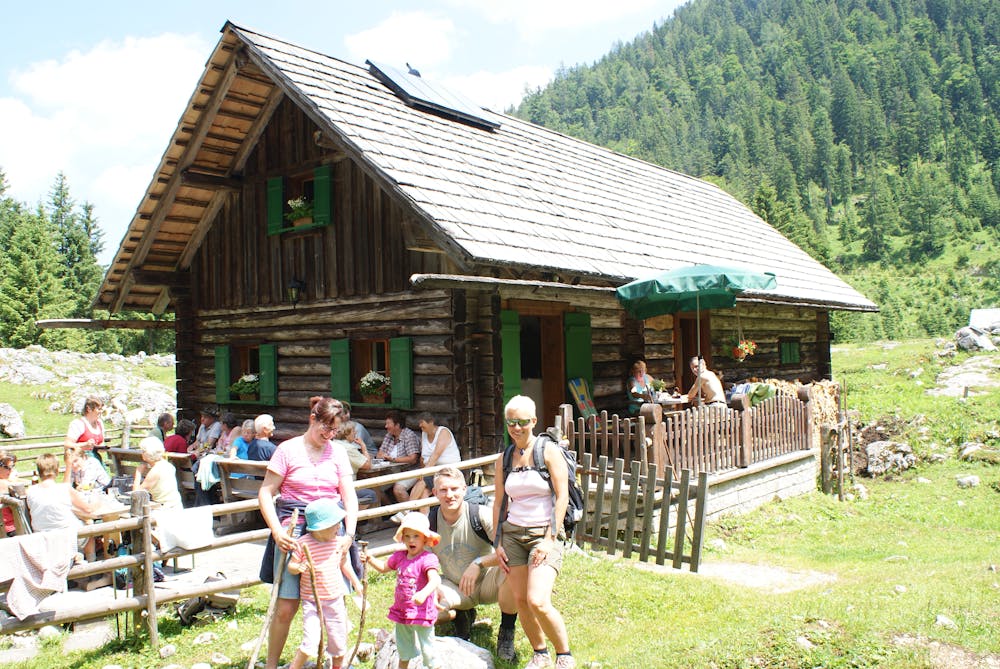
It goes a bit along the Vorderen Gosausee, always with a view of the King Dachstein. After approx. one kilometre, a forest road branches off, slightly uphill. After about an hour you reach the Ebenalm, in the middle of a small forest clearing. The signposted shortcut takes you past the "Kreidebruch" (chalk quarry), where table chalk was broken 50 years ago. From here you also have a wonderful view of the Gosaukamm with its mighty peaks. When you arrive at your destination, you can enjoy the nature at the hut with many delicacies. A very steep but quite romantic path leads from the Ebenalm - "through the Klamm" - to the reservoir in the Hintertal. Good footwear and sure-footedness are required for this variant. "Order hiking maps of the Dachstein Salzkammergut region ... https://www.dachstein-panorama.at/?s=pano68545&utmsource=tourdata&utmmedium=textlink&utmcampaign=tourdata360tour" https://www.dachstein-panorama.at/?s=pano68545&utmsource=tourdata&utmmedium=textlink&utmcampaign=tourdata360tour "To the 360° tour through the Gosautal ...mountain rescue: 140
Difficulty
Moderate
Hiking along trails with some uneven terrain and small hills. Small rocks and roots may be present.