Gams Couloir
Sölden
Stubaier Gletscher
Trentino-Alto Adige
Exploring Chamois territory featuring wide powder slopes and a steep chute at the end.
Freeride Skiing Difficult
- Distance
- 989 m
- Ascent
- 7 m
- Descent
- 285 m
- Low Point
- 2.3 km
- High Point
- 2.6 km
- Gradient
- 41˚

Ski past the Gamsgarten Bergstation on a mellow slope until you spot the Kitzlift T-Bar. Aim to cross the lift slightly above the lower end (there will probably be tracks).
- •
- •
Description
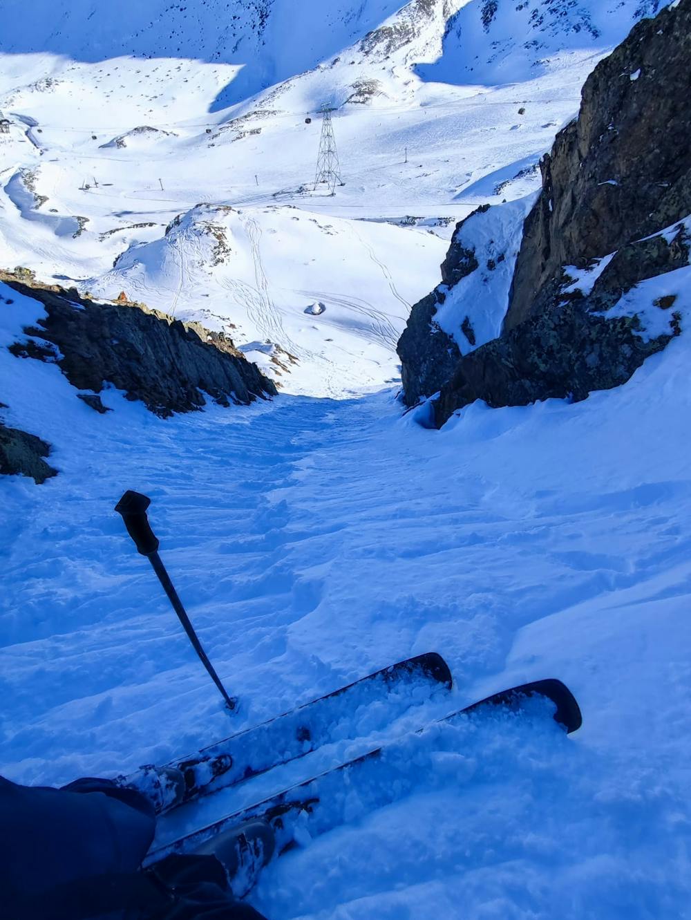
Traverse the mountainside without gaining nor losing height, keeping the Gamsgarten lift on the Skier's right. Due to a landslide, you will have to navigate through a rocky section while these rocks are huge and you cannot miss them (and ruin your skis).
As soon as you managed the rock field you will be rewarded with some beautiful wide powder turns. Make sure you show some good technique here since everyone in the gondola will watch you! ;)
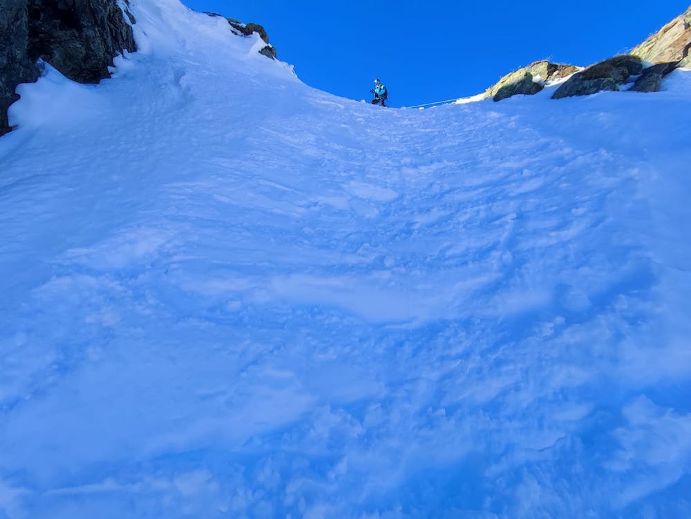
Also, make sure to not gain too much speed since these slopes feature a huge cliff at the bottom end (and you want to gaze at some Chamois). The only way down is a narrow and steep chute which marks the crux of this route. It is about 45° steep but there are no dangerous rock features in the runout. Depending on the snow conditions you have to descend with either jump-turns or side slipping (as seen in the picture by my predecessor).
After skiing the chute follow the obvious route down to Mittelstation, get in the Gamsgarten lift and admire the beautiful line you just skied.
Difficulty
Difficult
Serious gradient of 30-38 degrees where a real risk of slipping exists.
Medium Exposure (E2)

As well as the slope itself, there are some obstacles (such as rock outcrops) which could aggravate injury.
Remoteness
Away from help but easily accessed.
Best time to visit
Features
- Cliffs
- Couloir