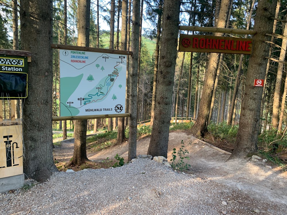
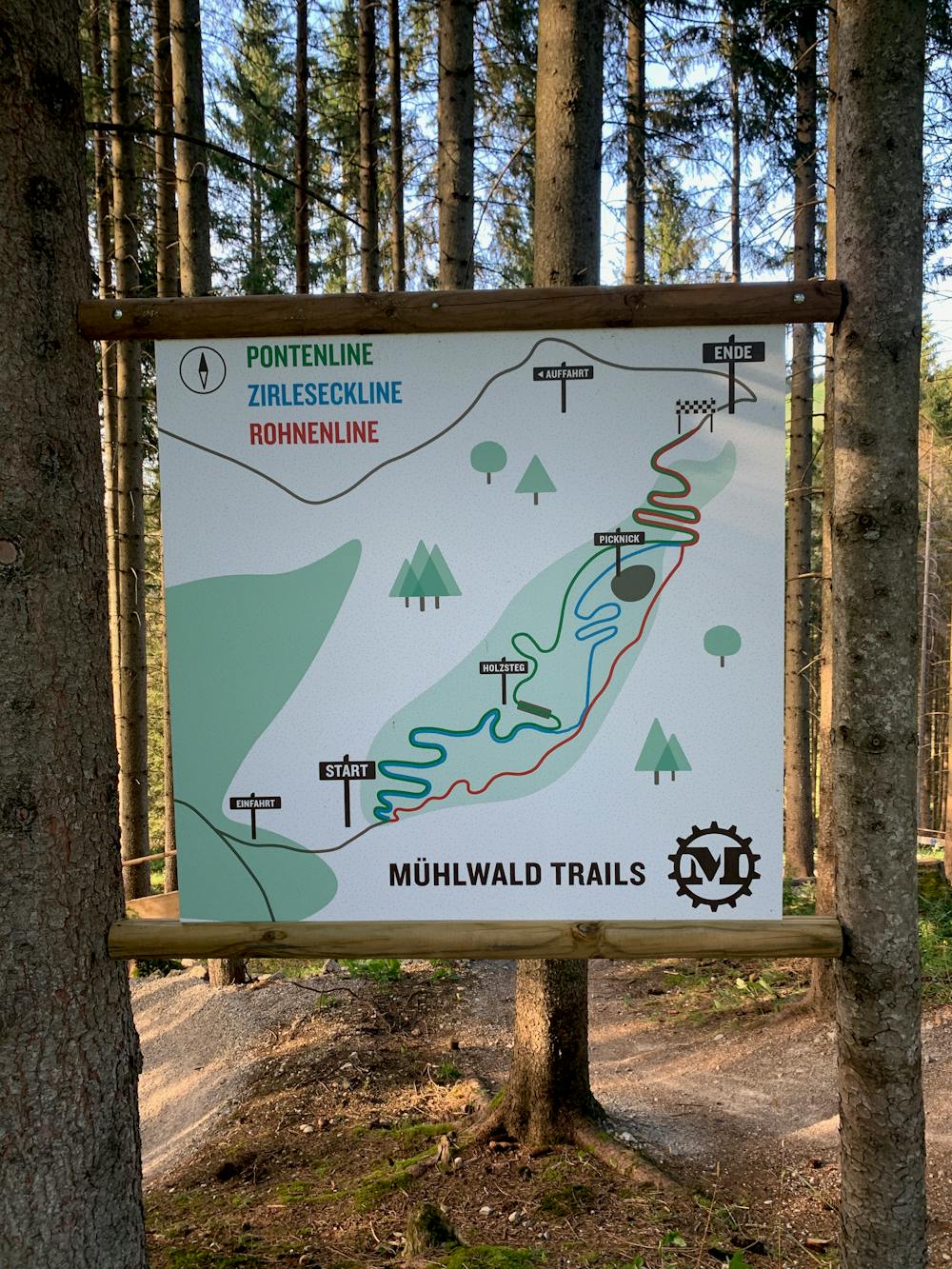
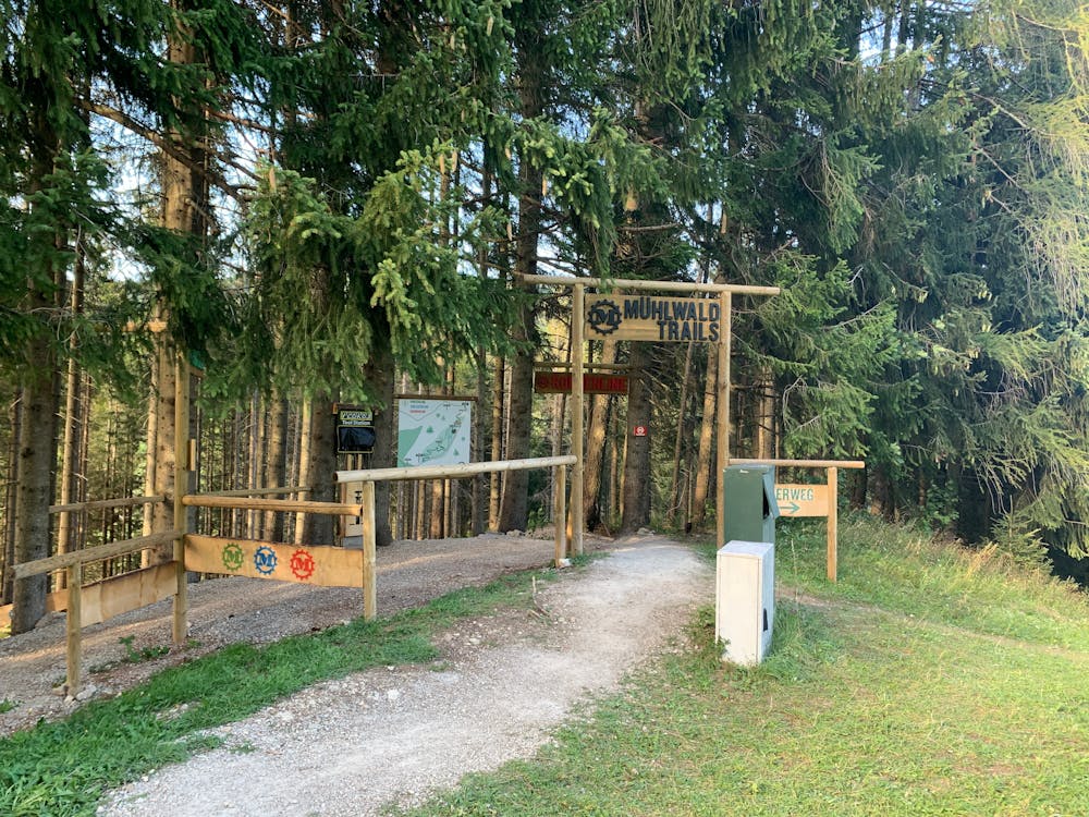
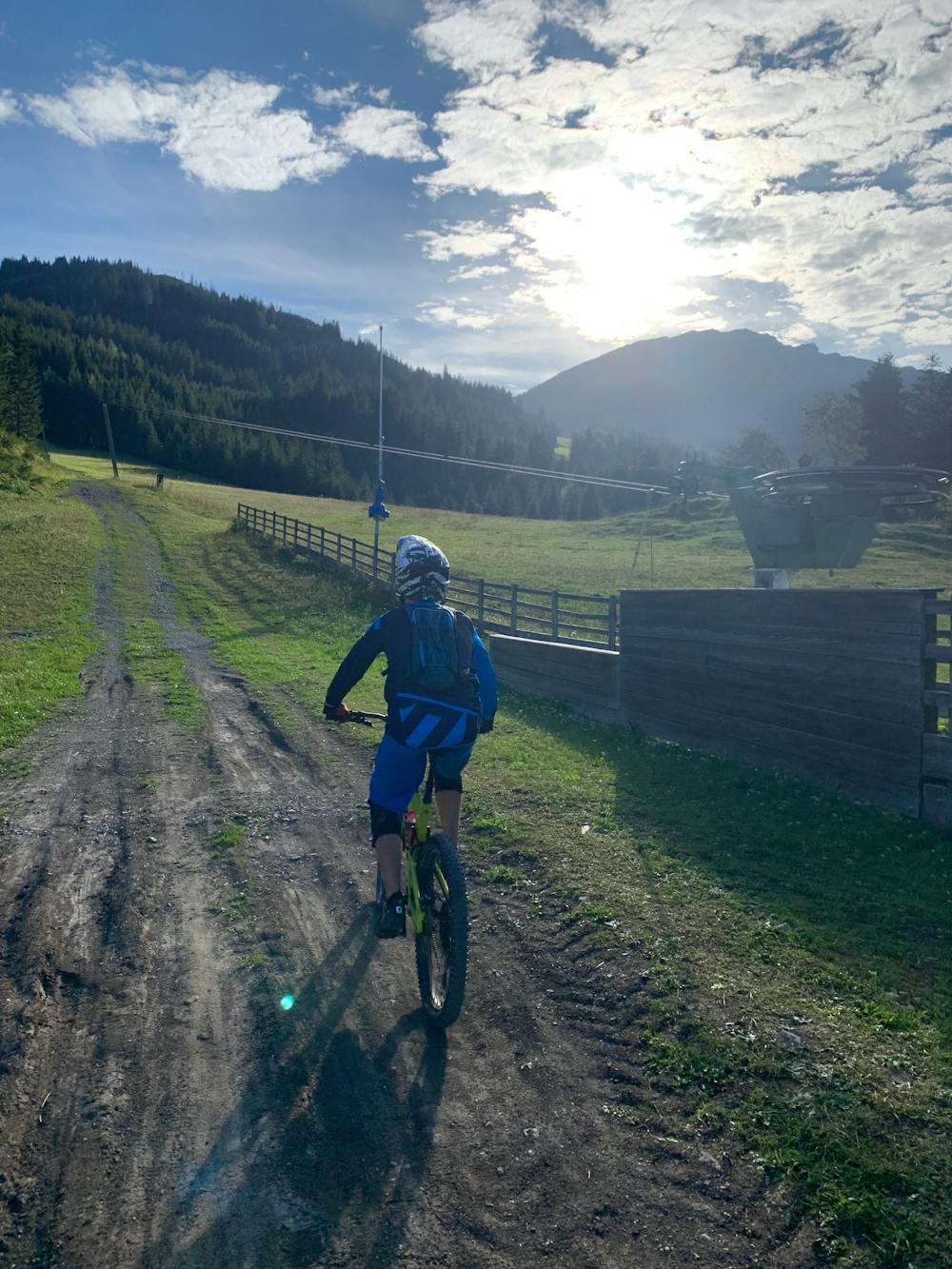
Rohnenline - Mühlwald Trails
The technical red trail
Mountain Biking Easy
- Distance
- 339 m
- Ascent
- 0 m
- Descent
- 39 m
- Duration
- 0-1 hrs
- Low Point
- 1.1 km
- High Point
- 1.1 km
- Gradient
- 9˚
The Mühlwald Trails are a new set of short, fun bike trails near Zöblen in Austria.
- •
- •
- •
- •
- •
- •
Description
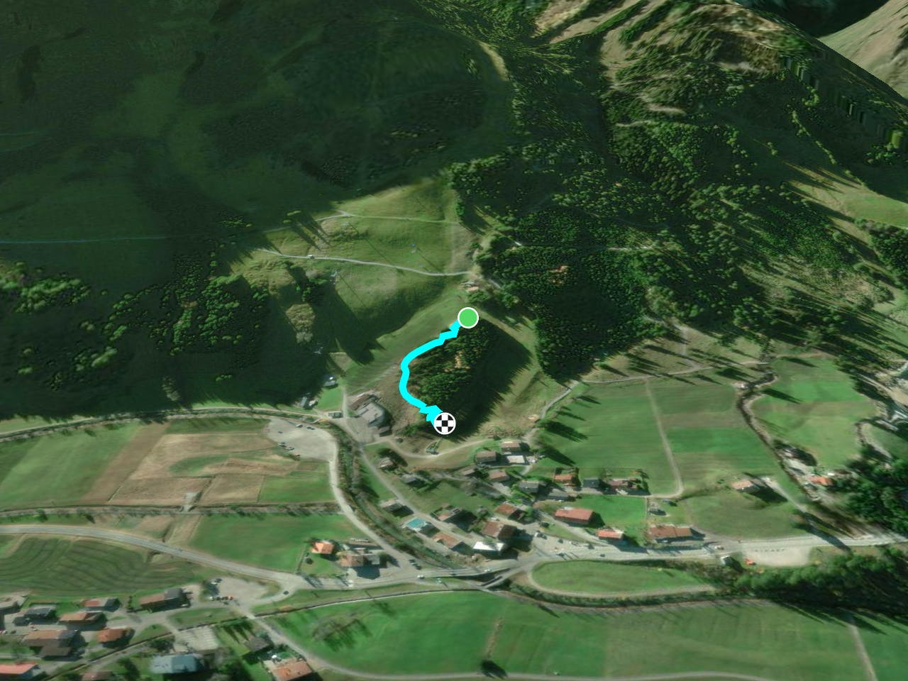
Access the trails directly from the car park by crossing the bridge, turning right and following the lift line to the top.
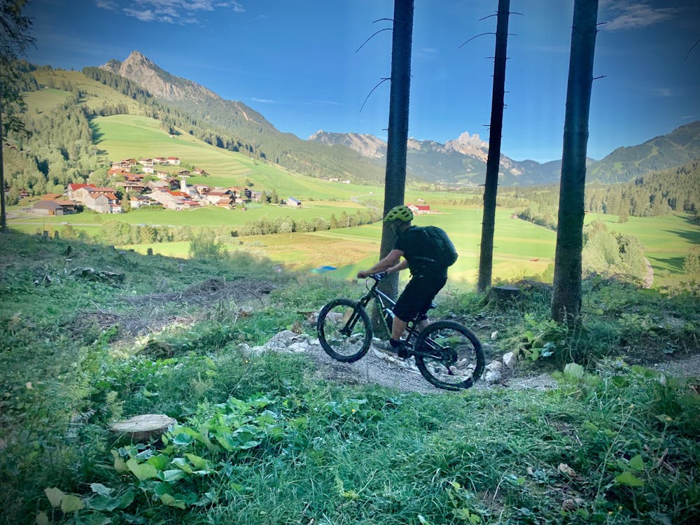
There are three routes and this is the "Rohnenline", the hardest of the three, but still pretty easy.
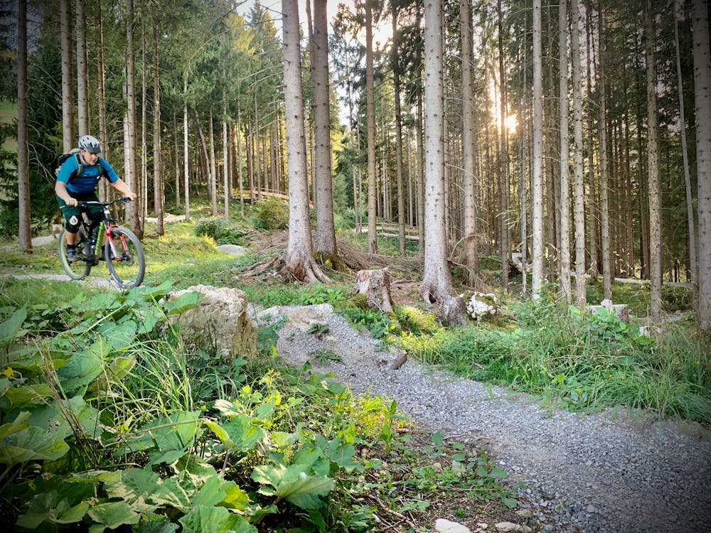
It's a technical trail, with a mixture of gravel, roots and rock slabs.
Difficulty
Easy
Mostly smooth and non-technical singletrack with unavoidable obstacles 2in/5cm tall or less. Avoidable obstacles may be present. Ideal for beginner riders.
Low Exposure

The path is on completely flat land and potential injury is limited to falling over.
Remoteness
Close to help in case of emergency.
Best time to visit
Features
- Flow
- Technical
- Singletrack
- Roots
- Rock Rolls
- Rock Slabs
- Rock Gardens