93 m away
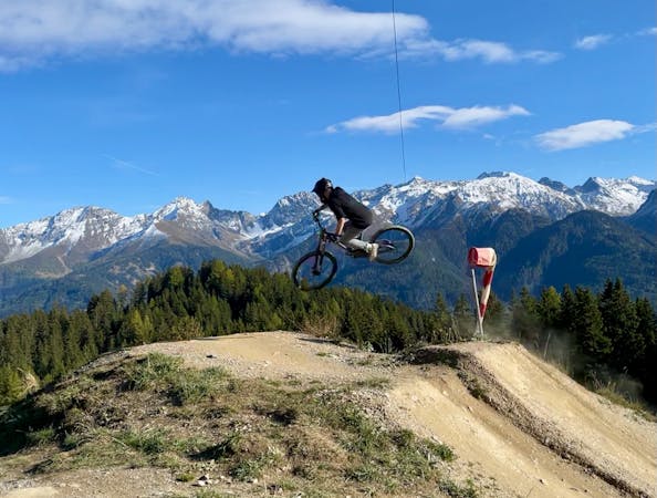
Downhill Strecke
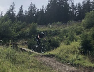
The downhill track of Serfaus-Fiss-Ladis - challenge yourself in this technical ride!
Extreme Mountain Biking
- Distance
- 2 km
- Ascent
- 0 m
- Descent
- 416 m
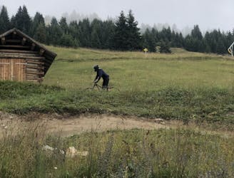
A gentle descent that doesn’t demand too many skills
Mountain Biking Easy

This is a popular mountain biking route which is generally considered to be easy. It's an unknown remoteness, it features unknown exposure and is typically done in an unknown time of year. From a low point of 1.8 km to the maximum altitude of 1.8 km, the route covers 168 m, 0 vertical metres of ascent and 31 vertical metres of descent.
Vuelta is a side kick of the Milky Way and offers a gentle descent that doesn’t demand too many skills. It’s the perfect follow up to get prepared for the next level, the red trails.
Easy
Mostly smooth and non-technical singletrack with unavoidable obstacles 2in/5cm tall or less. Avoidable obstacles may be present. Ideal for beginner riders.
93 m away
The downhill track of Serfaus-Fiss-Ladis - challenge yourself in this technical ride!
Extreme Mountain Biking
101 m away
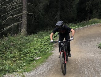
Fast and smooth blue line in Serfaus-Fiss-Ladis Bikepark
Moderate Mountain Biking
101 m away
Wide and fast red line in Serfaus-Fiss-Ladis Bikepark - the perfect track for training jumps!
Difficult Mountain Biking
106 m away
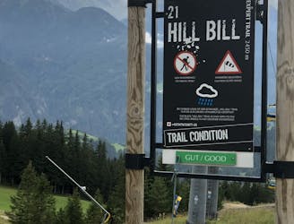
Various terrains are waiting for you on this black track! From drops to rock gardens and jumps - it has it all!
Severe Mountain Biking
4 routes · Mountain Biking