1 m away
Stilluptal Road Bike
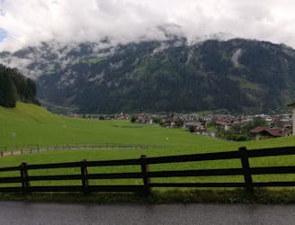
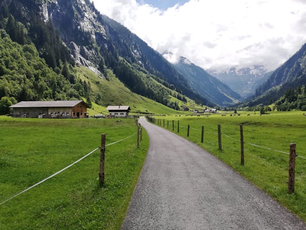
Incredible and varied scenery in a wild mountain valley.
Difficult Road Biking
- Distance
- 31 km
- Ascent
- 1 km
- Descent
- 1 km
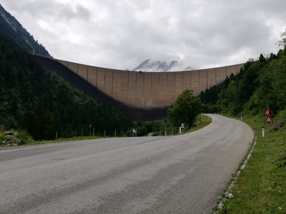
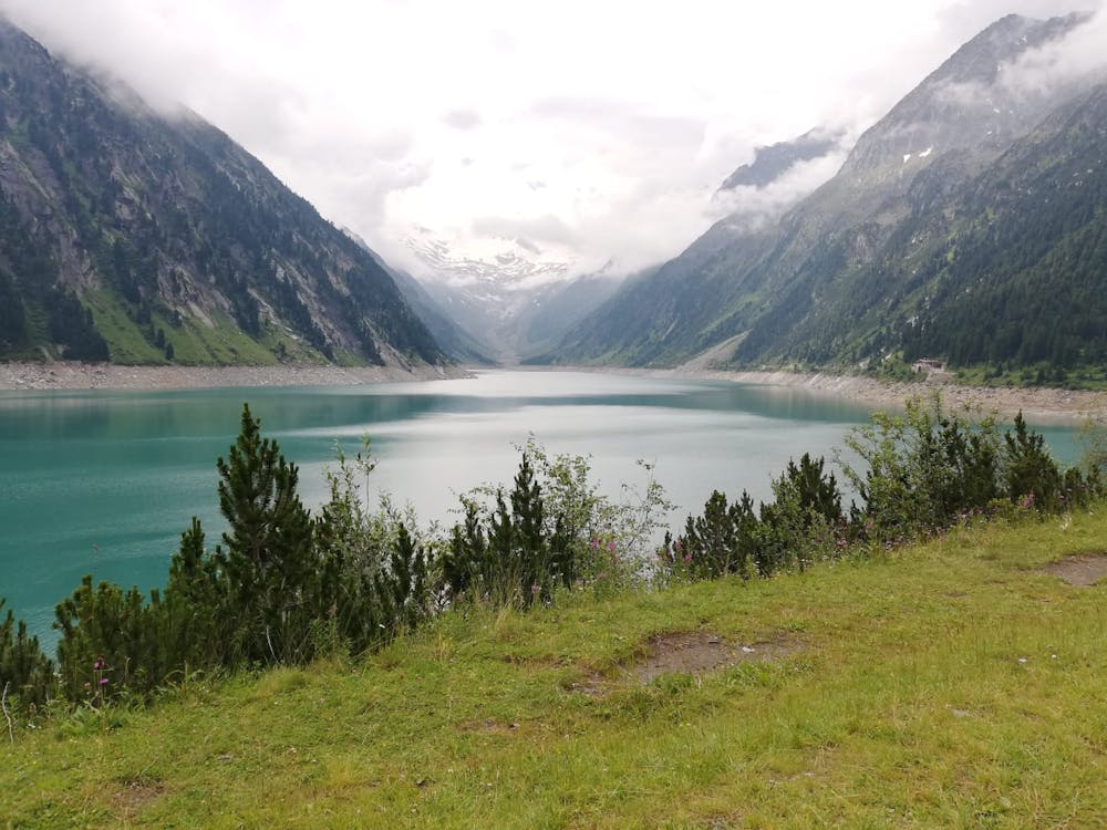
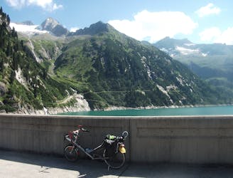
A spectacular ride to an awe-inspiring dam and a beautiful blue lake.
Road Biking Difficult

This is a great ride made all the more satisfying by the fact that doing it saves you a long wait and €14 compared to driving up to the lake.
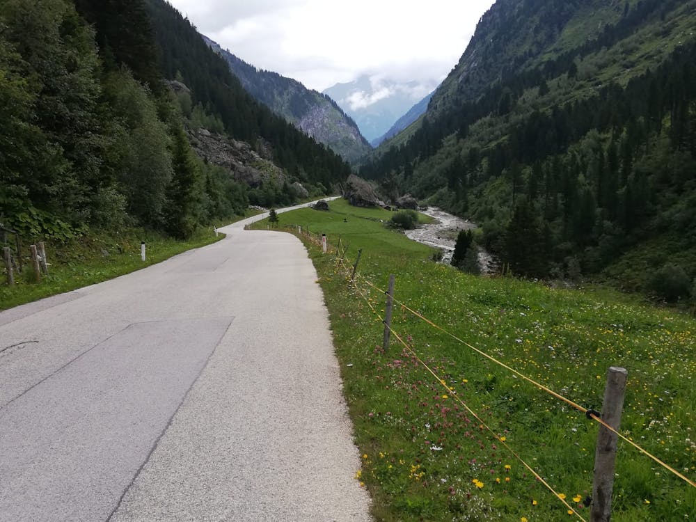
Start out in Mayrhofen and head south past the village of Hochsteg into the narrow, atmospheric valley which leads to the small settlement of Ginzling. Carry on through Ginzling and on through Rauth to reach the hamlet of Herbergalm, home to the Aplengasthuas Breitlaner. The valley you ride through to reach the Aplengasthuas Breitlaner is spectacular and so tight at times that it seems impossible that the road will be able to find a way through! Luckily for you it does keep going and it's a great ride with some spectacular rock walls looming over you for much of the way.
Upon reaching the Aplengasthuas Breitlaner pass through the toll booth (cyclists aren't required to pay but drivers and motorbikers have to pay €14) and begin zig zagging steeply up through forests into the valley which leads to the Schlegeisspeicher. As you leave the trees the valley straightens and opens up to reveal the spectacular dam at the northern end of the lake. Climb gently up towards the dam and then head up a final few steep hairpins to reach the dam and the lake. The views are utterly spectacular and are ample reward for your efforts. Take them in (along with a coffee at one of the cafes on the shore of the lake) and then rip down the way you came up!
Difficult

Close to help in case of emergency.
1 m away
Incredible and varied scenery in a wild mountain valley.
Difficult Road Biking
4 m away
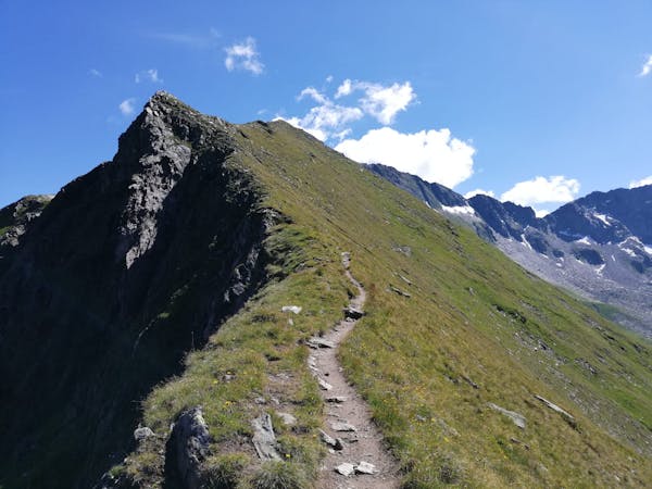
A classic valley ride to a wild lake.
Difficult Road Biking
3 routes · Road Biking
8 routes · Mountain Biking · Hiking · Road Biking
8 routes · Mountain Biking · Hiking · Road Biking