3.1 km away
Vennspitze
A mellow peak with great views across the landscape of the Wipptal.
Moderate Ski Touring
- Distance
- 5.7 km
- Ascent
- 808 m
- Descent
- 808 m
A classic ski tour new the Italian border following an old ski slope.
Ski Touring Easy

One of the biggest assets of Innsbruck when talking about skiing is the position where the city is located: in no time you can drive on the highway in any direction - south, north, east or west - chasing the best snow conditions within a wide radius. When the last storms came from the south, heading towards Italy is probably one of the best decision to make in order to find the biggest amount of snow.
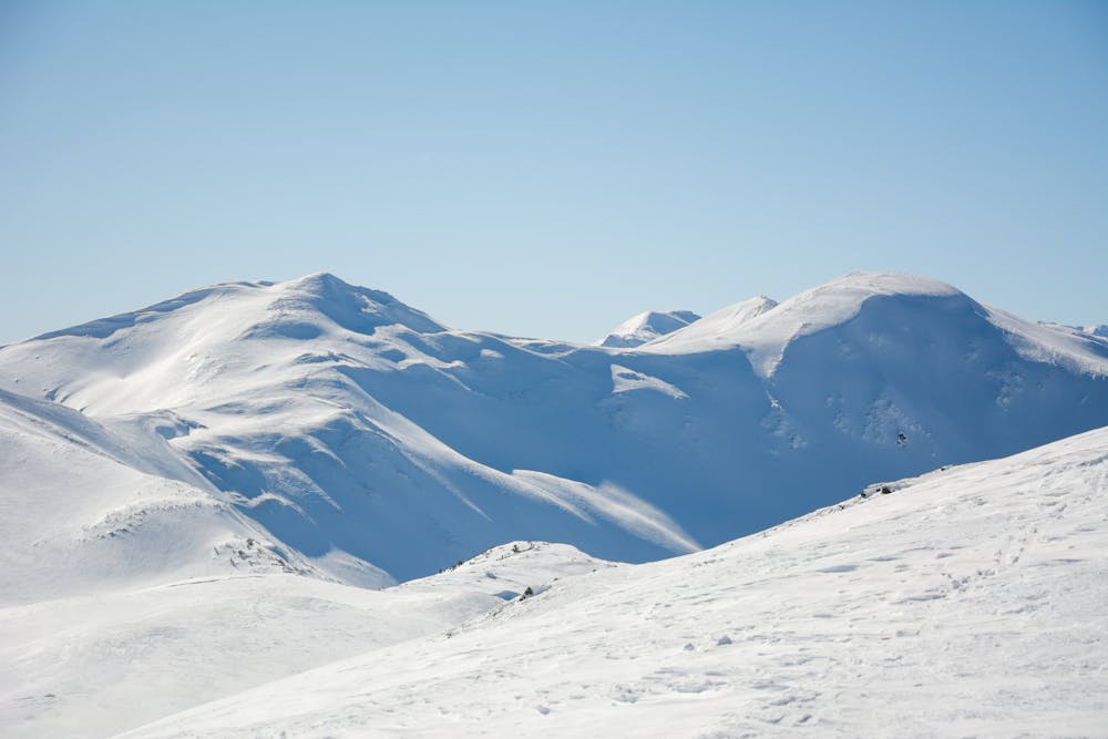
The starting point of this route is indeed only few kilometers before Brenner Pass - the border dividing Austria from Italy - and the Sattelberg peak is right on the border between the two countries: when you look south you will be able to see the first Italian peaks while looking from East to West passing through North you will see, in order: Tuxer Alps, Nordkette and Stubaier Alps.
Sattelberg is one of the most famous ski tours for beginners around Innsbruck land, as the whole route follows an old ski slope which used to be served by a lift back in the days. Thanks to this reason, the climb - and the descent as well - is quite mellow and it does not present any particular technical obstacles. When the slope is about to reach the ridge, a hut is located exactly in the middle of the field and it’s usually open during winter time as well, making it the perfect place to take a break before heading back down to the parking lot.
To find the right start for this route is quite easy: from the parking lot close to the highway bridge, it gets into the slope which will take you all the way up to Sattelbergalm. At the very beginning of the route, you could also check the correct functioning of your transceiver thanks to an avalanche checkpoint, where your avalanche transceiver is automatically checked. From the hut to the peak the route is first on the north facing side of the mountain then reaches the ridge that will take the skiers all the way up to the summit cross (2115). From here, the descent follows exactly the same route - all the way back to the car.
Easy
Wide gentle slopes at around 20 degrees or less.

Exposure is limited to that of the slope itself. Getting hurt is still likely if the slope is steep and/or the snow is hard.
Close to help in case of emergency.
3.1 km away
A mellow peak with great views across the landscape of the Wipptal.
Moderate Ski Touring