6.7 km away
Roßkirpl

An infamous off piste line of Giggijoch
Difficult Ski Touring
- Distance
- 1.3 km
- Ascent
- 73 m
- Descent
- 410 m
www.runskitirol.com/skimo/waze-spitze
Ski Touring Extreme

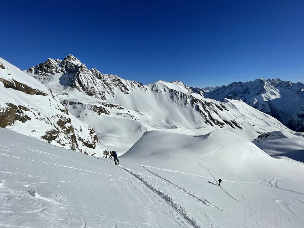
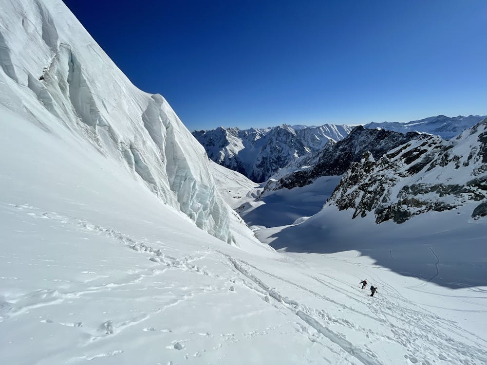
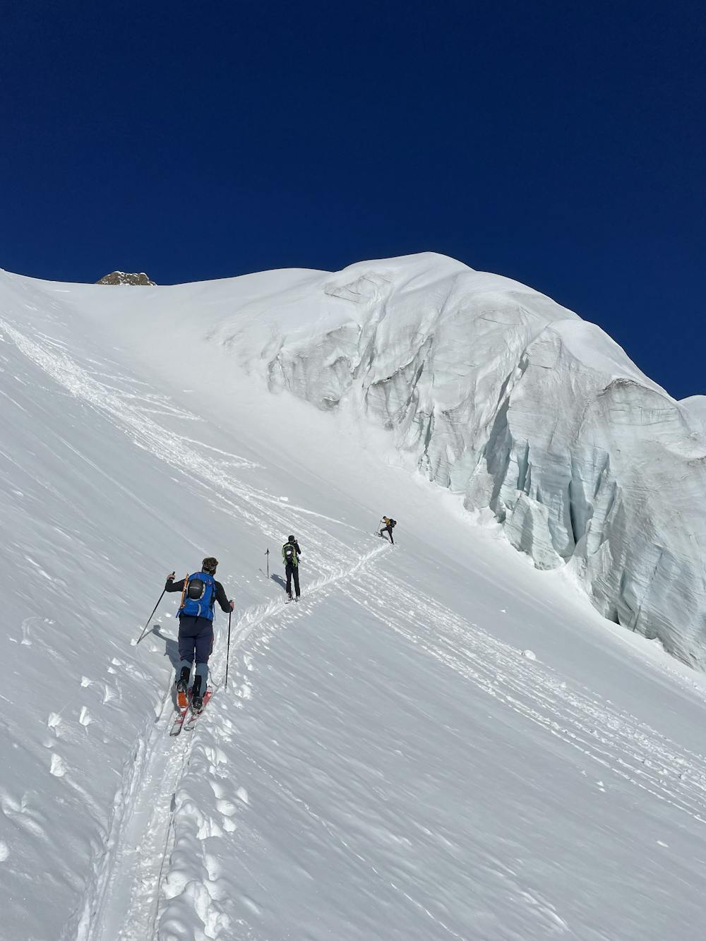
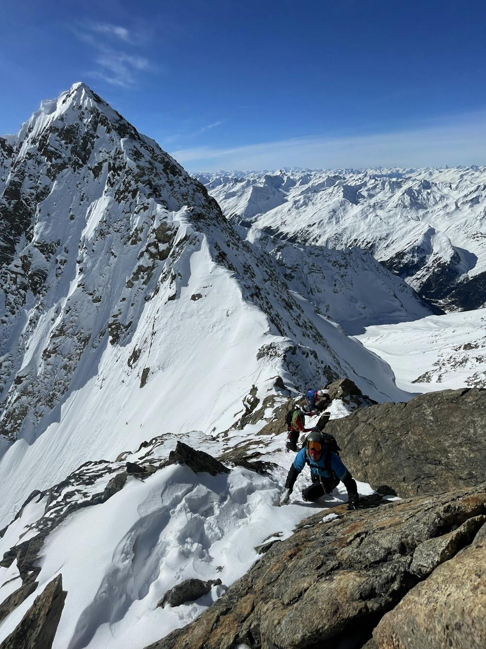
This is a popular ski touring route which is generally considered to be extreme. It's remote, it features high exposure (e3) and is typically done between February and May. From a low point of 1.6 km to the maximum altitude of 3.5 km, the route covers 7.2 km, 1948 vertical metres of ascent and 31 vertical metres of descent. It's graded 4.3 and Labande grade 4. You'll need rope, skins, ice axe, crampons and glacier kit to complete it safely.
A true Tyrollean winter classic to the summit of Waze Spitze. Steep, technical, with beautiful views. Everything you need for a good adventure.
Extreme
Extreme skiing terrain above 45 degrees. These routes are reserved for experienced experts.

In case of a fall, death is highly likely.

Away from help but easily accessed.
6.7 km away
An infamous off piste line of Giggijoch
Difficult Ski Touring
7.3 km away

Steep off-piste for experienced skiers with the option for cliff drops
Severe Ski Touring