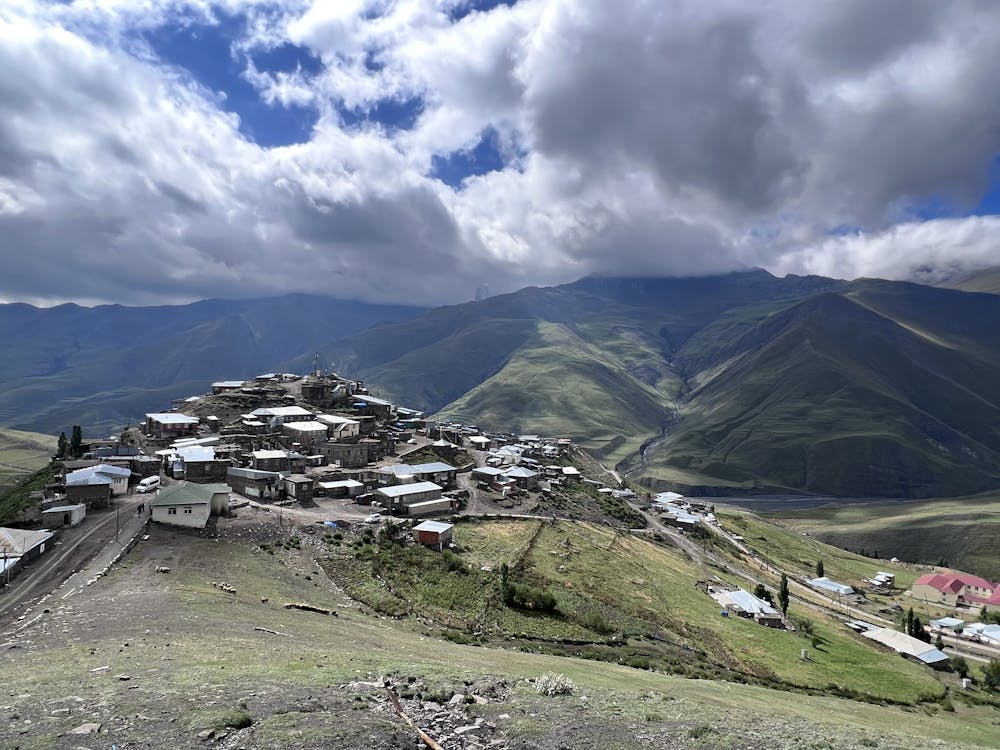
Xinaliq - Qalayxudat hiking
One day 8,4 km panoramatic hike from authentic xinaliq village where time stopped via Transcaucausian trail
Hiking Moderate
- Distance
- 8.5 km
- Ascent
- 304 m
- Descent
- 261 m
- Duration
- 2-3 hrs
- Low Point
- 2.2 km
- High Point
- 2.3 km
- Gradient
- 6˚

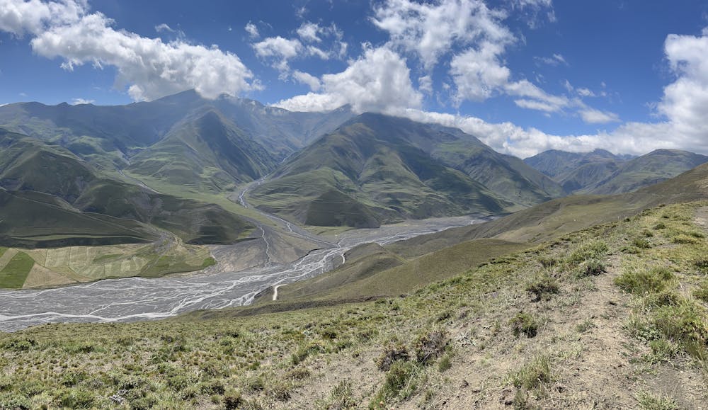
This is a popular hiking route which is generally considered to be moderate. It's remote, it features low exposure and is typically done between June and September. From a low point of 2.2 km to the maximum altitude of 2.3 km, the route covers 8.5 km, 304 vertical metres of ascent and 261 vertical metres of descent.
- •
- •
Description
Easy hiking starts from Xinaliq and goes along the valley with lot of panoramatic views over the old village with stone houses. Afternoon hike or leisure slow one day hike.
Difficulty
Moderate
Hiking along trails with some uneven terrain and small hills. Small rocks and roots may be present.
Low Exposure

The path is on completely flat land and potential injury is limited to falling over.
Remoteness

Away from help but easily accessed.
Best time to visit
Features
- Historical
- Picturesque
- Dog friendly
- Family friendly