7 routes · Alpine Climbing · Hiking
The big kahuna! This is a classic mountaineering day in a wild part of the Andes.
Alpine Climbing Difficult

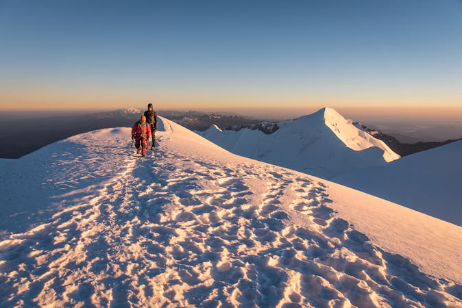
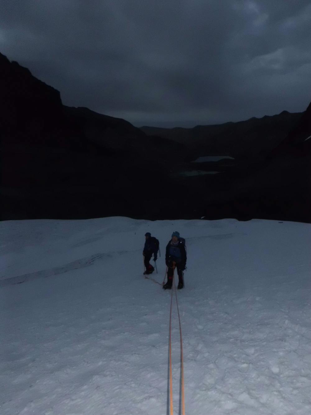
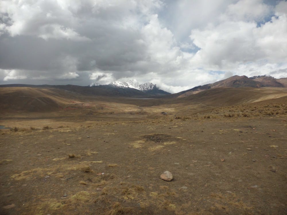
Get up very early and begin your day by traversing around the western shore of Lake Chairkhota and then climbing up through moraines and boulder fields to the southern tip of the glacier which will eventually lead you onto Pequeno Alpamayo. Put your crampons on and climb the glacier to the subsidiary peak of Tarija. From the top of Tarija you are looking straight at Pequeno Alpamayo’s summit pyramid and you can’t fail to be excited and slightly nervous upon seeing the peak. It looks imposing and incredibly aesthetic so take a moment to pick out the route you’re going to climb, which is the left skyline as you look at the mountain. If, upon reaching Tarija, energy levels or conditions are not good enough to allow you to carry on safely to Pequeno Alpamayo, head back down to base camp with a small consolation summit in the bag.
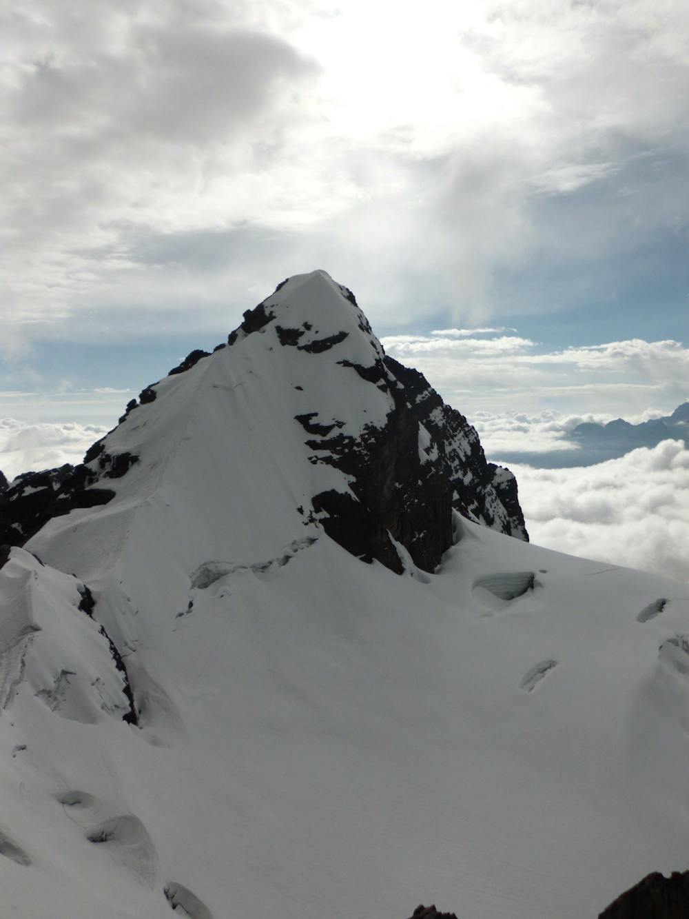
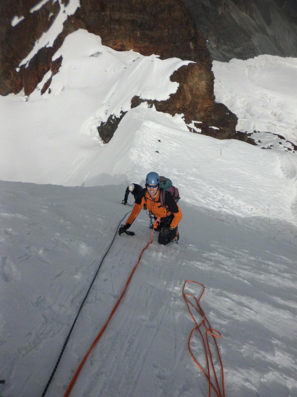
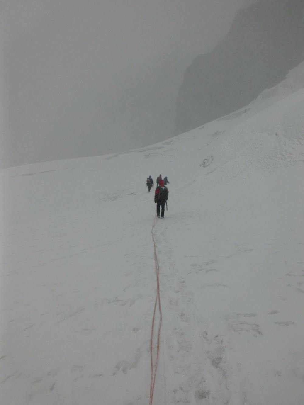
Descend slightly from Tarija and then traverse across to the foot of Pequeno Alpamayo’s summit tower. Climb this via the left skyline, which includes some steep ice/snow climbing and will require you to rope up and place good, solid protection using ice screws and snow stakes. If your snow climbing skills are good enough you can probably manage with one ice axe per person but you may be glad of having a second, lightweight axe when tackling the steeper sections of the ridge.
Your efforts on the ridge and glacier before it are all rewarded when you reach the truly spectacular summit of Pequeno Alpamayo, which enjoys fabulous views of the nearby Condoriri mountains and across the Bolivian plains.
Descend the way you came (taking care on the descent of the ridge, which is exposed and might require some abseils) all the way back to base camp. It’s perfectly possible to spend the night at base camp but after 4 days in the hills, most people opt to put in a final bit of effort in return for the prospect of some comfort, and descend all the way down to the village of Tuni. Whether you end up at base camp or down in Tuni, a good night’s sleep is guaranteed!
Difficult
The beginning of truly technical terrain which might involve pitched climbing on rock and/or ice, exposed terrain and complex route finding in ascent and descent. Equivalent to AD, AD+

The route features some exposed and/or difficult to protect sections.

Little chance of being seen or helped in case of an accident.
7 routes · Alpine Climbing · Hiking