
7 routes · Alpine Climbing · Hiking
Mountaineering to the south summit of Illimani
Hiking Difficult

The route up to the South Summit of Illimani is one of the most stunning alpine ascents in the country. Illimani has three sub-peaks, and while the South Summit is the tallest, it also provides epic views of the other more dramatic summits. This climb is usually done in 3-4 days and does require some mountaineering experience as well good physical fitness. Peaking at 21,122', proper acclimatization is a necessity before attempting to climb this mountain.
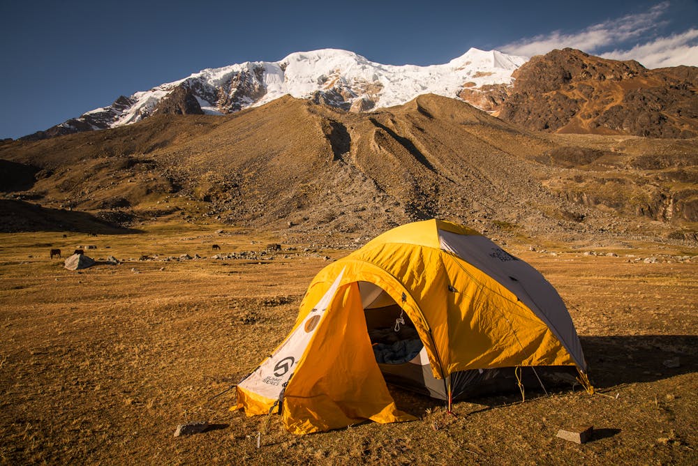
The climb starts from the small town of Pinaya, which is about a 4-hour drive from the bustling city of La Paz. After a 2-3 hour hike with about 2000 feet of elevation gain, you will reach an expansive flat field with llamas and pack horses at the foot of the mountain. This is where you will set up base camp for the night and slowly continue your acclimatization process.
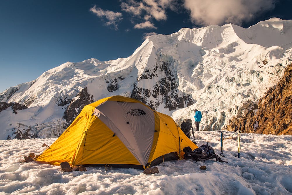
From base camp, the route continues to the southeast, up the rocky slopes of the southwest ridge. The climb up to high camp is not technical, but is brutal with rocky scrambles and over 3,000' of elevation gain, reaching 18,000' at high camp, also known as "Nido de los Condores" (Condors Nest). The views from high camp across to the other peaks on Illimani are simply stunning, and are not easy to forget.
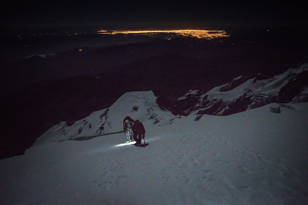
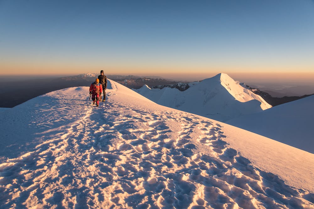
From high camp, you will likely get an early start in the middle of the night in order to reach the summit by sunrise. Here is where the technical climbing starts, and experience with climbing in cold and dark conditions with crampons and two ice axes is essential. The steepest slopes top out around 50-55 degrees, and the final push up to the summit ridge maintains a +45 degree grade for almost 1000' of elevation gain. This is definitely the hardest part of the climb, as it is the most technically challenging part as well as the most physically demanding at over 20,000' of elevation.
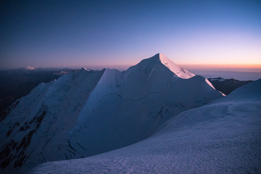
The last push along the ridge to the summit is much more straightforward, although precaution of the cornice should be taken, as a massive bergschrund lies just below the ridge. After reaching the summit, the return route is the same, with some tricky descent sections to do with tired legs.
Reaching base camp and then the town of Pinaya is a great relief, and a success worth celebrating. This was by far my most epic adventure in Bolivia, although I am sure other incredible experiences remain to be discovered in this under-appreciated landscape.
Difficult
Hiking trails where obstacles such as rocks or roots are prevalent. Some obstacles can require care to step over or around. At times, the trail can be worn and eroded. The grade of the trail is generally quite steep, and can often lead to strenuous hiking.

Some trail sections have exposed ledges or steep ascents/descents where falling could cause serious injury.
Little chance of being seen or helped in case of an accident.
7 routes · Alpine Climbing · Hiking