The Death Road
One of the World's most famous rides which is well worth the hype!
Mountain Biking Moderate
- Distance
- 61 km
- Ascent
- 1.7 km
- Descent
- 5.2 km
- Duration
- 3-4 hrs
- Low Point
- 1.2 km
- High Point
- 4.7 km
- Gradient
- 17˚

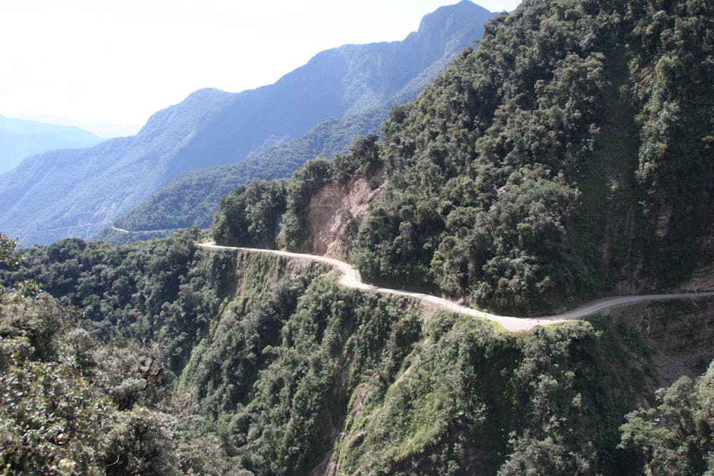
Despite the dramatic name, this is a fun adventure with minimal technicality and (provided you ride in control) minimal risk as well. It takes you down (and it's almost all down) a road section and then the famous "Death Road" itself which is a jeep track perched above some, at times, huge cliffs.
- •
- •
- •
Description
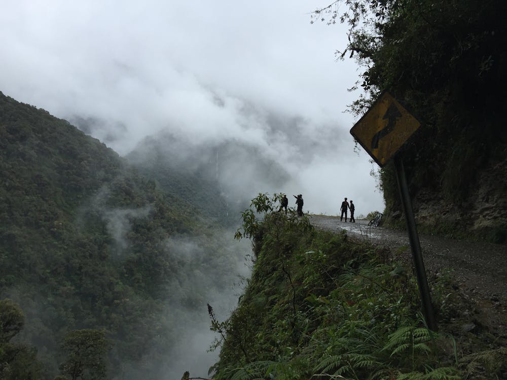
The road was constructed in 1930 and got its name because it is a single track which had traffic using it in both directions, and it doesn't feature guardrails. Furthermore, the weather is often damp and cloudy, making visibility poor and increasing the danger. Nowadays the route is open only to cyclists and although there have been around 20 fatalities since it became this way in 1998, you will be fine so long as you ride well within your ability and give the edge of the road a wide berth.
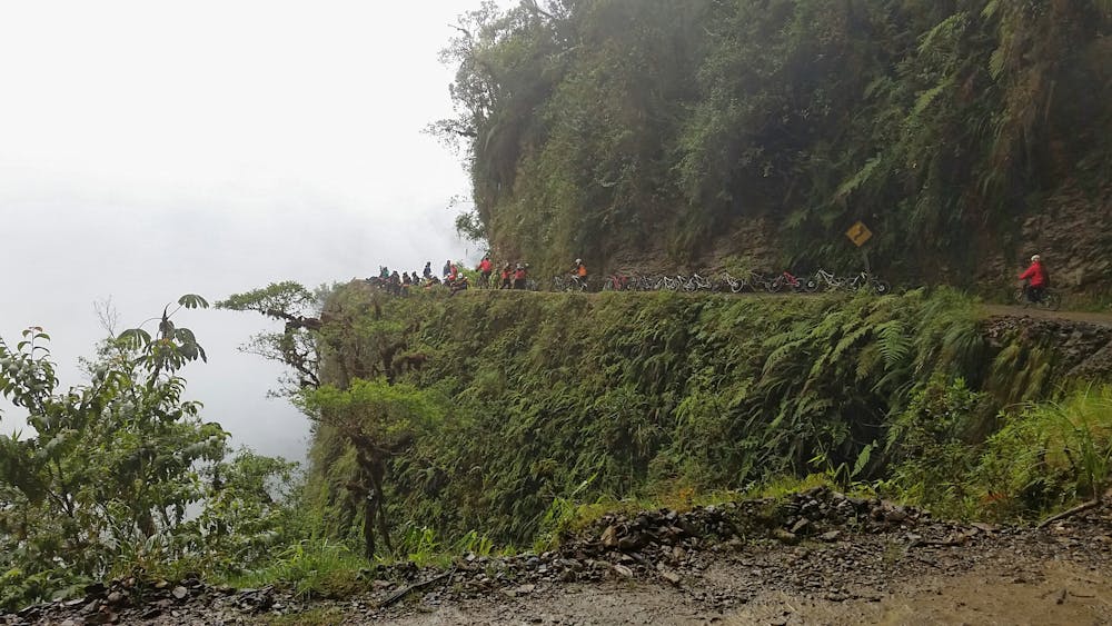
The route is done in one (long) day starting and finishing it La Paz, and the city is home to numerous companies offering bike rental and transport to and from the start of the adventure. Prices range from around $50 to $110 and as a general rule, you get what you pay for in terms of guide and bike quality. Barracuda (http://bit.ly/2VVG3QF) and Gravity (http://bit.ly/2Qg1IwU) are two of the better known operators.
Start out by driving up to a wide, cold and exposed col next to the Laguna Estellani. From here make a fast and fun descent of the mountain road to the north down to a leftwards hairpin just past the gas station at Cotapata. At the hairpin is a yellow signpost telling you that Death Road is off to the right. Follow the directions on the signpost and prepare for an adventure!
The riding on the Death Road itself is never technical, it's just mile after mile of fun, flowy jeep track. Sometimes the drop off to the left is insignificant but sometimes it is absolutely stomach churning! Take plenty of photos and ride slowly enough that there is ZERO chance of you accidentally going off the left of the track...
Eventually, after a massive 3500 metres of descent you eventually emerge at the village of Yolosa, from where you can drive back to La Paz and toast your adventure!
Difficulty
Moderate
Mostly stable trail tread with some variability, with unavoidable obstacles 8in/20cm tall or less. Other obstacles such as rock gullies and steep sections may exist. Ideal for lower intermediate riders.
Extreme Exposure

Some trail sections are extremely exposed where falling will almost certainly result in serious injury or death.
Remoteness

Away from help but easily accessed.
Best time to visit
Features
- Shuttle-run
- In the forest
- Road sections
- Wet-weather friendly