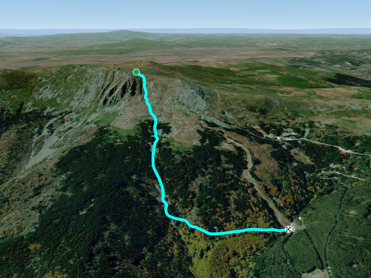
The "Avalanche"
This track is combined with backcountry ski on moraine river
Freeride Skiing Moderate
- Distance
- 3 km
- Ascent
- 18 m
- Descent
- 746 m
- Low Point
- 1.5 km
- High Point
- 2.2 km
- Gradient
- 33˚
This is a popular freeride skiing route which is generally considered to be moderate. It's very remote, it features medium exposure (e2) and is typically done between February and April. From a low point of 1.5 km to the maximum altitude of 2.2 km, the route covers 3 km, 18 vertical metres of ascent and 746 vertical metres of descent. It's graded 4.3 and Labande grade 5.
Description
The area is named "The avalanche" very long time ago so be careful with it. The slope is 40 degree steep. The track continues in backcountry on moraine river and ends at the beggining of Lale 1 lift with 10 min walking from Veda hut.
Difficulty
Moderate
Slopes become slightly steeper at around 25-30 degrees.
Medium Exposure (E2)

As well as the slope itself, there are some obstacles (such as rock outcrops) which could aggravate injury.
Remoteness

Little chance of being seen or helped in case of an accident.
Best time to visit
Features
- Trees
- Cliffs
- Walk Required