Cox Hill Ridge | C'est Notre Monde
A winter hike to a panoramic ridge
Hiking Difficult
- Distance
- 13 km
- Ascent
- 750 m
- Descent
- 750 m
- Duration
- 3-4 hrs
- Low Point
- 1.5 km
- High Point
- 2.2 km
- Gradient
- 10˚

- •
- •
- •
- •
- •
Description
ENGLISH https://www.cnotremonde.com/en/itineraries/alberta-en/cox-hill-ridge-en/ Cox Hill Ridge is a 2190 m high mountain (7185 ft) located in the foothills of the Canadian Rockies in Kananaskis Country. Although long and demanding, this hike is perfect for a winter adventure: no technical difficulty, a well maintained trail and a panoramic view at the top. What more could we ask? C’est Notre Monde invites you to discover this surprising little mountain only one hour away from Calgary.
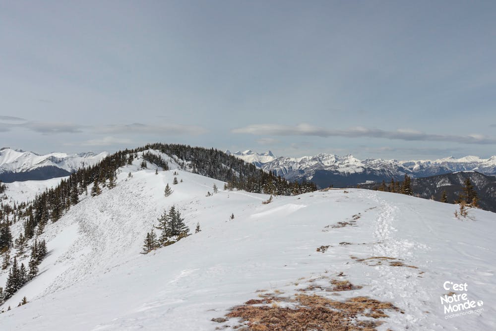
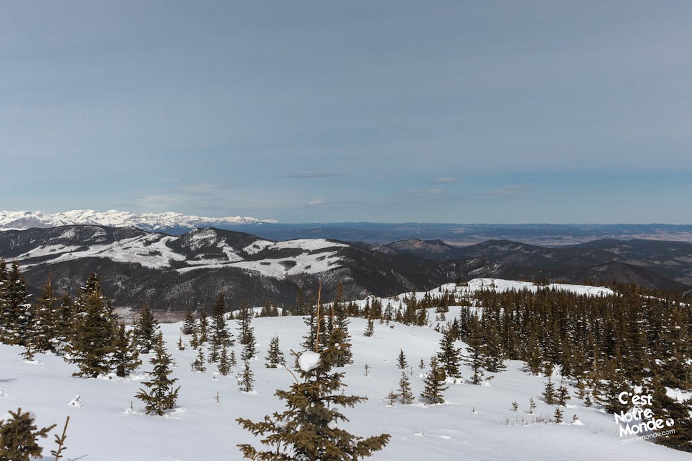
DIRECTIONS Start your hike on the “Tom Snow Track” trail, following the Jumpingpound Creek on your right. You will cross the river on a large wooden bridge and reach an intersection afterward. The right trail (Cox Hill) will take you all the way to the summit. The majority of this hike is in the forest with some openings from time to time to the surrounding hills. The well maintained trail climbs consistently with some rare flat sections. After 4.2km (2.6 mi), you will find a nice view point towards the Prairies on your left. After leaving the forest, you will find yourself at the bottom of a ridge.
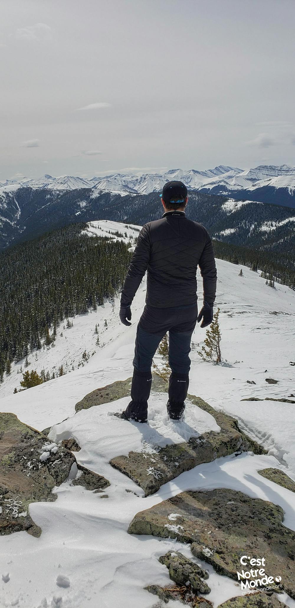
The final climb to the right is more steep and demanding. At the top, you will find a cairn (a pile of rocks) indicating the South East Ridge at around 2170 m high (7119 ft). The view here is already stunning with Moose Mountain on one side and the boundless chain of the Rockies on the other. You are not at your final destination however, you still need to walk the ridge to the final summit.
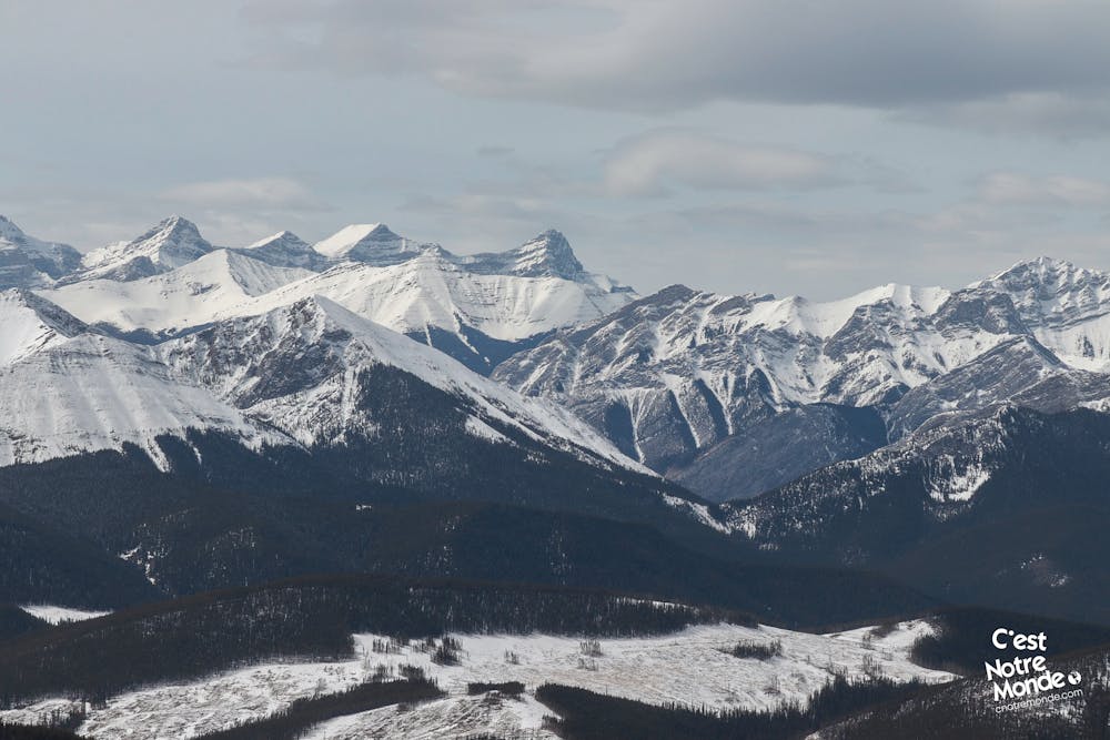
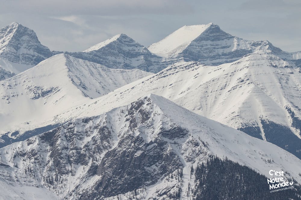
This ridge is 550 m long (0.3 mi) with a few up and down sections that offers a panoramic view until the final summit, at 2190 m of altitude (7185 ft). The 360 degree view of the region is astonishing. Will you be able to identify some of the surrounding summits, such as the easily identifiable Midnight Peak.
Retrace your steps to get back to the parking lot.
FRANÇAIS https://www.cnotremonde.com/randonnees/alberta/cox-hill-ridge/ Cox Hill Ridge est une montagne de 2190 m (7185 ft) d’altitude située au pied des Rocheuses Canadiennes dans Kananaskis Country. Bien qu’assez longue et exigeante, la randonnée pour atteindre son sommet se prête parfaitement à l’hiver : aucunes difficultés techniques, un sentier bien tracé et une vue panoramique. Que demander de plus ? C’est Notre Monde t’invite à découvrir cette montagne pleines de surprises à 1h seulement de Calgary.
ITINÉRAIRE Démarre ta randonnée sur le “Tom Snow Track trail” en suivant la rivière Jumpingpound Creek sur ta droite. Tu traverseras la rivière sur un large pont en bois et tu atteindras une intersection un peu plus loin. Prends le sentier de droite (Cox Hill Trail) qui te mènera jusqu’au sommet. La majeure partie de cette randonnée se trouve dans la forêt avec de temps à autre quelques points de vue sur les collines environnantes. Le sentier est bien tracé et la montée est constante (avec quelques passages plats). Bien que longue, elle ne devient jamais technique. Au bout de 4.2 km (2.6 mi), tu trouveras un petit point de vue panoramique sur les prairies. Enfin, tu sortiras de la forêt quelques centaines de mètres plus loin et te retrouveras au pied de la crête de Cox Hill.
La montée finale vers la crête est plus pentue et demande un plus grand effort. À ton arrivée sur la crête, tu découvriras un cairn (tas de pierres). Bravo, tu as atteint le sommet sud-est de Cox Hill à environ 2170 mètres d’altitude (7119 ft) ! La vue est déjà superbe avec d’un côté Moose Mountain et de l’autre la grande chaîne des Rocheuses. Tu n’es pas pour autant arrivé à destination. Il te reste à parcourir la crête de Cox Hill jusqu’au sommet final.
Cette large crête s’étend sur environ 550 mètres (0.3 mi) et offre une jolie vue à 360 degrés. Elle comporte quelques petites montées et descentes, pour au final t’emmener au sommet de Cox Hill Ridge (officiel) à une altitude de 2190 mètres (7185 ft). Celui-ci offre une vraie vue panoramique sur les Rocheuses. Tu pourras notamment identifier Midnight Peak au loin.
Le retour au stationnement se fait par le même chemin.
Difficulty
Difficult
Hiking trails where obstacles such as rocks or roots are prevalent. Some obstacles can require care to step over or around. At times, the trail can be worn and eroded. The grade of the trail is generally quite steep, and can often lead to strenuous hiking.
Low Exposure

The path is on completely flat land and potential injury is limited to falling over.
Remoteness

Away from help but easily accessed.
Best time to visit
Features
- Alpine
- Wildlife
- Picturesque
- Summit Hike
- Dog friendly
- Wild flowers
- Water features
- Family friendly
- Forestry or heavy vegetation