Mt Hector North Face
Banff National Park
Spring Skiing on the iconic Ski Mountaineering line.
Ski Touring Difficult
- Distance
- 14 km
- Ascent
- 1.5 km
- Descent
- 1.5 km
- Duration
- 7-8 hrs
- Low Point
- 1.8 km
- High Point
- 3.2 km
- Gradient
- 42˚
This classic ski route is exploding in popularity, and it's easy to see why. It's a thoroughly enjoyable ski mountaineering objective with easy road access and spectacular summit. It is imperative to move quickly on this route because warming causes the significant overhead hazard risk to rise dramatically. Most parties aim to complete this route and be back to the car within five to seven hours.
- •
- •
- •
- •
- •
- •
Description
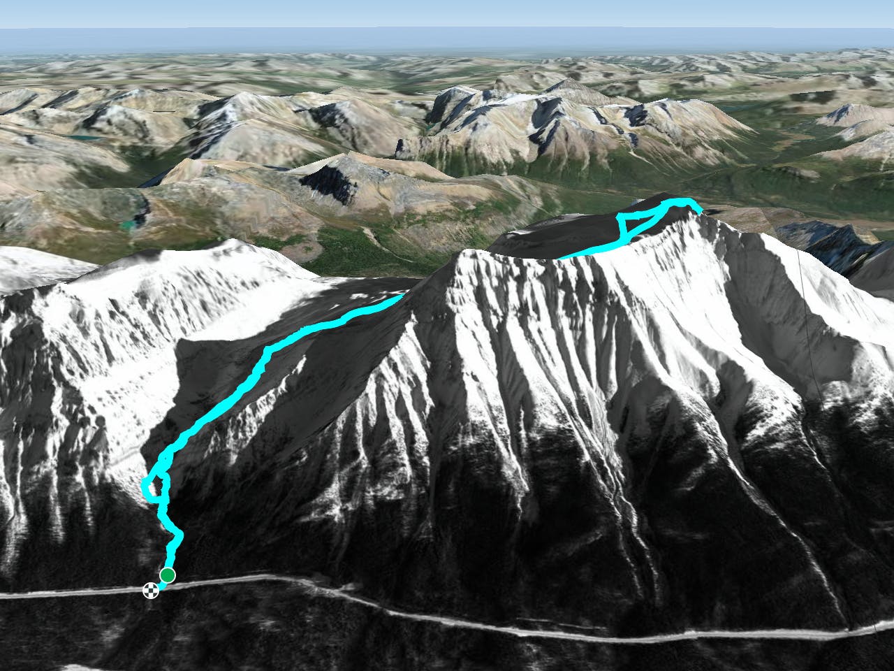
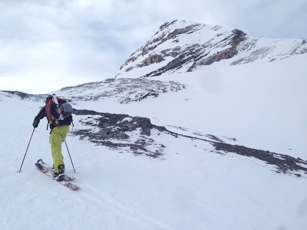
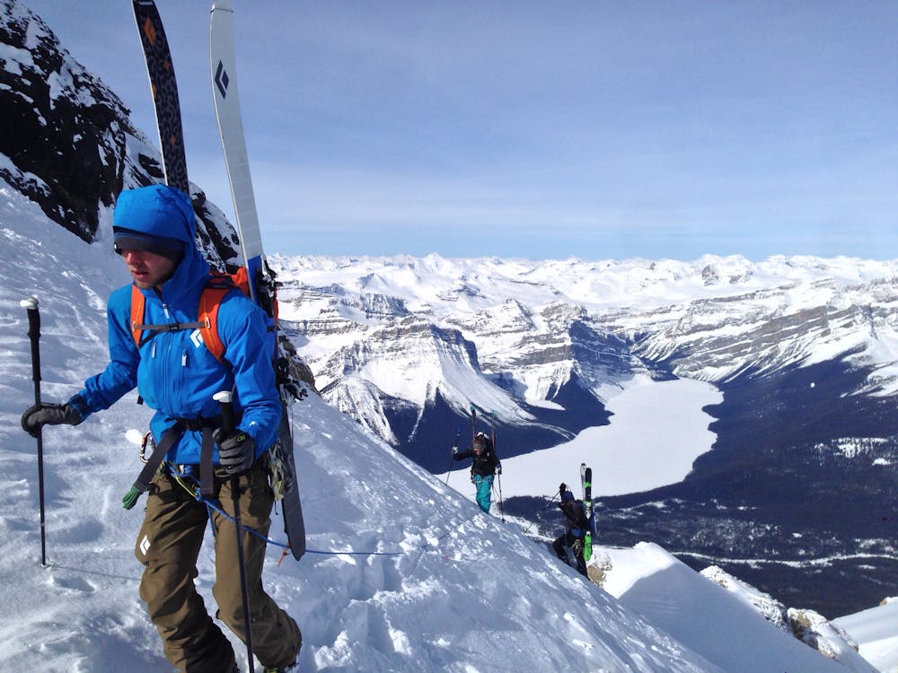
Mount Hector's main route requires a ski mountaineering ascent. It moves through a lot of complex avalanche terrain, across glaciers, and through many terrain traps. Most people will do this route in spring, aiming to be off the mountain before noon. This route should be attempted only by very fit parties with experience in glacier travel. It is a route that requires constant movement. This route can and has been snowshoed, but this is more often over the course of two days because it's tough for snowshoes to move at a pace necessary to avoid avalanche terrain.
The route begins at an easy to miss turnoff for the Mount Hector drainage that lies between Andromache and Hector. The skin track leads up along the trail for a kilometer before steepening considerably. A bootpack is usually required to reach the valley above.
Following the valley, keep to the south Hector side, gaining elevation until you reach a series of moraines. From here, pick a route that suits the snow conditions best.
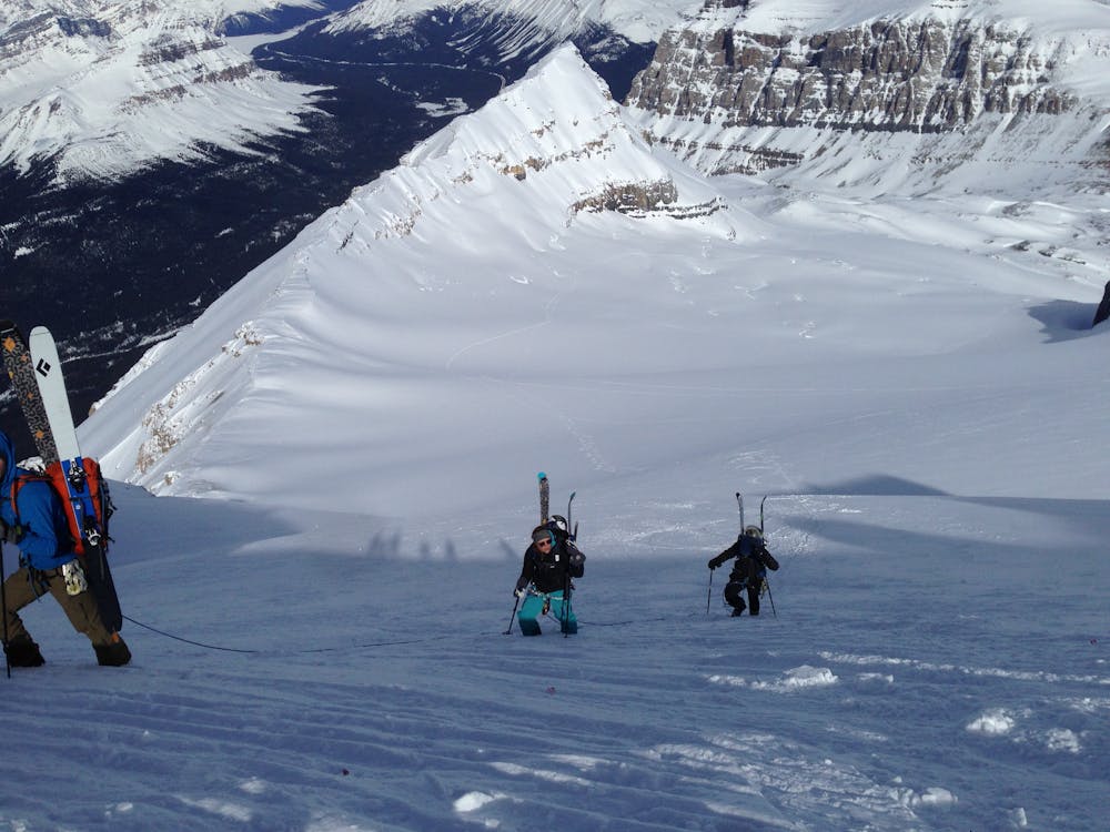
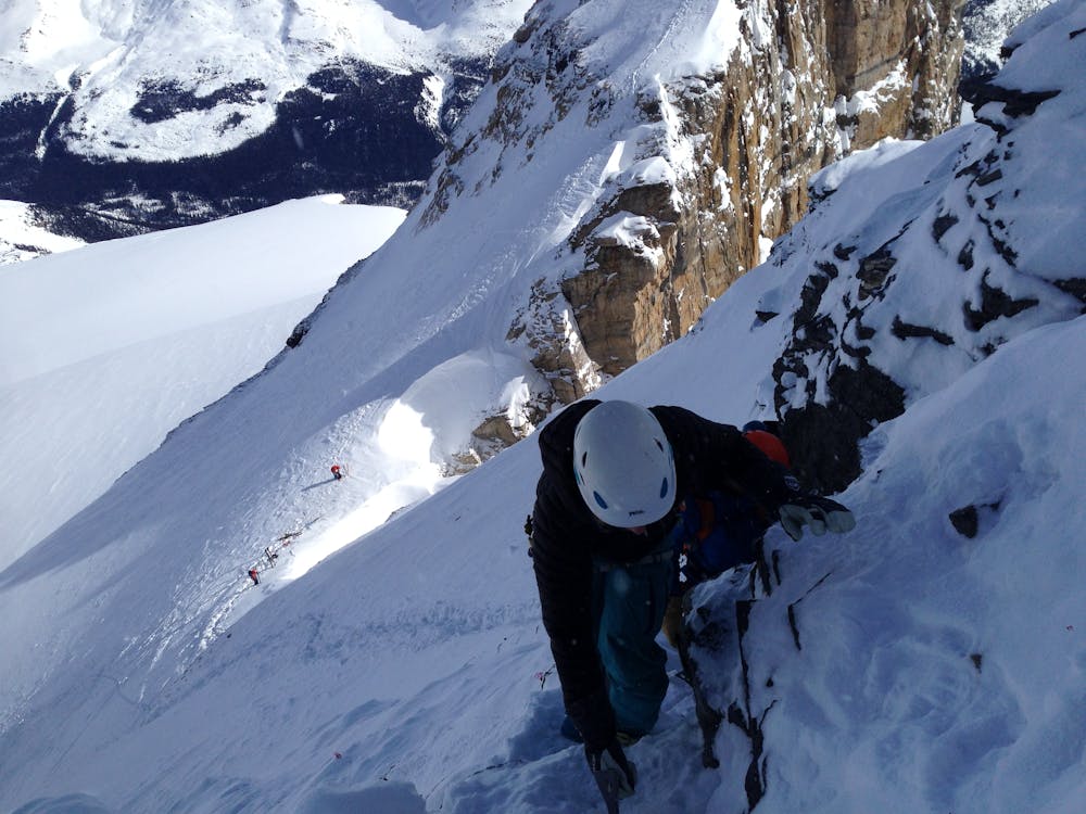
Past this is a good spot to rope up as you step onto the glacier. Keep your ski crampons ready because they will be required soon. The route steepens as you progress. Eventually ski crampons become necessary because the terrain and hard spring conditions make for tricky skinning. Many people bootpack this section instead.
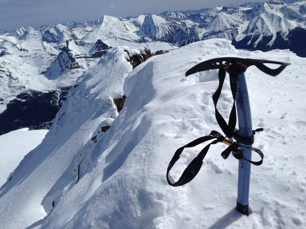
Once you gain the base of the summit block you'll see a slight gully just beneath the upper col between the main peak and the subpeak that pushes through the first band. Ascend up the snowfield and then traverse westward, up a couple of rock steps onto the summit.
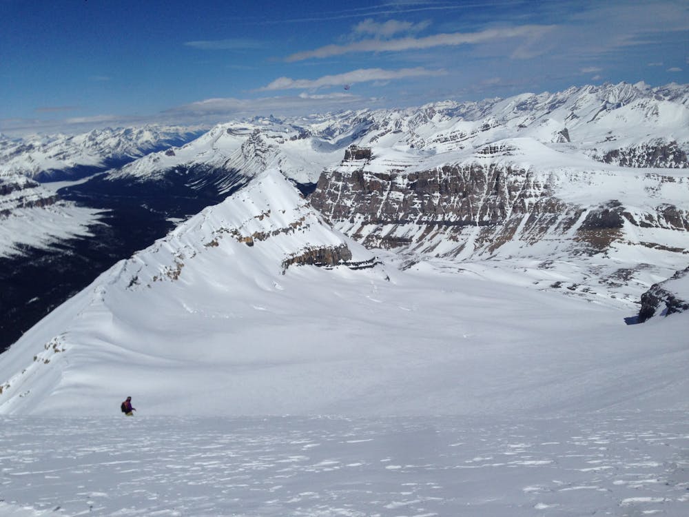
Well done, you've made it! The downclimb is tricky, and as of yet there are no solid options for rappels. Descend back to your skis and rip down the valley. The run is beautiful, and while the snow is rarely superb, it's great fun.
As you proceed back down to the valley and into the gully, be very cautious. Neighboring Mount Andromache has a bad habit of releasing early morning avalanches that wipe out the gulley. Scrambling down the rock bands above the gulley to the west is often the safer option.
PACK LIST Avalanche Recue Kit Crevasse Rescue Kit Rope Helmet, Harness, biners Ice ax, crampons Speed Touring clothing Headlamp Snacks and Water Map, compass, GPS
Difficulty
Difficult
Serious gradient of 30-38 degrees where a real risk of slipping exists.
Medium Exposure (E2)

As well as the slope itself, there are some obstacles (such as rock outcrops) which could aggravate injury.
Remoteness

Little chance of being seen or helped in case of an accident.
Best time to visit
Features
- Bowl
- Alpine
- Single Descent
- Ski Mountaineering
Equipment required
- Rope
- Skins
- Ice axe
- Crampons
- Glacier kit