Opal to Grizzly Traverse
One of the best all around views you will get off highway 40. A hard climb with ridges, route finding and beautiful trails.
Trail Running Extreme
- Distance
- 10 km
- Ascent
- 1.3 km
- Descent
- 1.2 km
- Duration
- 2-3 hrs
- Low Point
- 1.6 km
- High Point
- 2.6 km
- Gradient
- 24˚

You will need two vehicles or prepare to run or walk the road back to the car.
- •
- •
- •
- •
- •
- •
- •
- •
- •
- •
- •
- •
- •
- •
- •
- •
- •
- •
- •
- •
- •
- •
- •
- •
- •
- •
- •
- •
- •
- •
- •
- •
Description
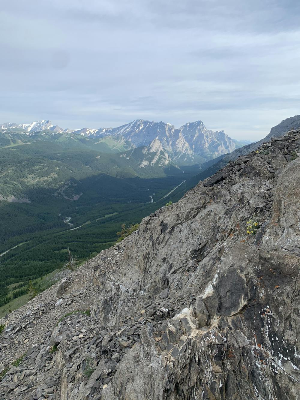
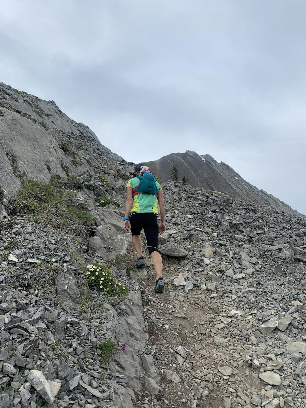
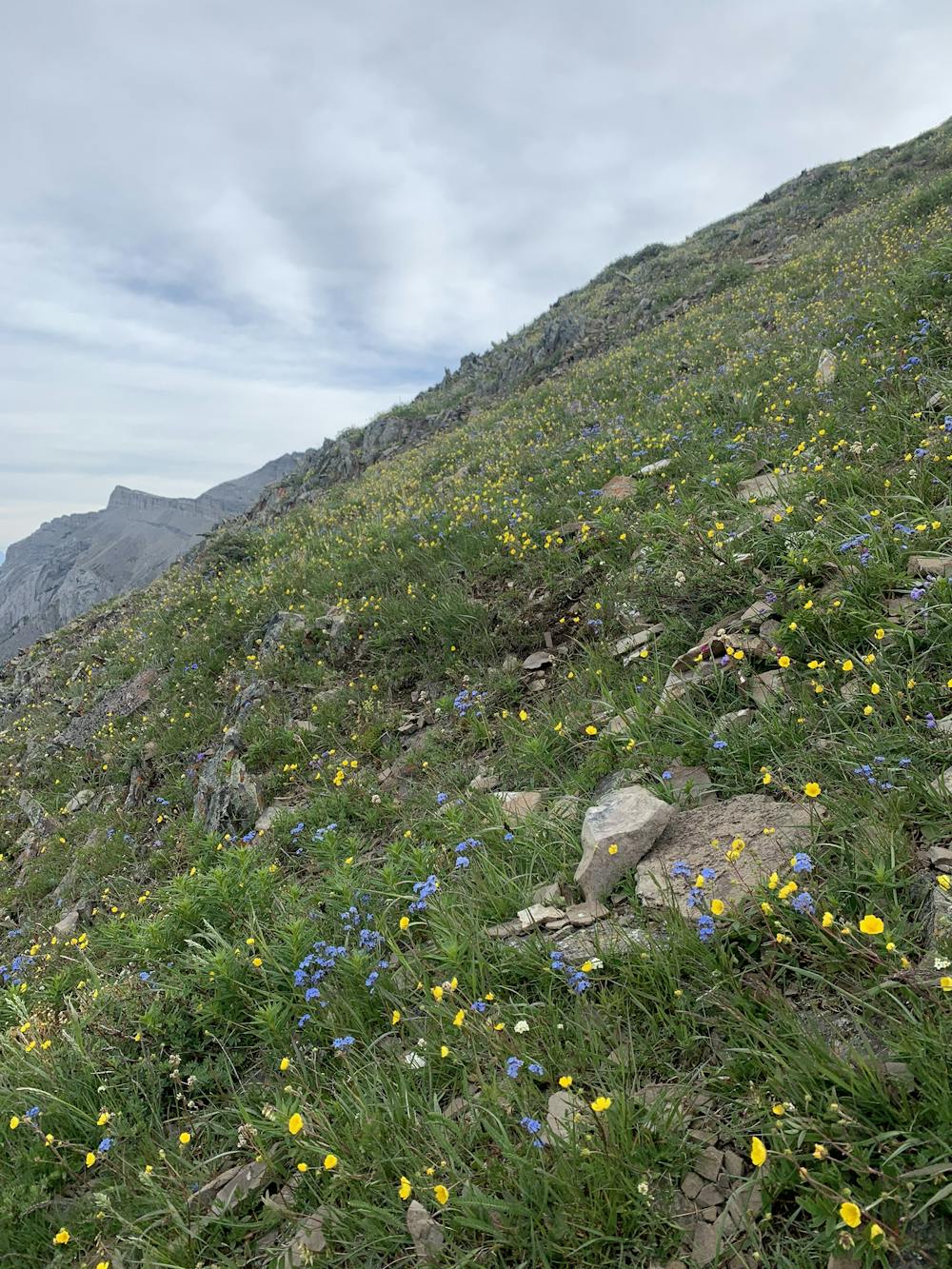
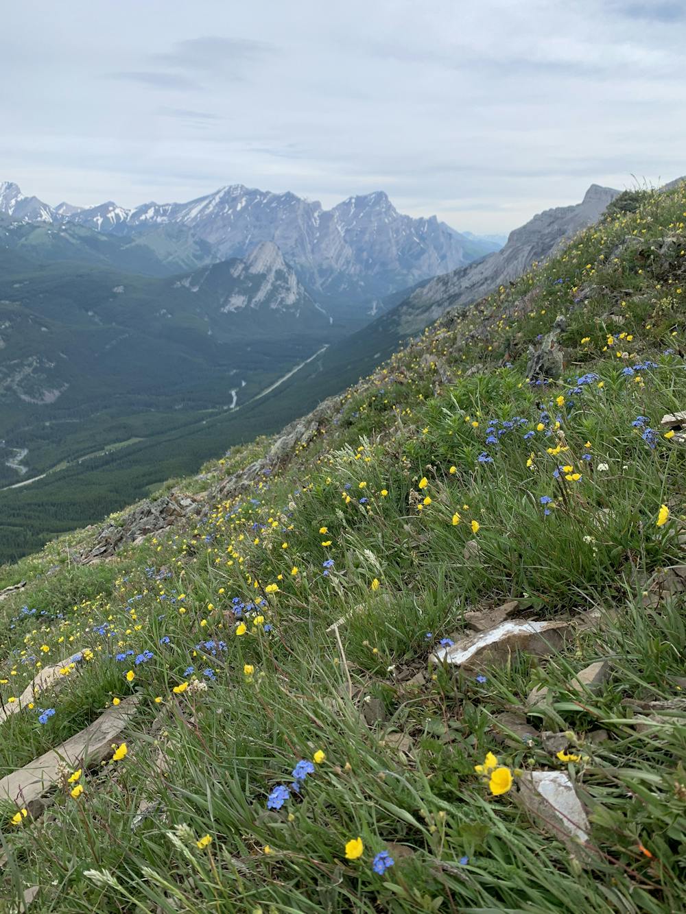
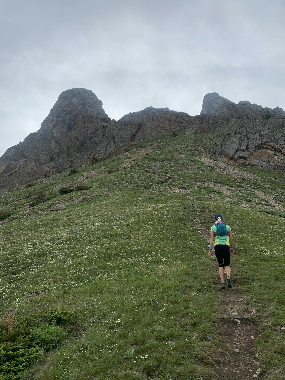
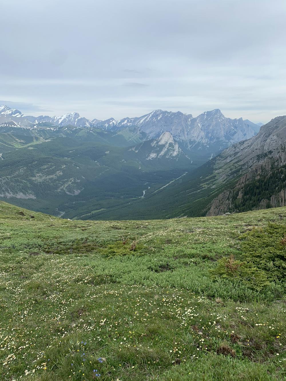
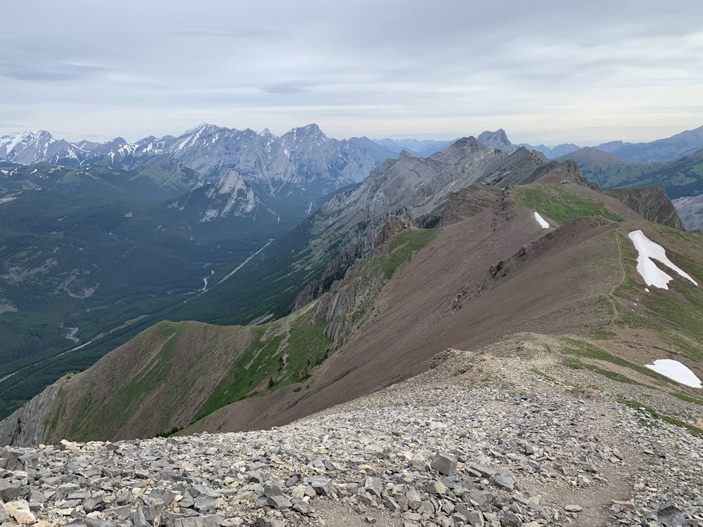
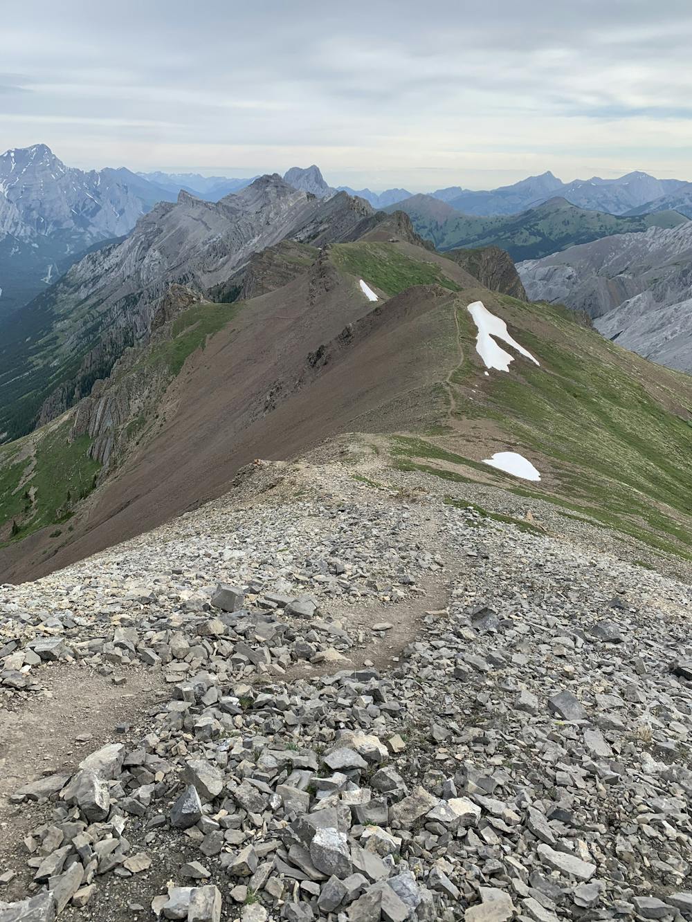
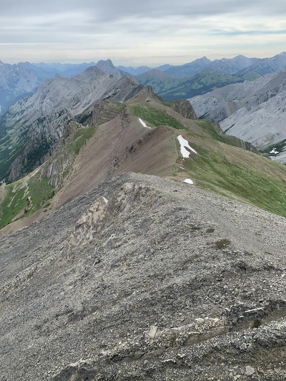
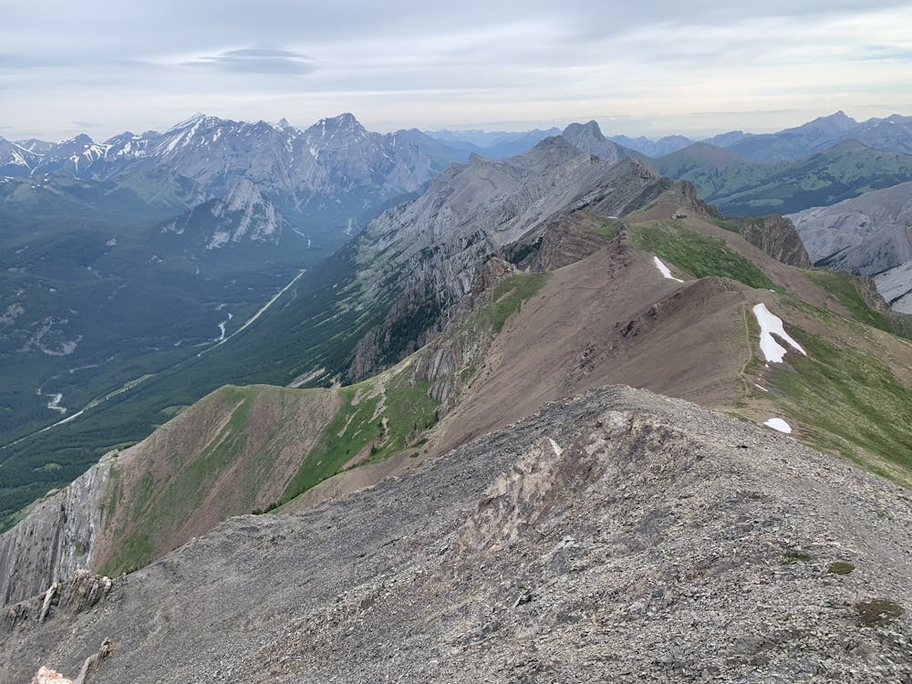
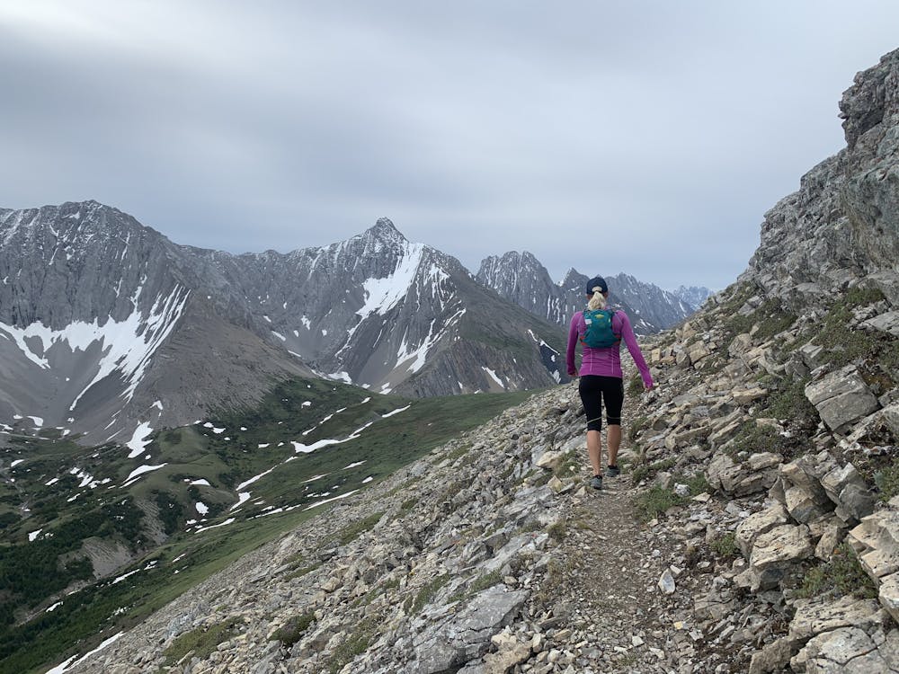
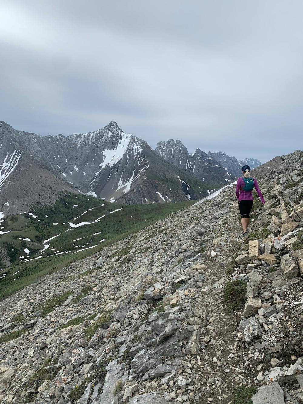
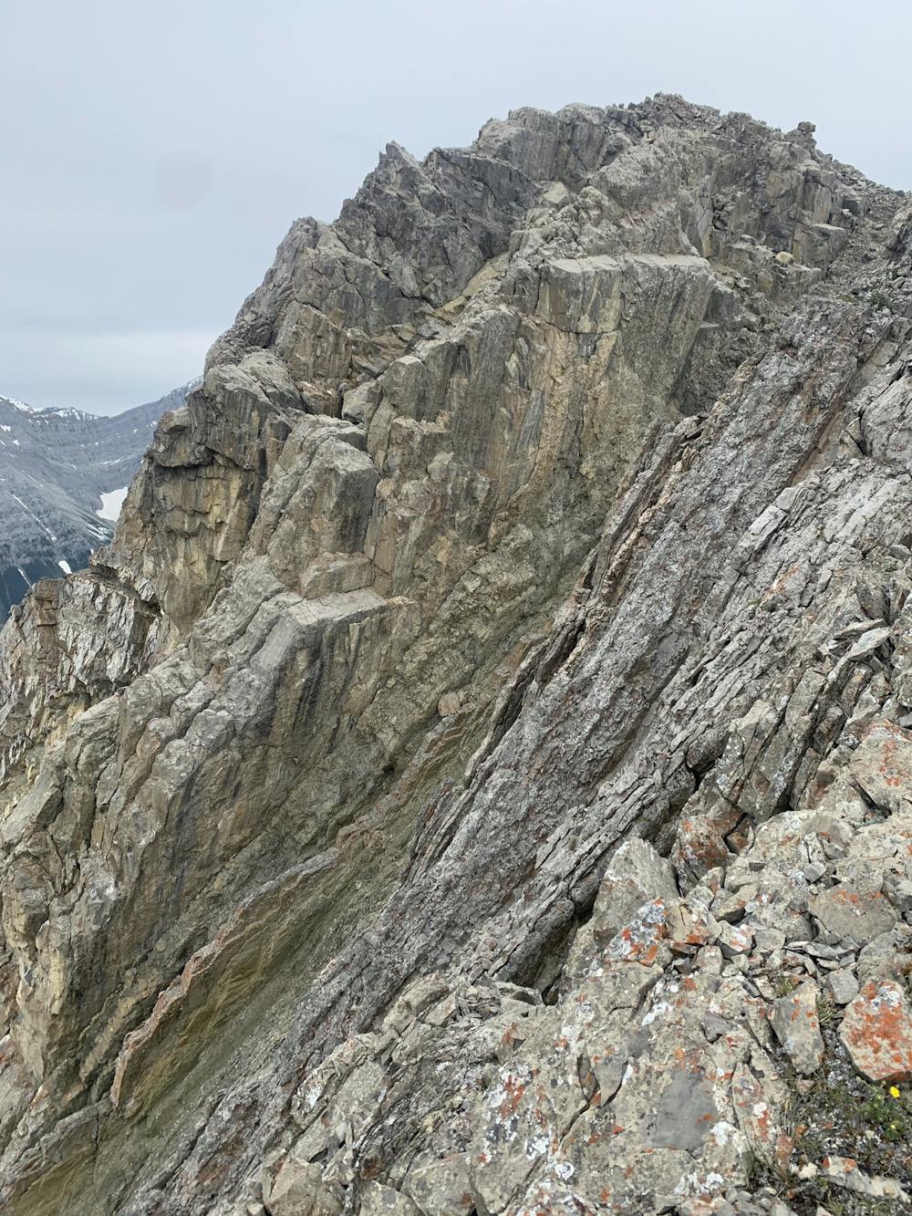
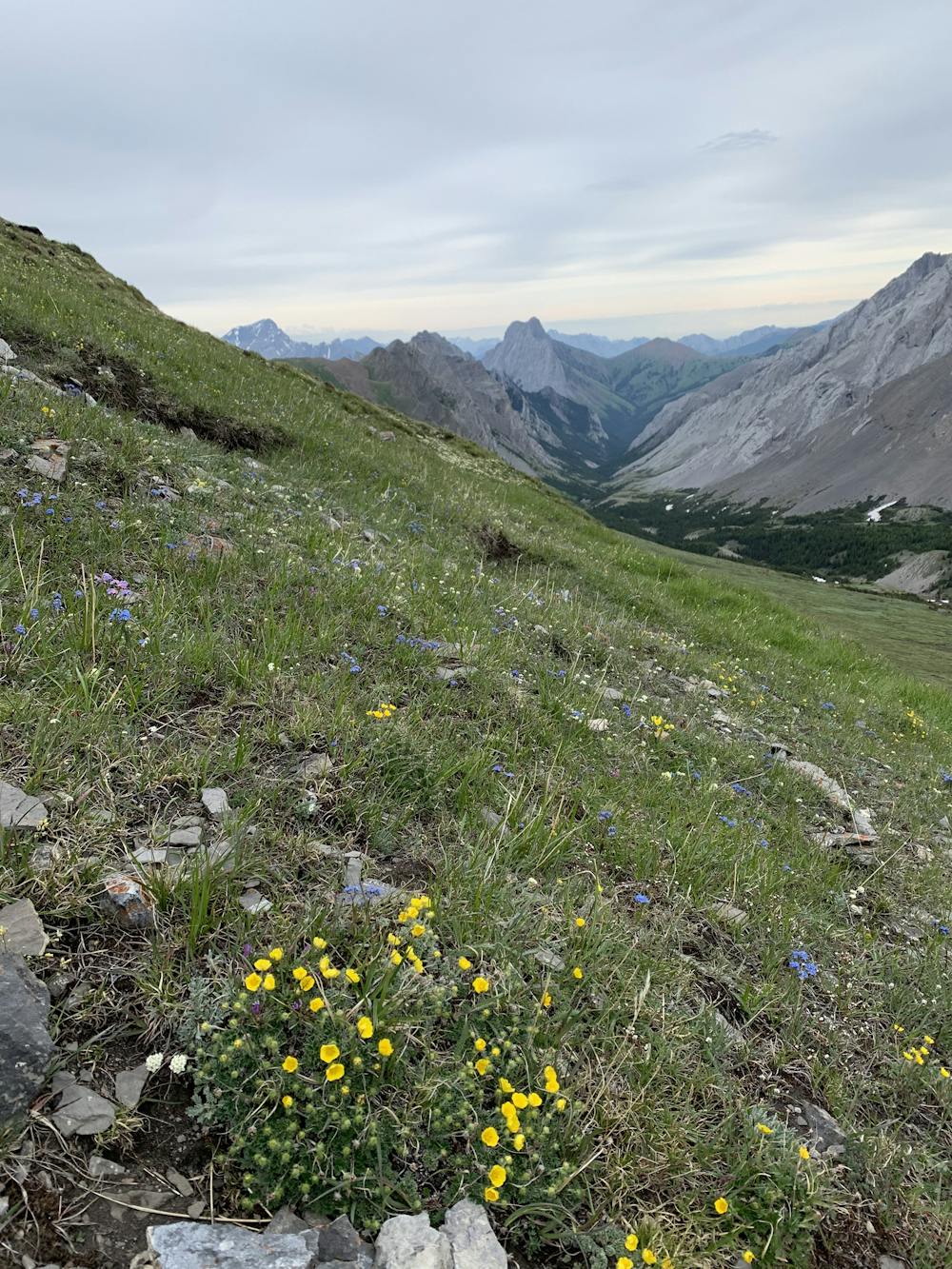
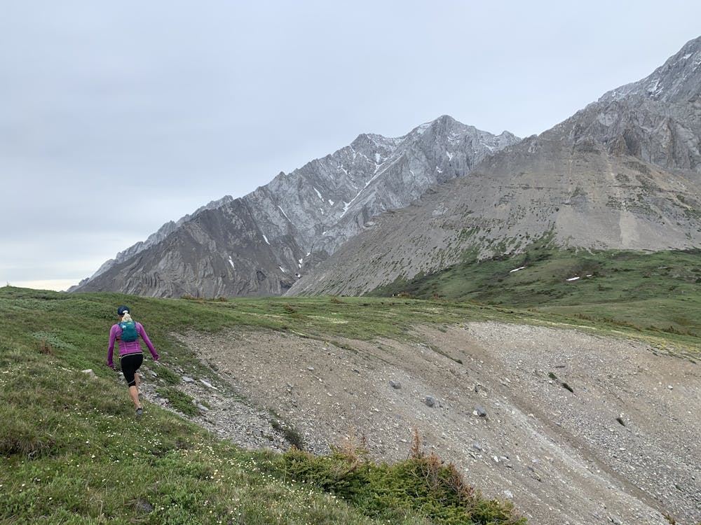
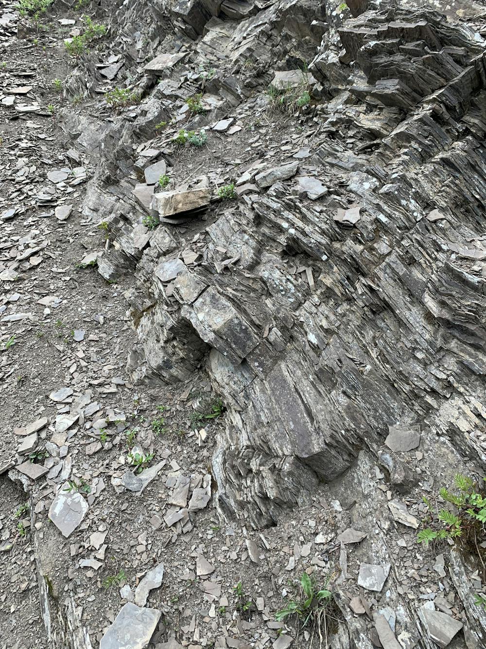
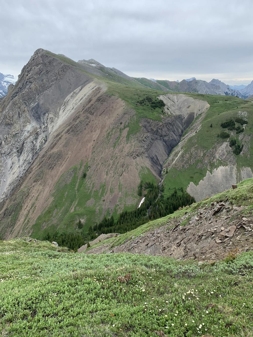
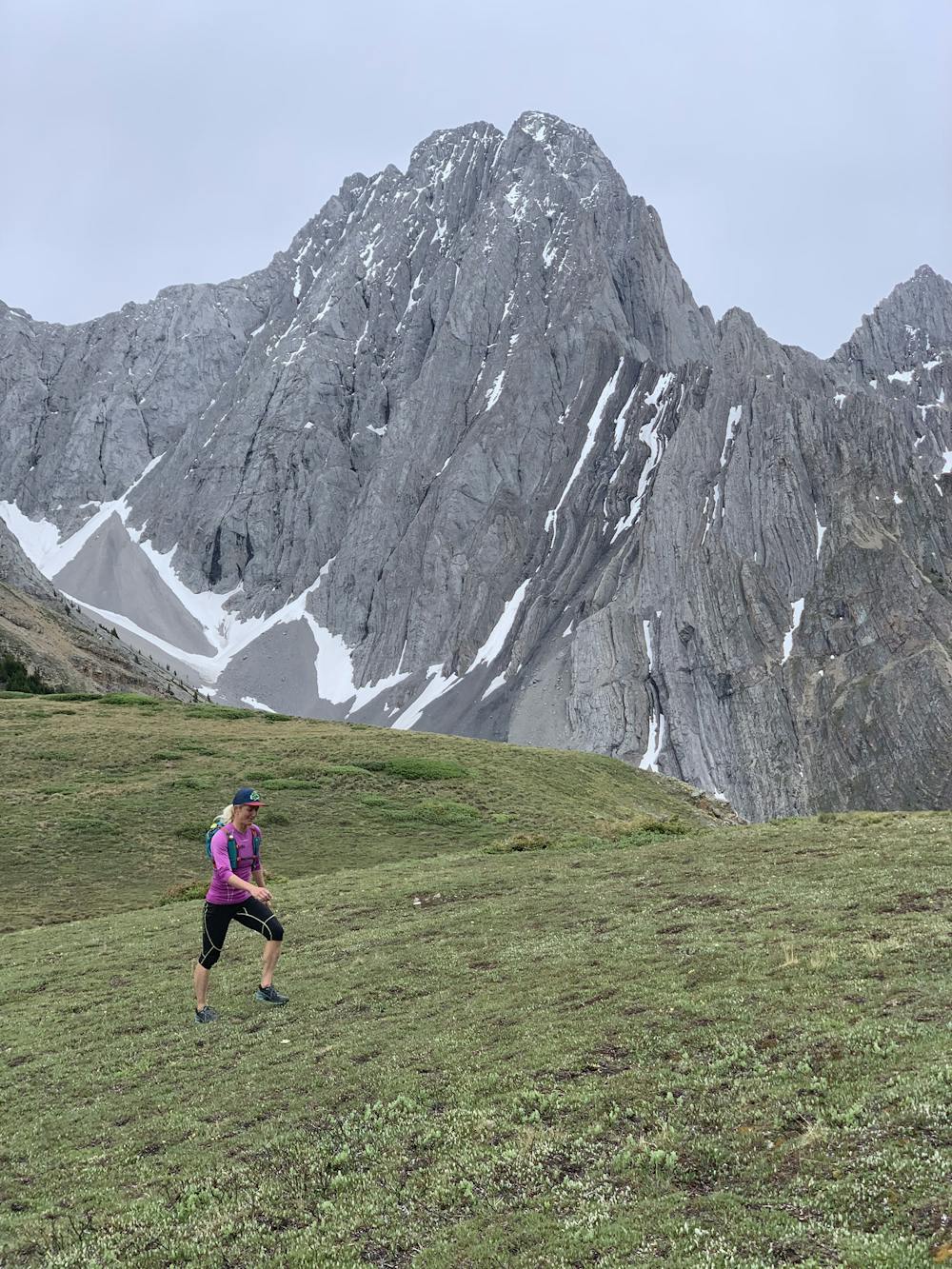
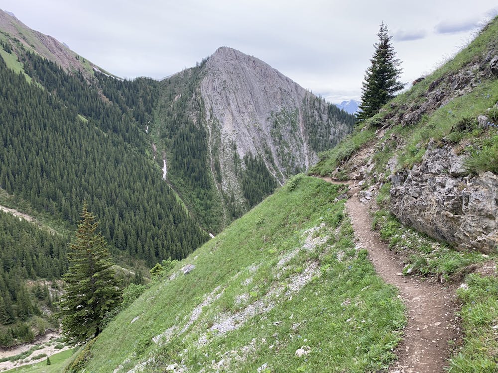
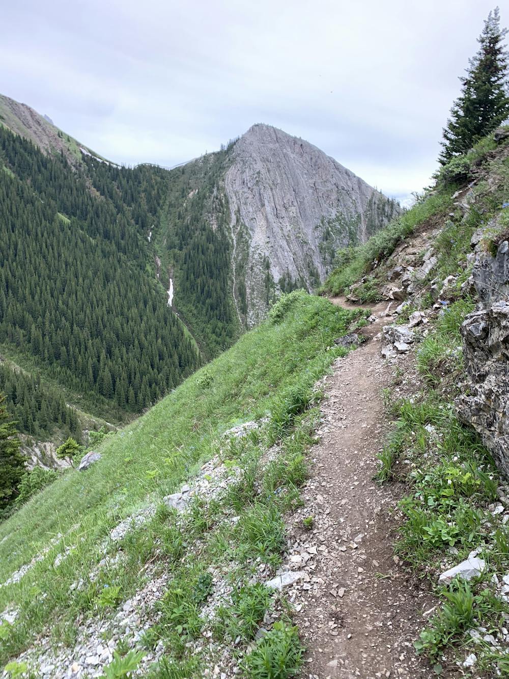
Once you leave the parking lot of the Fortress gas station, you will be climbing immediately. It does not get easy until the top of the ridge. You will follow a trail that will start to get into some scree and rock as you get higher up. The rock is fragile, and you should make sure that your footing and handholds are very stable. You will gain lots of elevation early and have opportunities to rest with some wildflowers and a great view of the valley.
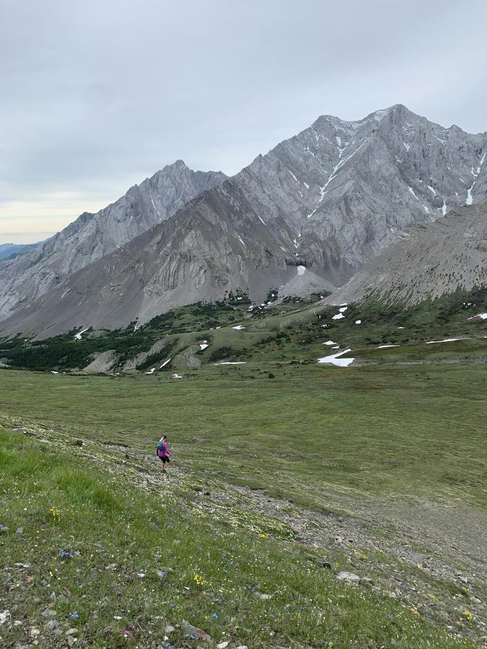
Once you're almost to the final push for the summit, you need to take the time to look behind you and get the full view of the valley. It is stunning.
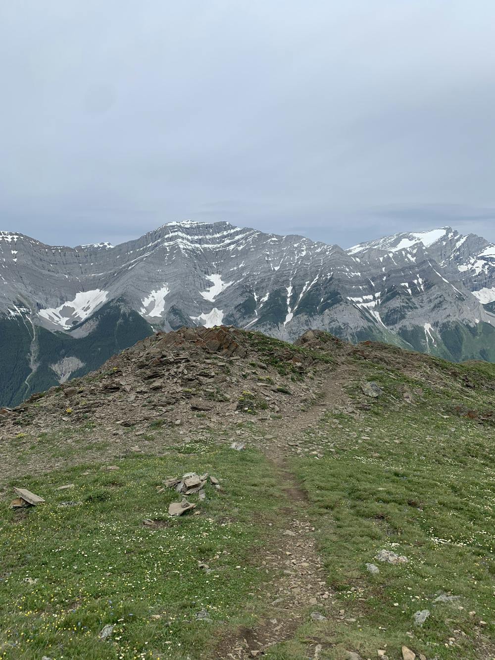
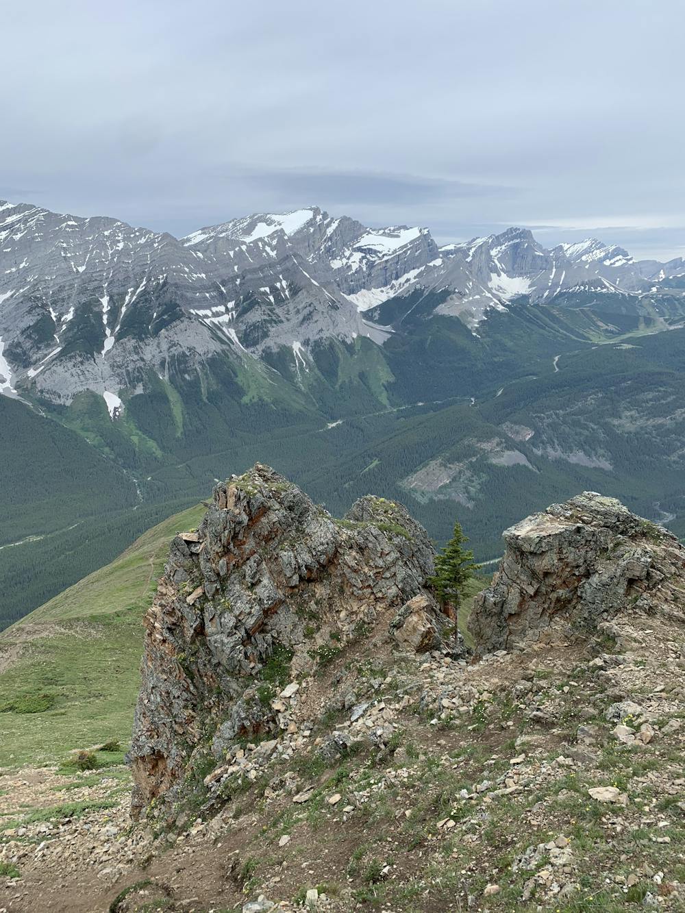
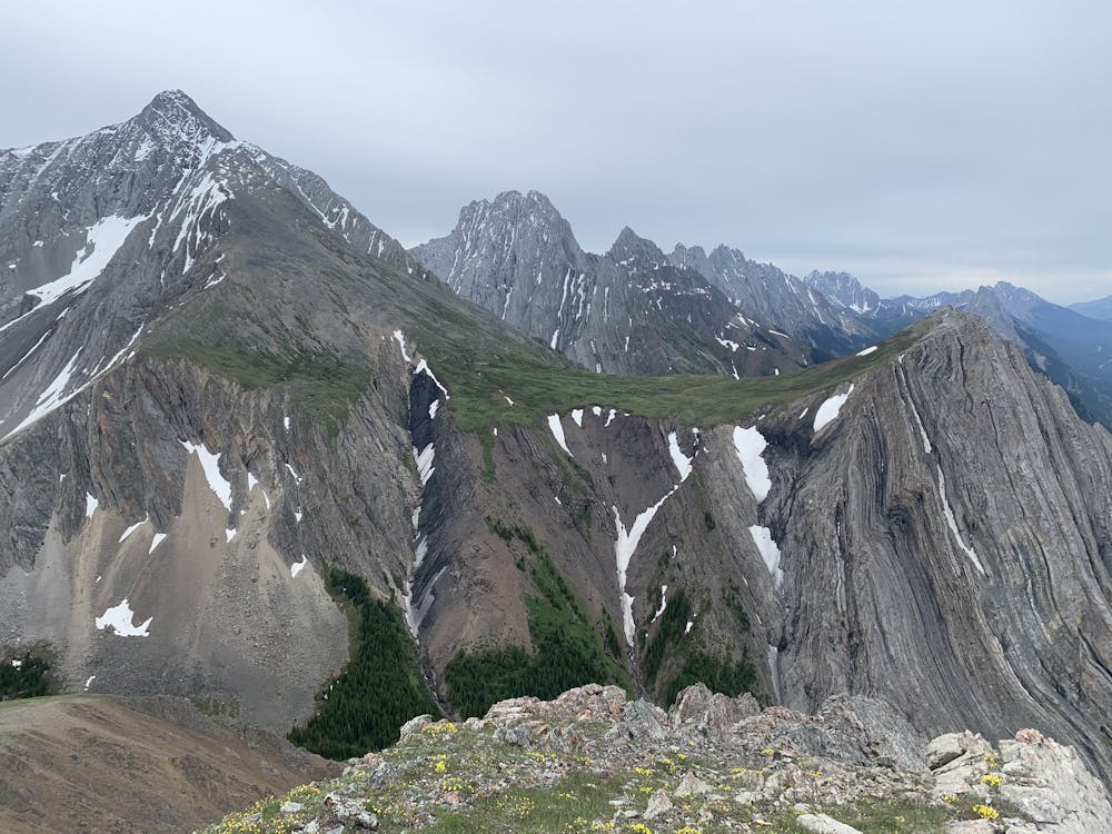
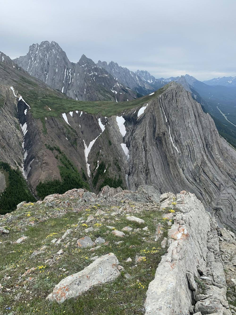
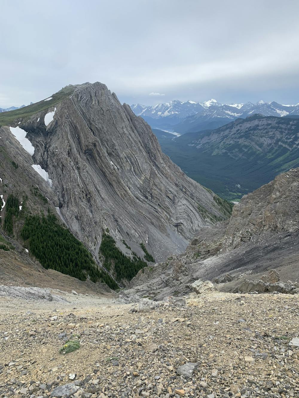
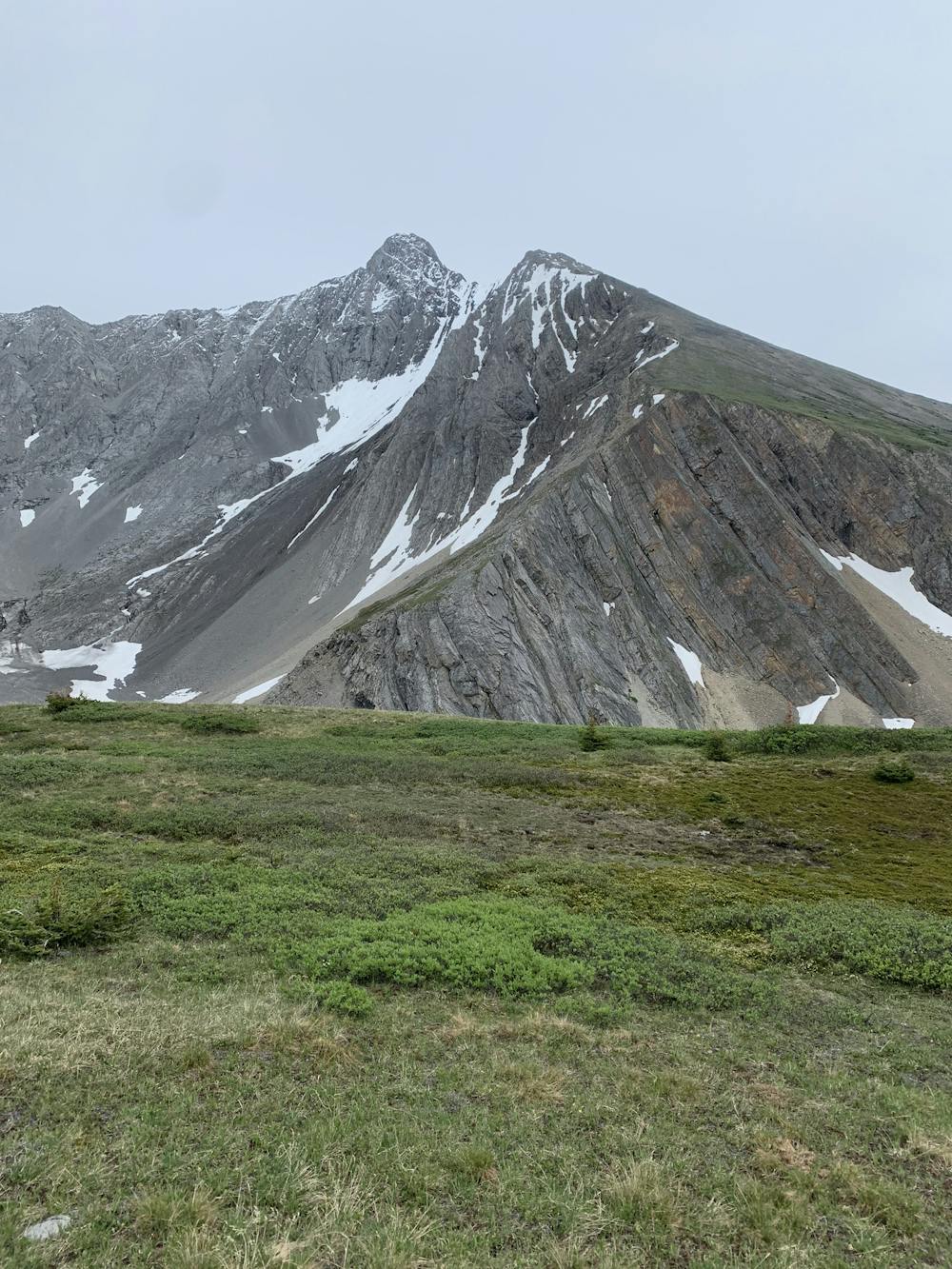
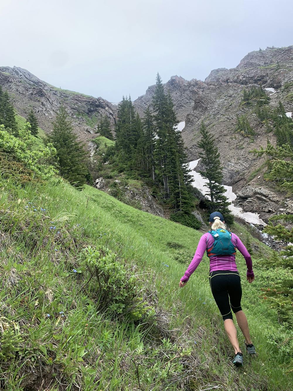
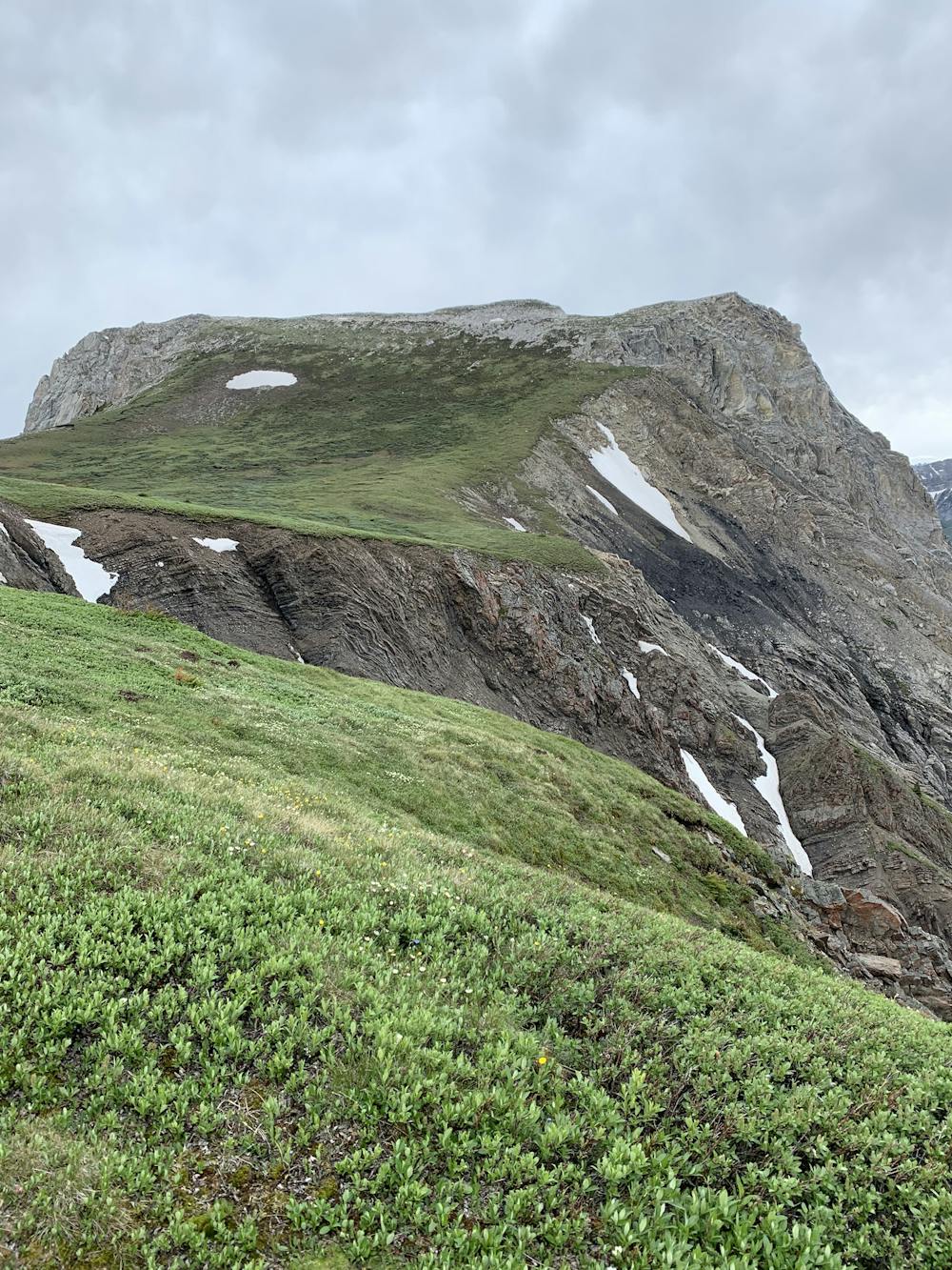
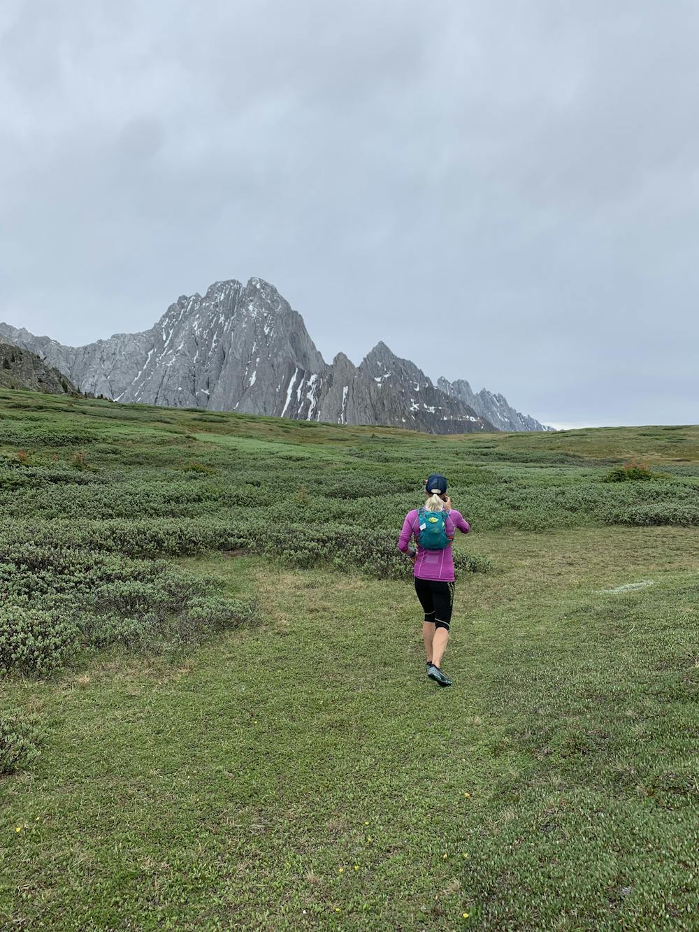
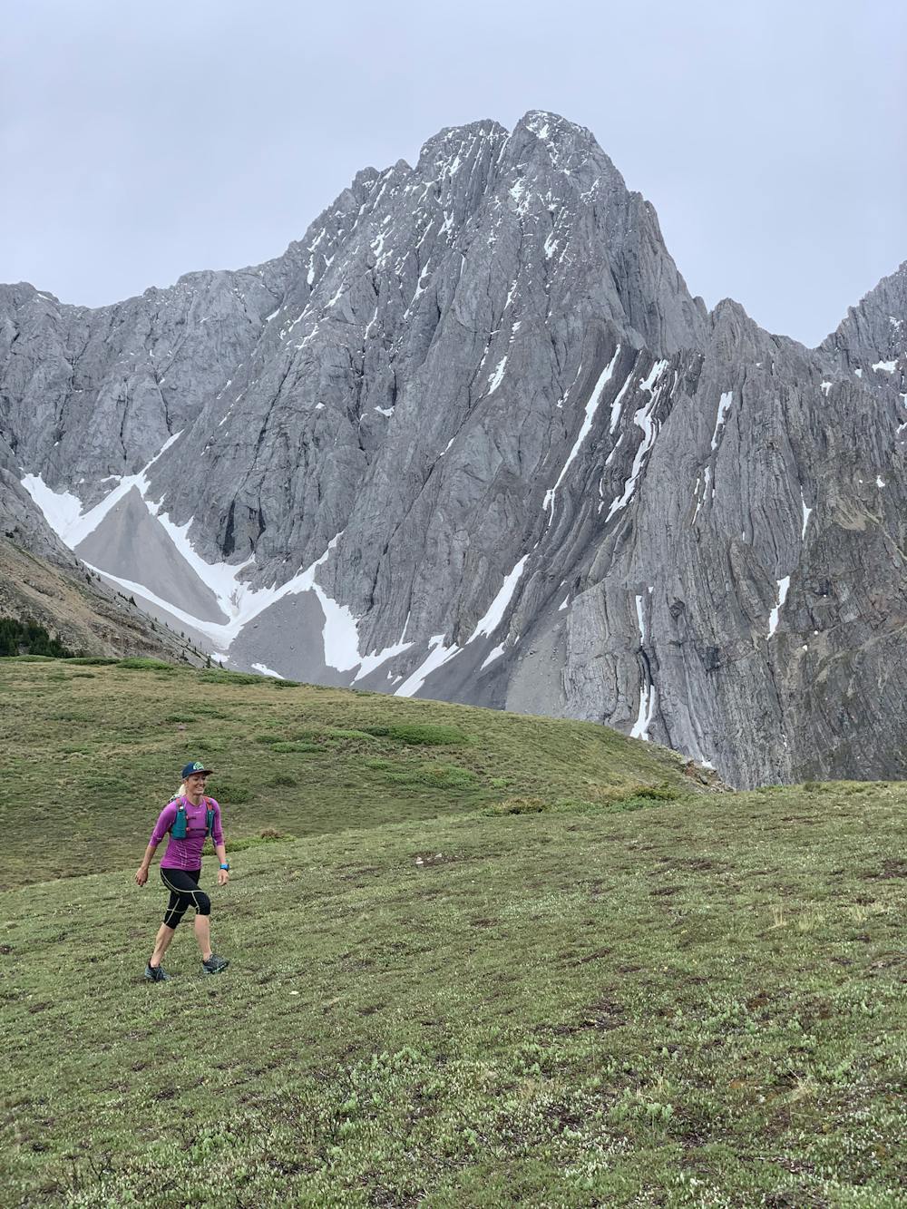
At the summit, you are now heading along the ridge and towards Grizzly Peak. There are two options: you can head down the drainage where the creek is, or cut across the creek and through the thick bush where you can climb a very steep hill, which will bring you to the alpine meadow of Grizzly Peak. From here, you can tag the summit and look at the unique rock and the valley.
You will then head down the Grizzly Peak trail. The top part has loose rocks and dirt, but as you descend, it does get easier. Soon enough, you'll see your car next to the road.
Difficulty
Extreme
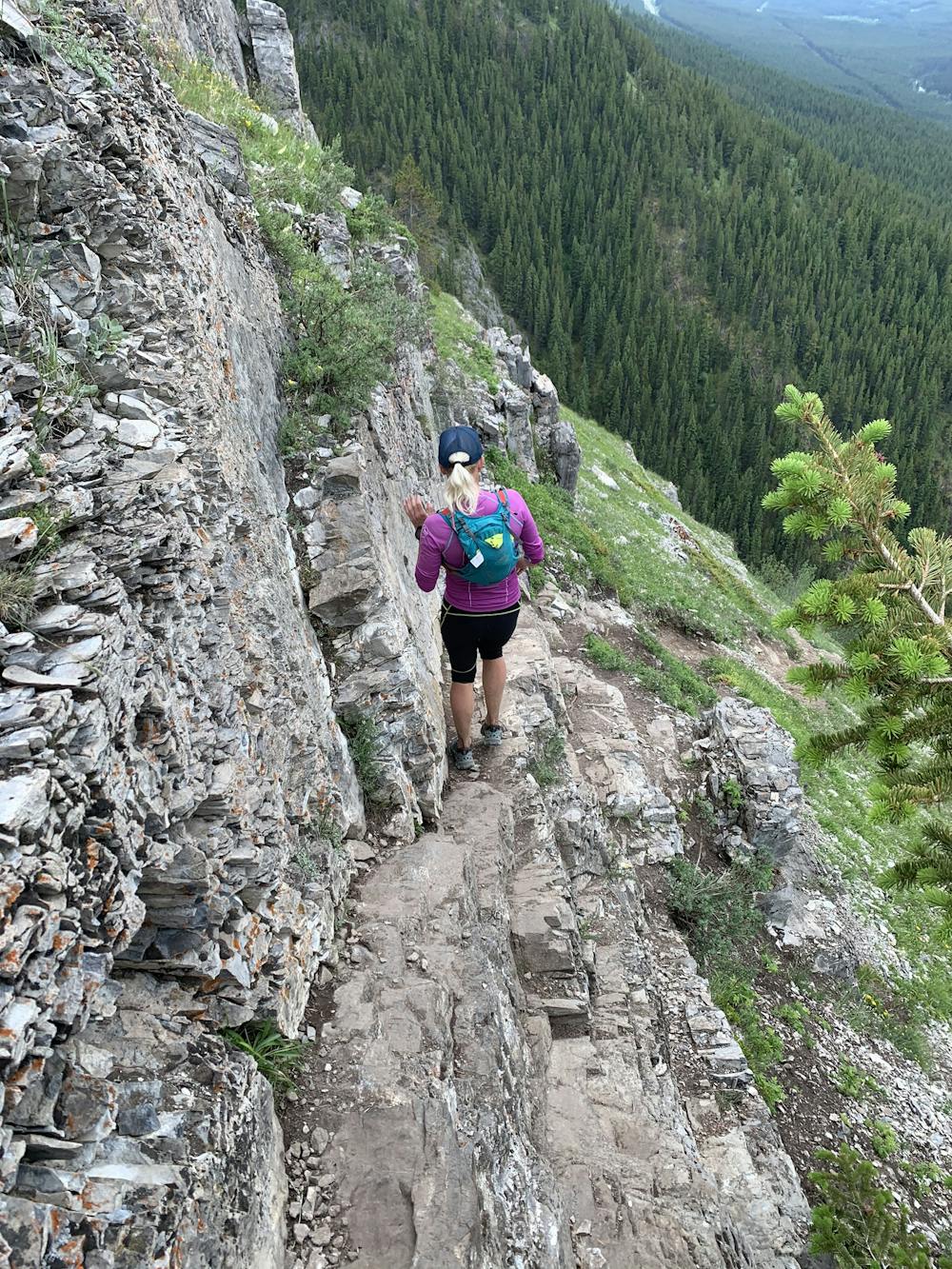
Extreme Exposure

Some trail sections are extremely exposed where falling will almost certainly result in serious injury or death.
Remoteness

Little chance of being seen or helped in case of an accident.