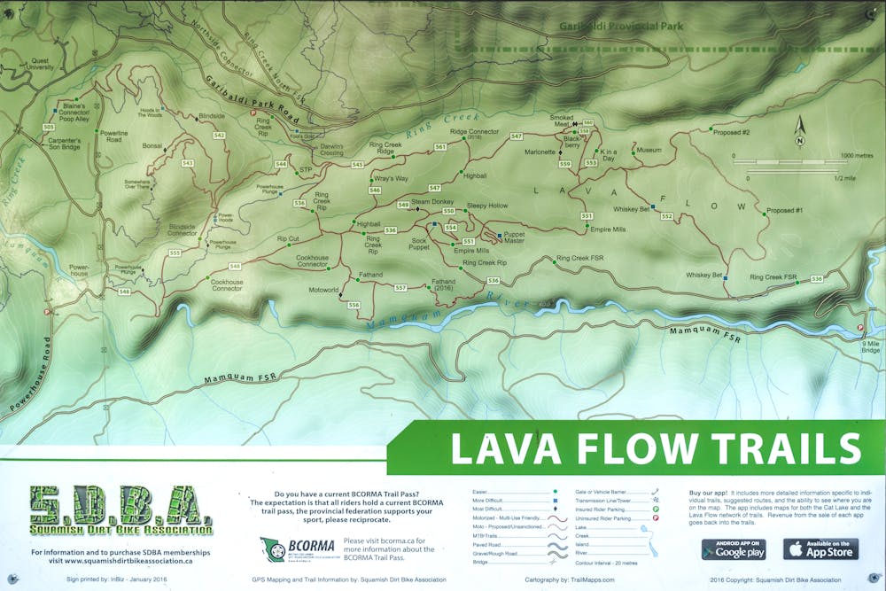
Ring Creek Rip
Squamish
Dirt Biking Moderate
- Distance
- 6.8 km
- Ascent
- 381 m
- Descent
- 68 m
- Low Point
- 244 m
- High Point
- 576 m
- Gradient
- 8˚

This is a popular dirt biking route which is generally considered to be moderate. It's remote, it features medium exposure and is typically done between March and December. From a low point of 244 m to the maximum altitude of 576 m, the route covers 6.8 km, 381 vertical metres of ascent and 68 vertical metres of descent.
- •
- •
Description
Dirt bike grade: Green.
Difficulty
Moderate
Medium Exposure

The trail contains some obstacles such as outcroppings and rock which could cause injury.
Remoteness
Away from help but easily accessed.
Best time to visit
Features
- Flow
- Technical
- Wet-weather friendly
- Roots
- Rock Gardens