5040 Peak
Vancouver Island
A true hidden gem of a hike en route to Tofino that is unknown to most but well worth a visit
Hiking Severe
- Distance
- 6.9 km
- Ascent
- 898 m
- Descent
- 898 m
- Duration
- 2-3 hrs
- Low Point
- 618 m
- High Point
- 1.5 km
- Gradient
- 22˚

This is one of my favorite hikes on all of Vancouver Island, it's short and steep, but the views on a clear day are truly epic.
- •
- •
- •
Description
There are 2 routes up 5040 Peak, this route goes via Cobalt Lake and requires driving further down a poorly maintained dirt road to get to the trail head. A 4WD vehicle with good ground clearance is highly recommended to get down this road, although it is possible to get there with a 2WD if it has good ground clearance.
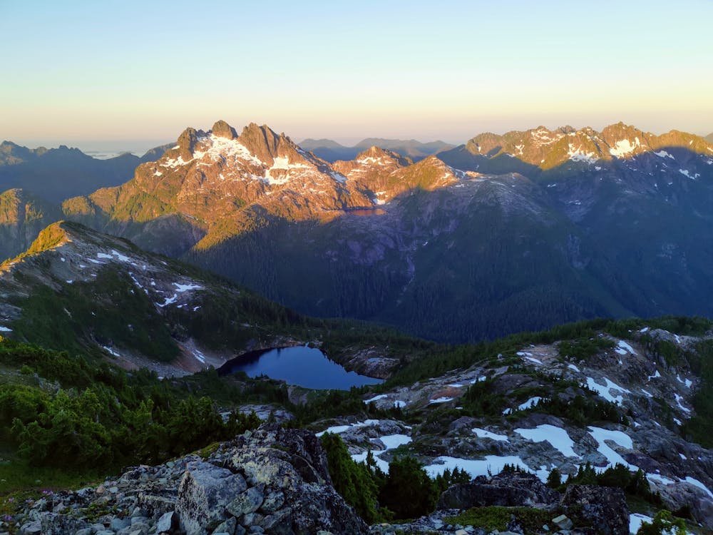
Once at the trailhead the hard climb begins, this trail is very steep up through the forest, and may require some scrambling in sections, but generally the trail is clear to see and easy to follow. As you get closer to the lake the trail does get a little easier as the gradient eases off, before eventually getting to the beautiful Cobalt Lake. If you are day hiking, then this is a great place to have a break and enjoy the views before making the ascent to the summit.
Cobalt Lake does make a great campsite if you wanted to turn this into an overnight trip - which is something I would highly recommend - but you can also stay at the Alpine Hut if booked ahead of time. If you choose to camp at Cobalt lake, note that there is no established campsite here, this is complete wild camping & practicing "leave no trace" is essential.
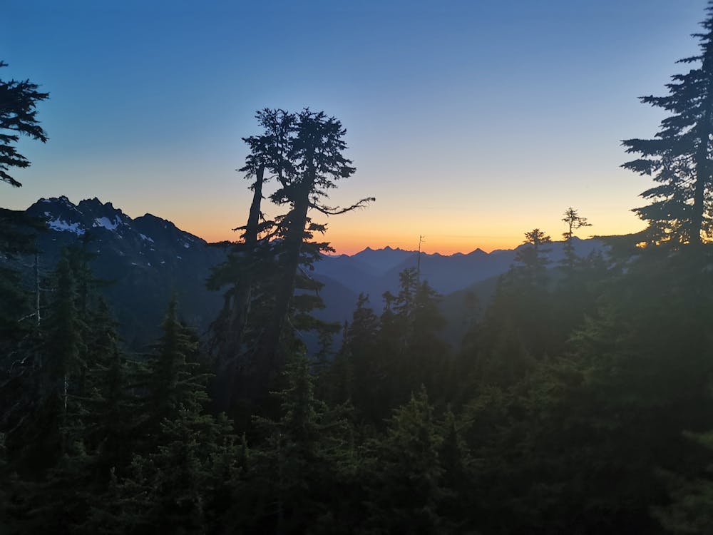
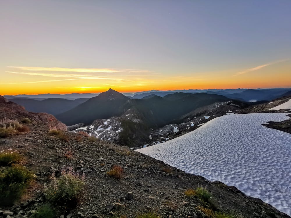
The benefit of completing this as an overnight hike is having the luxury of watching an amazing sunset from either the hut or your tent & then having the option to hike to the summit for sunrise, which is well worth the early start.
From Cobalt Lake the trail goes back into the trees for a short but steep climb up to the ACC alpine hut, this is just above the tree line and where the trail becomes a lot harder to follow as the vegetation thins out. You keep heading up from the hut till you hit the ridgeline, then switchback to make the final ascent to the summit.
The views from the summit are some of the best on Vancouver Island, with mountains views in every direction. If you made it up here for sunrise or sunset it will make it even more special.
You can descend back the way you came or, if you had 2 cars, you could descend down the NW ridge trail back to the logging road to make this a loop.
If you complete this as a day hike, allow plenty of time to get to the trail head, whilst it isn't a majorly long hike, it is 2 hours from Tofino and Port Alberni, if you have 4WD you might make it there quicker, if you have 2WD it could be longer. Mosquitos are prevalent in this area, so be sure to bring insect repellant to have a more enjoyable time.
Difficulty
Severe
Hiking challenging trails where simple scrambling, with the occasional use of the hands, is a distinct possibility. The trails are often filled with all manner of obstacles both small and large, and the hills are very steep. Obstacles and challenges are often unexpected and can be unpredictable.
Medium Exposure

The trail contains some obstacles such as outcroppings and rock which could cause injury.
Remoteness

Little chance of being seen or helped in case of an accident.
Best time to visit
Features
- Alpine
- Wildlife
- Picturesque
- Summit Hike
- Wild flowers
- Forestry or heavy vegetation