Berg Lake
Jasper National Park
Hike this world-renowned trail to an iceberg-dotted lake
Hiking Difficult
- Distance
- 38 km
- Ascent
- 1.4 km
- Descent
- 1.4 km
- Duration
- 1 day +
- Low Point
- 845 m
- High Point
- 1.7 km
- Gradient
- 9˚

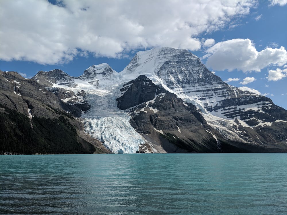
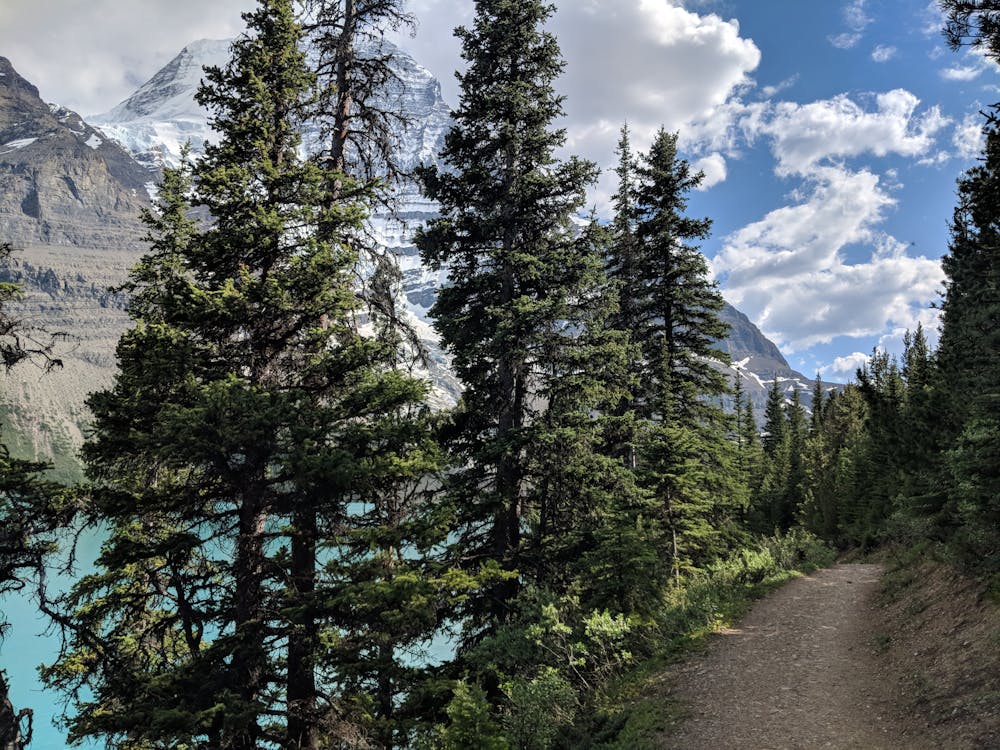
As a world-class trail and one of the most popular in the Canadian Rockies, Berg Lake hardly needs an introduction. Ascending 800m to an iceberg-dotted lake, guarded by the imposing Mt. Robson, this is an adventure that will satisfy beginner and advanced backcountry hikers alike.
- •
- •
- •
- •
Description
Reservations are required for the seven campsites along the route. These often book out early. Get further details and reserve a tent pad on the BC parks website: http://www.env.gov.bc.ca/bcparks/explore/parkpgs/mtrobson/berg.html.
Note that when you go to the visitor centre to pick-up your permit you are required to watch a rather old 15-minute-long orientation/safety video; so get mentally prepared for that delay!
Whilst most will walk all or part of the trail to Berg Lake over 2-3 days, camping along the way, it’s worth highlighting that biking is allowed as far as Kinney Lake and the entire route is also a good objective for (very fit) trail runners.
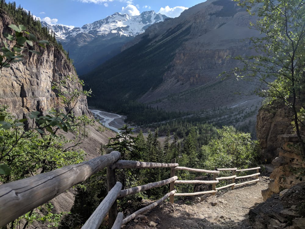
Although well-maintained, there are certainly some steep sections with loose rock underfoot and with sharp drop-offs on the trail edges. As the elevation profile shows, these steeper sections are near the middle where the trail climbs up from the valley floor, alongside the Robson River, to Emperor Falls. You gain 500m in this 3km section. Several waterfall viewpoints provide an excuse for a break and a welcome respite from the climb.
In comparison, the first section is a gradual incline, and the final 5km approaching and skirting Berg Lake is mercifully flat.
If you’re lucky enough to have snagged a spot at the Berg Lake campsite at the far end of the lake, you'll have plenty of time to soak in the view. If not, be sure to take a break from iceberg spotting to look up at Mt. Robson, the highest point in the Canadian Rockies, some 2000m above the lake. Return the same way—enjoy the downhill!
Difficulty
Difficult
Hiking trails where obstacles such as rocks or roots are prevalent. Some obstacles can require care to step over or around. At times, the trail can be worn and eroded. The grade of the trail is generally quite steep, and can often lead to strenuous hiking.
Medium Exposure

The trail contains some obstacles such as outcroppings and rock which could cause injury.
Remoteness

Little chance of being seen or helped in case of an accident.
Best time to visit
Features
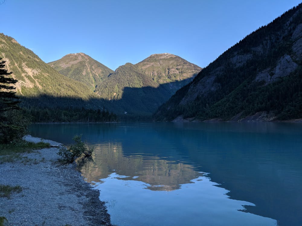
- Alpine
- Picturesque
- Water features