Cape Scott Trail
Vancouver Island
A remote trail with pristine beaches, epic sunsets, and the chance to see lots of wildlife such as Bears & Whales.
Hiking Moderate
- Distance
- 52 km
- Ascent
- 1.2 km
- Descent
- 1.2 km
- Duration
- 1 day +
- Low Point
- 0 m
- High Point
- 99 m
- Gradient
- 5˚

This route is typically completed as a 1 or 2 night backpacking trip, and includes the option to visit San Josef Bay, or you could choose to Skip this and just head back to the parking lot, although I promise you San Josef Bay is well worth the short hike, and makes for an awesome campground too!
- •
- •
- •
- •
- •
Description
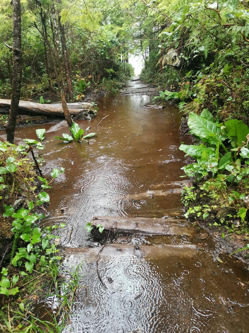
The inland section of this trail is very well maintained with lots of boardwalks, although these can be extremely slippery when wet. There are however; plenty of sections that don't have boardwalks, and since this is the west coast, it's almost a guarantee you will encounter mud on this trial, and potentially lots of it! If there has been large amounts of recent rain, you can expect parts of the trail to be flooded, which can be seen in one of the attached photos.
So considering you will get wet & muddy feet, why make the effort to do this trail? Well once you take the turn off towards Nels bright, the trail becomes a little less muddy, and you can start to see evidence of some of the history of the early settlers to this area, with old equipment left behind, and the remains of old settlements.
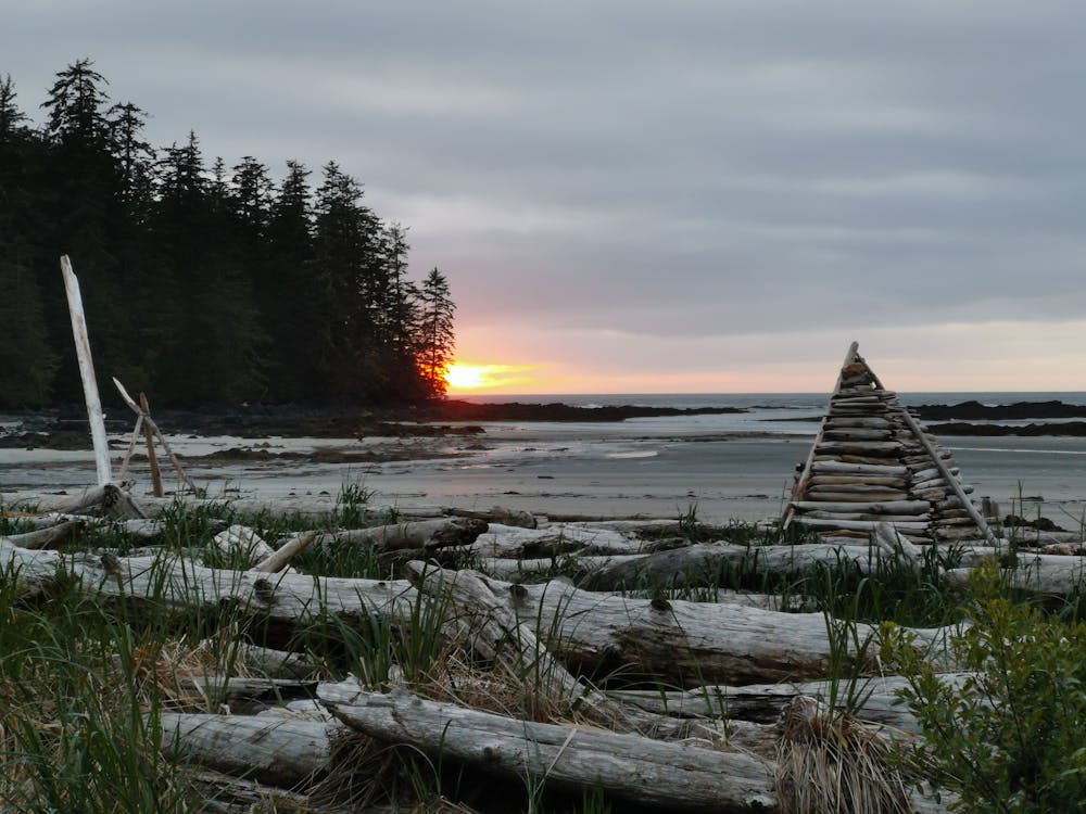
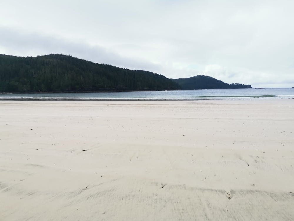
Nels Bright is the most popular place to camp on this trail, it's large Sandy Beach makes for an great campground, although ensure you are above the high tide line when finding a tent site. Once your tent is pitched, you can enjoy the views from the beach, watch the sunset, and maybe even spot some Whales out at sea.
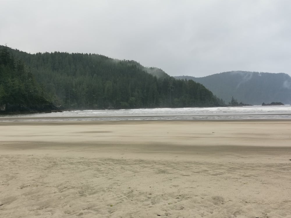
The trail from Nels Bright to the lighthouse goes along two more pristine beaches, which are well worth taking your time to relax on if you are lucky enough to be there on a sunny day. Also keep your eyes peeled to see if you can spot any wolf or bear tracks on any of these sections, especially the inland trails.
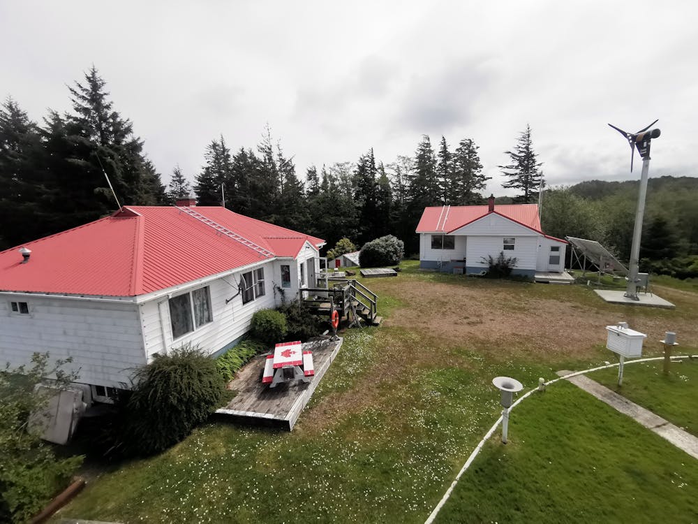
The final trail to the lighthouse follows and old access road, black bears are extremely common around this area, especially around the lighthouse. Once at the lighthouse you can go up and enjoy the view from the top, before returning back the way you came. On the way back be sure to visit San Josef Bay, you could camp here for another night or just visit, but the beach and views from this bay are spectacular, plus it's only a couple of km's from the trailhead.
Fresh filtered water is available at the lighthouse, otherwise all water needs filtering or treating, good water sources along the trail can be very limited.
Difficulty
Moderate
Hiking along trails with some uneven terrain and small hills. Small rocks and roots may be present.
Low Exposure

The path is on completely flat land and potential injury is limited to falling over.
Remoteness

Away from help but easily accessed.
Best time to visit
Features
- Wildlife
- Historical
- Picturesque
- Family friendly
- Forestry or heavy vegetation