Cheam Peak
Take in the North Cascades with a unique start in the sub-alpine.
Hiking Moderate
- Distance
- 8.5 km
- Ascent
- 684 m
- Descent
- 684 m
- Duration
- 2-3 hrs
- Low Point
- 1.4 km
- High Point
- 2.1 km
- Gradient
- 14˚

Located just outside of Chilliwack on the Canadian side of the North Cascades, this 8.5km out-and-back trail starts in the sub-alpine of the Cascade Range at the end of the Chipmunk Creek Forest Service Road.
- •
- •
- •
- •
- •
- •
- •
- •
Description
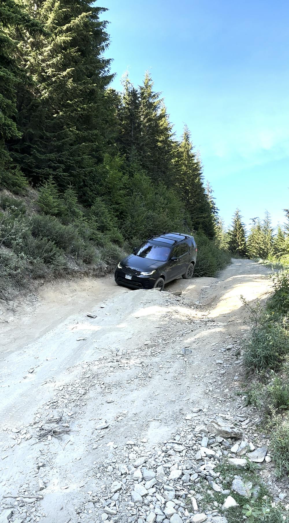
Chipmunk Creek FSR has been deactivated and is not regularly maintained, so a high-clearance 4x4 vehicle with a break-over angle of over 25° is highly recommended for the deeper cross ditches & rocky sections. There are two deep cross ditch sections which will involve getting at least 2 of your wheels in the air, but you can choose to park on the side of the road before the first one and hike the last 3.5km of the road to the trail head.
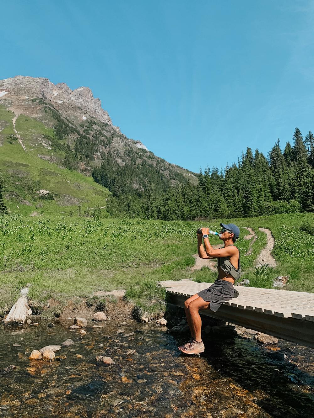
Once you get to the trail head in the sub-alpine, the trail starts off relatively flat with a slight descent into the lush meadows with a small stream & alpine lake on your right. There are no viable water sources after the first stream, so make sure you pack enough water for the rest of the hike, especially on a hot day. At least 1L of water is highly recommended.
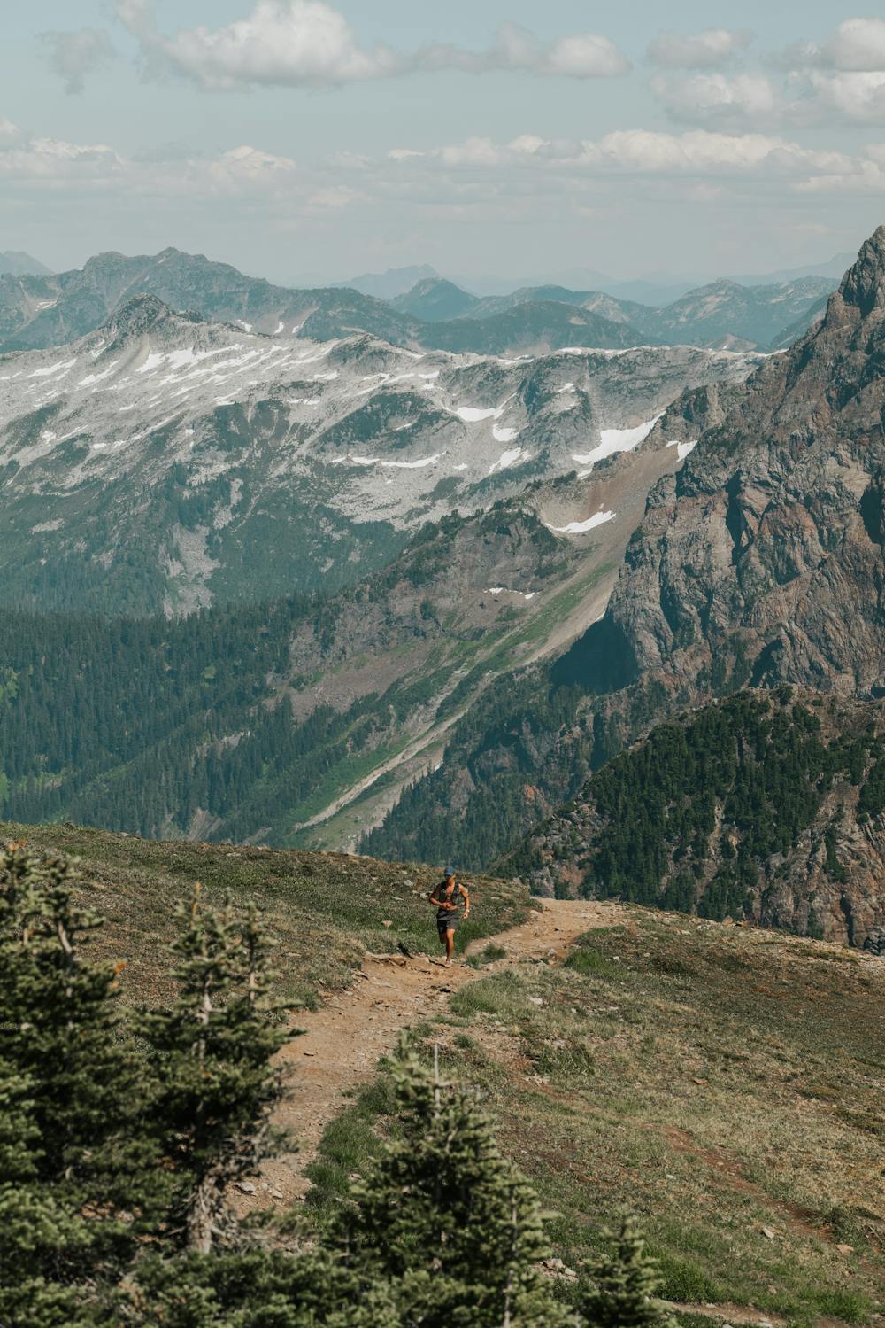
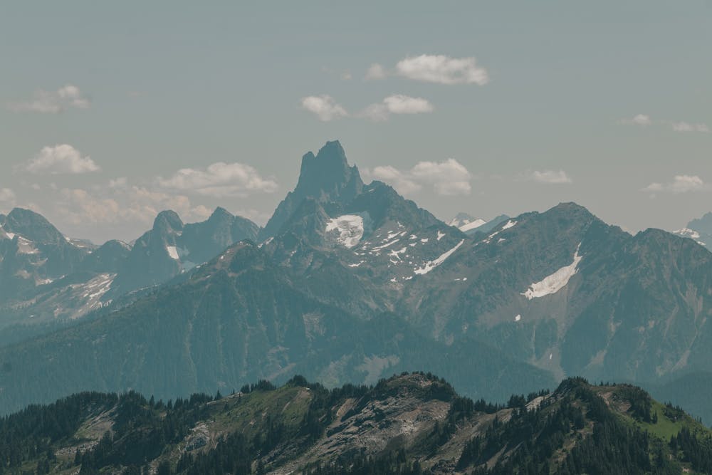
This trail is great for beginners as the 670m of elevation gain is delivered moderately and consistently, with a short steeper section at the very peak. As this trail starts in the sub-alpine, the entire route offers fantastic views, which is very uncommon as most trails in this area start at the bottom of the valley with no views until you pop out of the tree line.
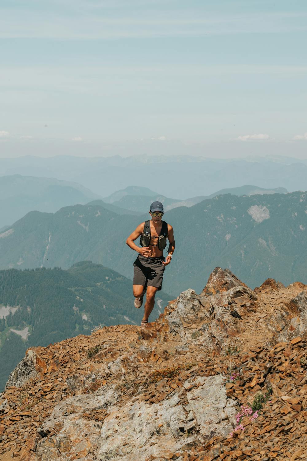
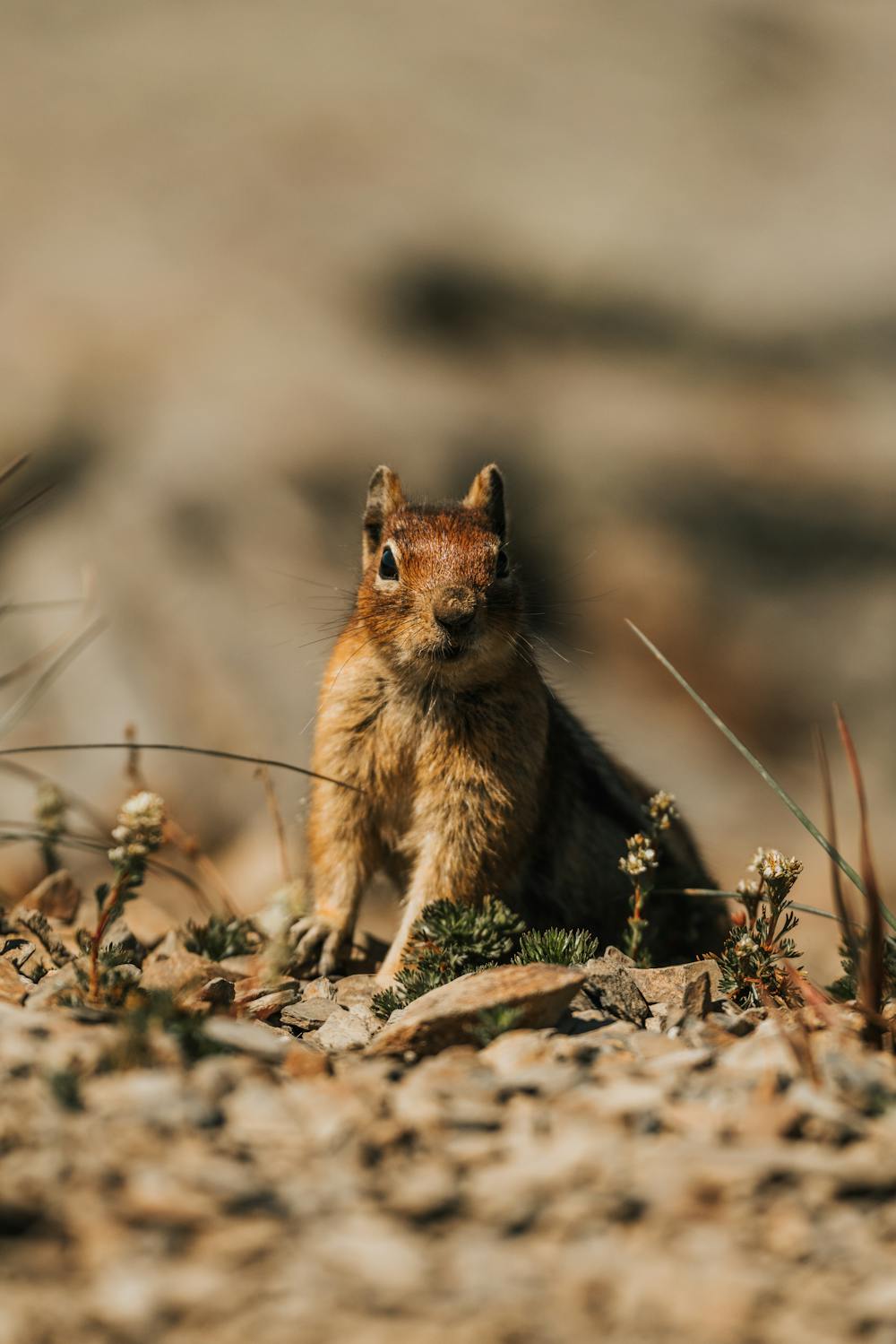
The first half of the hike takes you through beautiful alpine meadows with Lady Peak directly in front of you, before turning left and traversing over towards Cheam Peak, before a few final switch backs that take you to the sub-peak of Cheam. You’ll find a nice bench and a cool rock platform to eat lunch on at the sub-peak, where you’ll also likely run into a few squirrels.
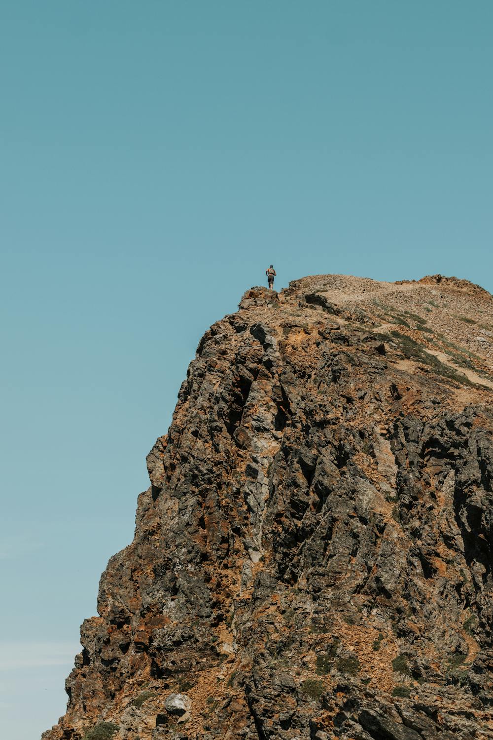
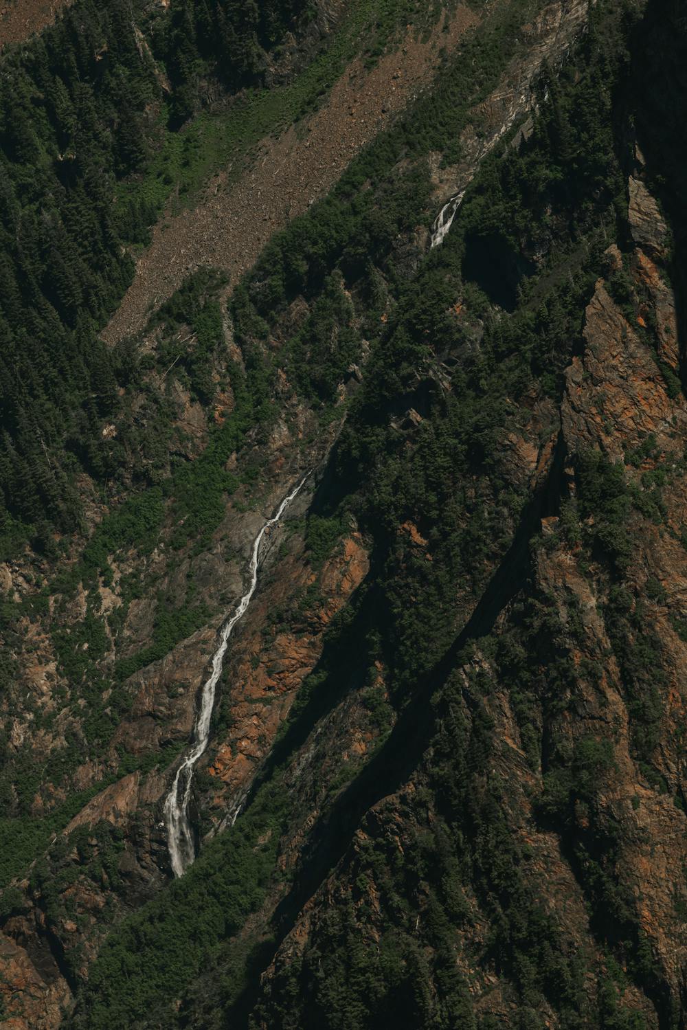
The peak is roughly another 100m from the sub-peak, and is worth the steep hike up to take in views of the rest of the rest of the North Cascade Range, as well as a small waterfall to your right.
Heading back down, you have the option to check out Lady Peak before descending back to the trailhead. Please note that Lady Peak requires scrambling experience and a scree descent, so hikers without proper footwear or experience with descending scree should not attempt this detour.
DOGS: Dogs are permitted on this trail.
NOTE: Bears are common in this area.
NOTE: 4x4 with high-clearance and >25° break-over is recommended.
Difficulty
Moderate
Hiking along trails with some uneven terrain and small hills. Small rocks and roots may be present.
Medium Exposure

The trail contains some obstacles such as outcroppings and rock which could cause injury.
Remoteness

Little chance of being seen or helped in case of an accident.
Best time to visit
Features
- Alpine
- Wildlife
- Picturesque
- Summit Hike
- Dog friendly
- Wild flowers