Cirque Lake
Paddle across Callaghan Lake, then hike a short but steep trail to a gem of a lake hidden higher in the mountains.
Hiking Difficult
- Distance
- 2.9 km
- Ascent
- 320 m
- Descent
- 320 m
- Duration
- 1-2 hrs
- Low Point
- 1.2 km
- High Point
- 1.5 km
- Gradient
- 16˚

Callaghan Lake is a beautiful and popular destination for camping, fishing, swimming, and boating. Most visitors stay in a relatively small area surrounding the one developed campground. There is, however, a stunning and relatively untouched lake hidden higher in the mountains where you can camp in the incredible solitude of the Callaghan Valley backcountry.
Description
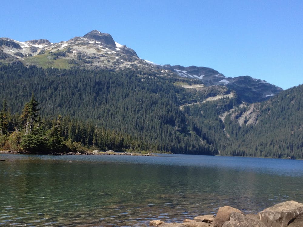
Though you can’t see Cirque Lake from Callaghan Lake, you can guess its location when standing in the main parking area on Callaghan’s southeast shore. Look directly across at the mountainous backdrop, and at the steep stream of water rushing down through thick forest. That water comes from Cirque Lake.
A steep, unmaintained trail leads from the far end of Callaghan Lake to Cirque Lake, but getting to where it starts is the first challenge. A faint, brushy path leads around the east side of Callaghan. The better way to get there, however—if you have the means—is to paddle. Land your boat at the backcountry campsites near the inlet stream. This is where the trail starts.
Hike upward through forest that soon gives way to views over the Callaghan Valley from a rocky hillside. The gradient doesn’t relent until the very top, when you enter the narrow outflow valley of Cirque Lake. Brilliant blue water appears before you, within a picture frame of green and gray streaks beneath snow-capped peaks. A network of social trails weave around the lake, but all the sides are steep—scrambling may be required in some places. Enjoy a dip in the frigid water, a bask on the shore, or an elevated vantage from surrounding slopes.
Sources: http://www.env.gov.bc.ca/bcparks/explore/parkpgs/callaghanlk/#Hiking http://hikeinwhistler.com/index.php/best/best-aerial-views/387-cirque-best-aerial http://hikeinwhistler.com/index.php/maps/callaghan-lake-map
Difficulty
Difficult
Hiking trails where obstacles such as rocks or roots are prevalent. Some obstacles can require care to step over or around. At times, the trail can be worn and eroded. The grade of the trail is generally quite steep, and can often lead to strenuous hiking.
Medium Exposure

The trail contains some obstacles such as outcroppings and rock which could cause injury.
Remoteness
Away from help but easily accessed.
Best time to visit
Features
- Picturesque
- Wild flowers
- Water features
- Forestry or heavy vegetation