
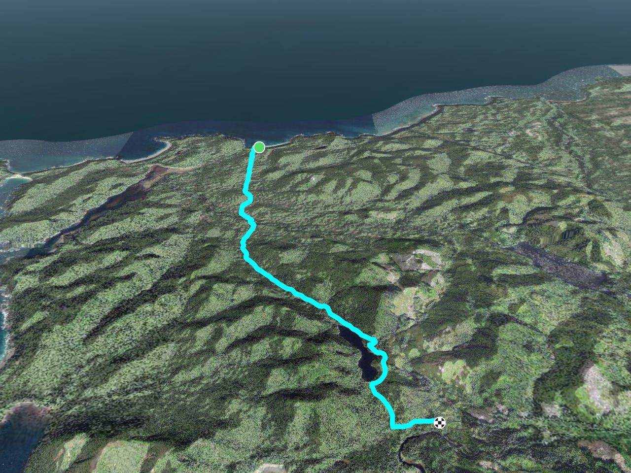
5 km away
Day 5 North Coast Trail
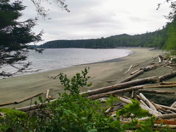
A technical and difficult inland section with a picturesque lake that makes it all worth it.
Difficult Hiking
- Distance
- 7.1 km
- Ascent
- 136 m
- Descent
- 147 m
A welcomed return to civilisation as you hike out on the historic Cape Scott Trail
Hiking Moderate
The final day on the North Coast Trail takes you onto the Cape Scott Trail, which was the first established trail in the Provincial Park back in 1973, although settlers first arrived here long before then. This is a historic trail and you can see the remnants of the original Danish settlements as you hike along the trail.
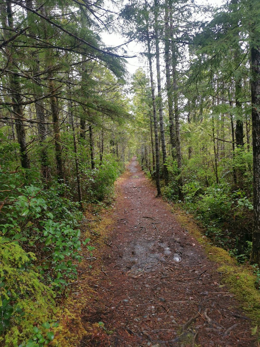
While this is the longest day on trail in terms of distance, it's actually the easiest, as the trail is very well maintained, with plenty of boardwalks and bridges to avoid most obstacles. This makes for a nice change of pace from the other days on trail, as you can finally get some momentum and enjoy some easier hiking without having to concentrate as much on the terrain.
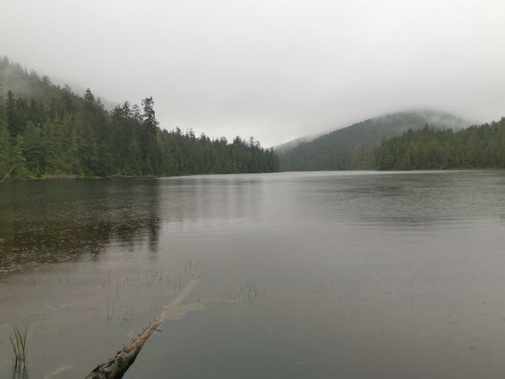
As you hike through the forest, keep you eyes open for the old growth Sitka Spruce trees, especially around Eric Lake. There are sections of forest here that are quite open, especially around the campground. The views of the forest here are some of the best on the entire North Coast Trail.
As you reach Eric Lake be sure to stop by the lake to enjoy the view from the waters edge. If you get here on a calm day, the surrounding hills reflect perfectly in the lake.
After Eric Lake it's only a short hike back to the parking lot where you will either have left your own car, or be scheduled on a shuttle to take you back to Port Hardy. Make sure you arrange this before you start the trail, as there is no phone service at the trailhead.
Even though this section of trail is well maintained, it is very muddy and can flood after heavy rain, so expect to get wet and muddy feet. The easiest & safest way to deal with this, is to just embrace it and go straight through the middle, rather than trying to go around it. Also the boardwalks are extremely slippery, so use caution when stepping on them or consider using micro spikes.
Moderate
Hiking along trails with some uneven terrain and small hills. Small rocks and roots may be present.

The path is on completely flat land and potential injury is limited to falling over.

Little chance of being seen or helped in case of an accident.
5 km away
A technical and difficult inland section with a picturesque lake that makes it all worth it.
Difficult Hiking
6 routes · Hiking