Gotcha Peak & Gott Peak via Blowdown
A difficult day hike to summit both Gott and Gotcha Peak by way of Blowdown Pass.
Hiking Difficult
- Distance
- 15 km
- Ascent
- 1.2 km
- Descent
- 1.2 km
- Duration
- 5-6 hrs
- Low Point
- 1.5 km
- High Point
- 2.5 km
- Gradient
- 22˚

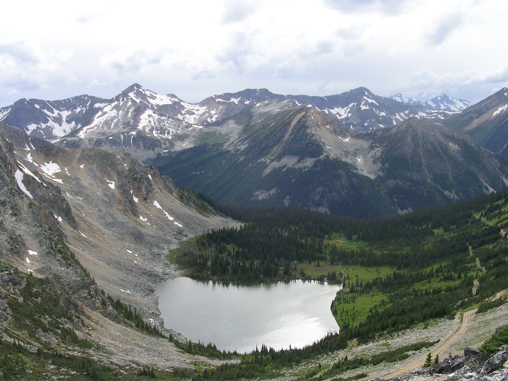
This epic backcountry route summits both Gotcha Peak and nearby Gott Peak for a long, difficult day hike not far from Duffey Lake. Following a gravel forest service road to Blowdown Pass, you'll pay visit to a stunning alpine lake with spectacular views looking into the mouth of the valley.
Description
Both summits require off-trail travel through areas that could host soft and unstable snow, even into the summer. Therefore, snowshoes are recommended year-round by some. Camping could be an option near the lake, but most aim to complete the hike in a day. Expect complete autonomy should anything go wrong and that cell reception is highly unlikely.
Compared to other routes in the area, this area sees few visitors and is not suitable for children. Dogs are also not allowed to visit any portion of the hike. Expect upwards of seven hours to reach both summits, but don't hesitate to cut your hike short if the weather turns south.
Sources: 10adventures.com Sebastian Patterson
Difficulty
Difficult
Hiking trails where obstacles such as rocks or roots are prevalent. Some obstacles can require care to step over or around. At times, the trail can be worn and eroded. The grade of the trail is generally quite steep, and can often lead to strenuous hiking.
High Exposure

Some trail sections have exposed ledges or steep ascents/descents where falling could cause serious injury.
Remoteness
Little chance of being seen or helped in case of an accident.
Best time to visit
Features
- Alpine
- Wildlife
- Picturesque
- Summit Hike
- Forestry or heavy vegetation