PNW Ridges: Mount McGuire
An epic ridge at the top with an optional scree descent
Hiking Moderate
- Distance
- 13 km
- Ascent
- 1 km
- Descent
- 1 km
- Duration
- 4-5 hrs
- Low Point
- 1 km
- High Point
- 2 km
- Gradient
- 25˚

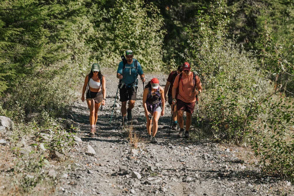
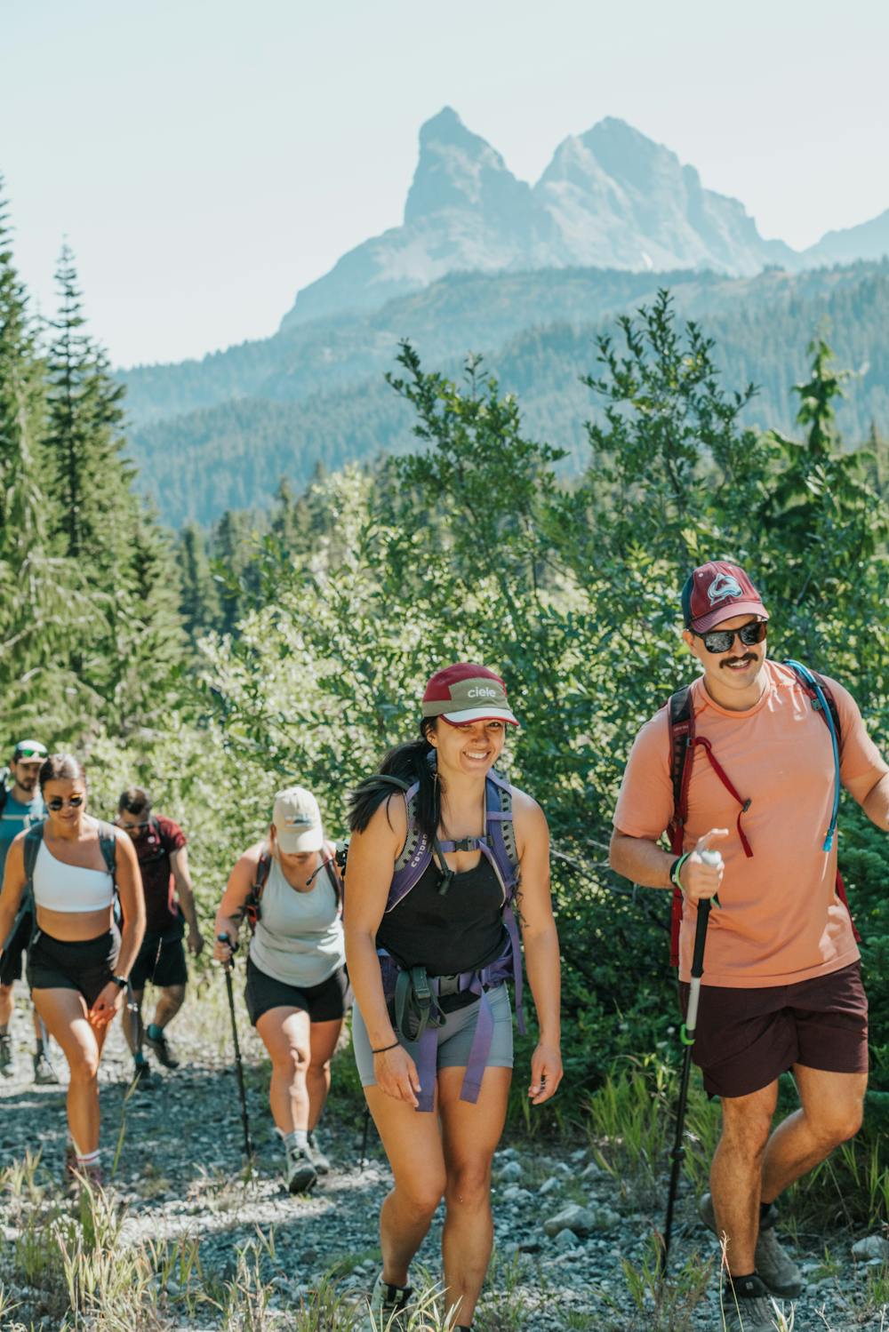
At the edge of the North Cascades on the Canadian border, Mount McGuire is nestled amongst the legendary Canadian Border Peak & Sleese Mountain peaks as well as Mount Baker. This ~15km out-and-back trail (depends on how far up you make it in your vehicle) starts in the tree line and follows New Borden Forest Service Road until the trail narrows at the col between Bog Creek Reserve and Mount McGuire (on the East side).
- •
- •
- •
- •
- •
- •
- •
- •
Description
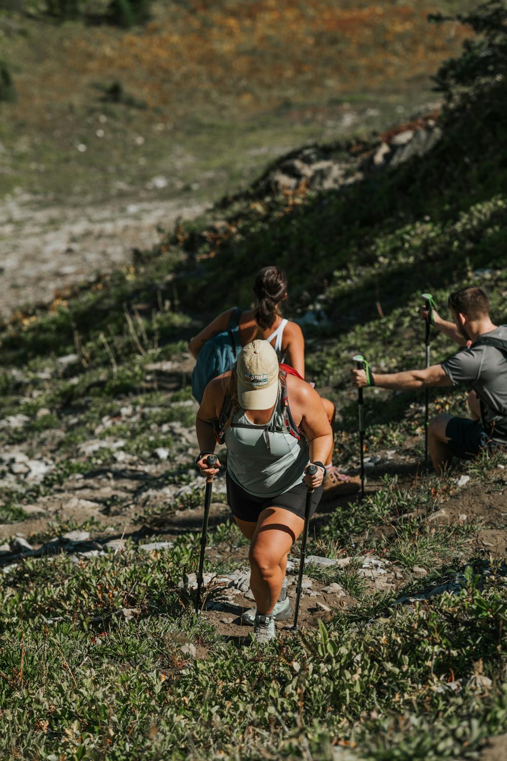
New Borden Forest Service Road (FSR) starts relatively is fairly manageable in a 2WD vehicle until ~7km where there is a washed out bridge. During the spring and early summer, this will involve crossing the river or creek. It’s highly recommended that you park here as there is very little room to turnaround after this crossing before the next washed out bridge at 1,070m. Both crossings require a high clearance 4x4 with appropriate approach and departure angles. Once you reach the junction at 1,070m, you’ll have to park your vehicle and follow the trail until you get to the junction at 1,480m, where you’ll see Mount McGuire. Stay left at this junction, and look for blue and pink markers to enter the forest at around 1,500m. From here, you’ll get on narrow foot trail which becomes fairly steep and pops out into alpine meadows.
As the rest of the trail from here is out of tree-line and exposed to the sun, starting earlier to avoid the heat from the sun is highly recommended, or bring plenty of water.
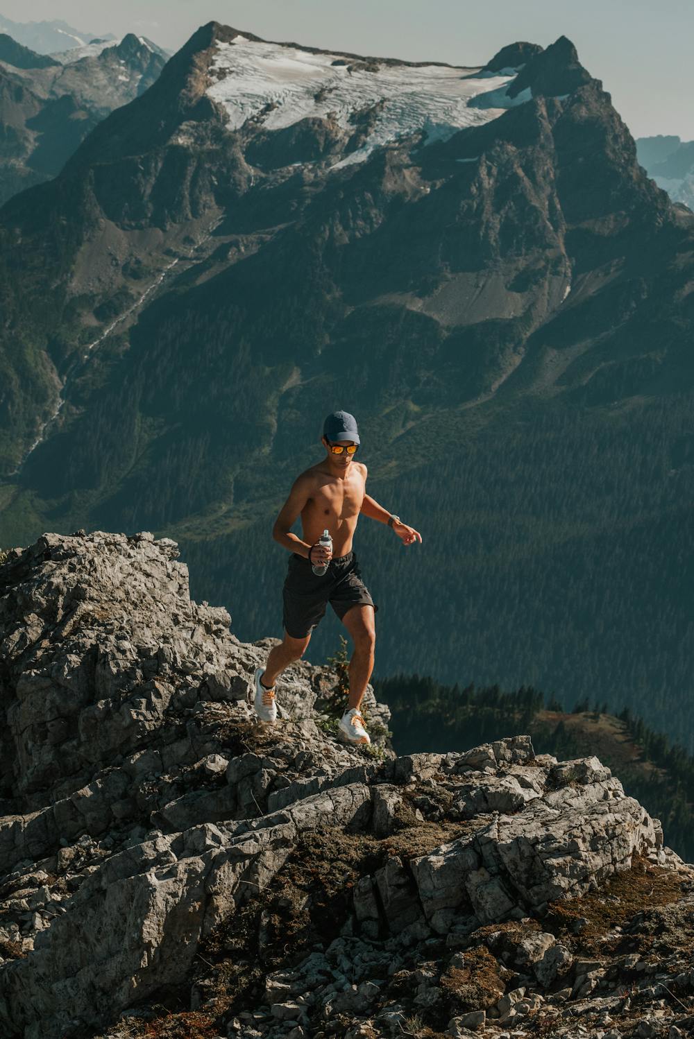
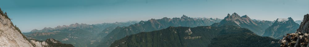
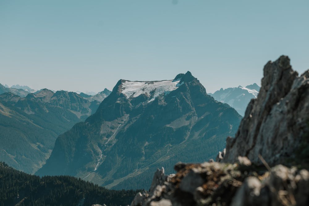
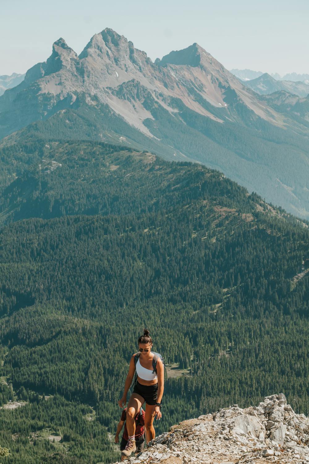
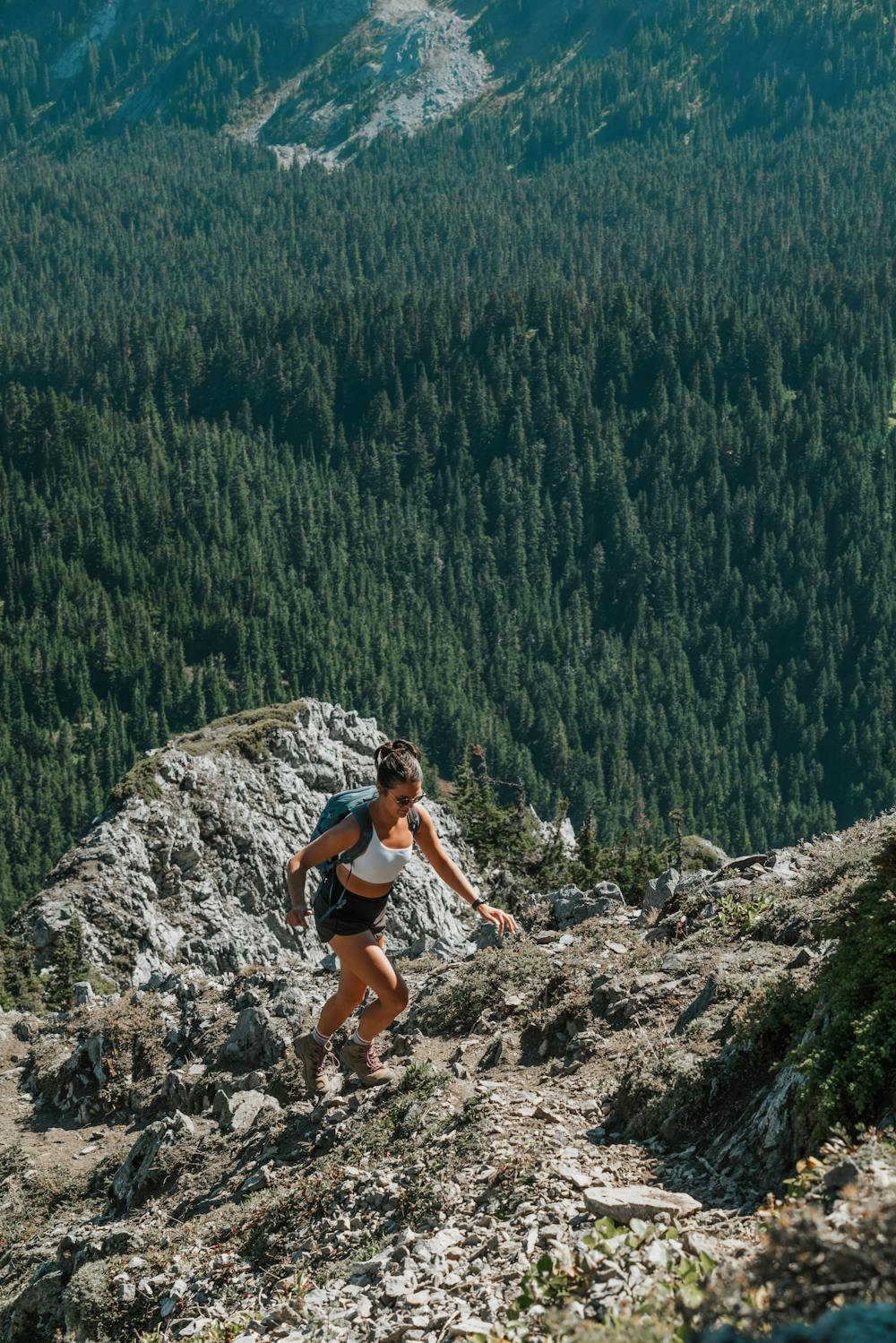
From 1,700m to the summit, this route follows the SE ridge with class 3 scrambling through a no-fall zone on the knife-edge ridge for the last 75m. Once at the top, you’re rewarded with panoramic views of Sleese, Canadian Border Peak, Mount Baker, and more.
DOGS: Dogs are permitted on this trail, but beware this can be a long trail depending how far you park, and there is a scramble to reach the summit.
NOTE: Bears are common in this area.
Difficulty
Moderate
Hiking along trails with some uneven terrain and small hills. Small rocks and roots may be present.
High Exposure

Some trail sections have exposed ledges or steep ascents/descents where falling could cause serious injury.
Remoteness

Away from help but easily accessed.
Best time to visit
Features
- Alpine
- Picturesque
- Summit Hike
- Dog friendly
- Wild flowers