Spion Kop Summit Trail & Paintbrush Loop
Climb one the most scenic peaks in the Okanagan and extend your trip with a loop through quiet forests
Hiking Difficult
- Distance
- 14 km
- Ascent
- 676 m
- Descent
- 676 m
- Duration
- 3-4 hrs
- Low Point
- 401 m
- High Point
- 857 m
- Gradient
- 10˚

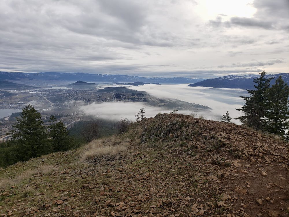
Despite its proximity to Kelowna and its various suburbs, the Spion Kop hiking area is wonderfully quiet, and breathtakingly beautiful.
- •
- •
Description
The trail network can be accessed from several parking lots, and there is a maze of paths to explore once you're underway. This loop covers the maximum amount of height gain and distance that it's possible to get in one Spion Kop hike, but it can be logically shortened, either by parking at one of the higher parking lots, or doing the trip to Spion Kop summit as an out-and-back.
If you want to do the whole thing, start by parking next to Wood Lake and then make the long climb up the Spion Kop Summit Trail, passing through an underpass below Highway 97 on your way. The views are good on the way up, and exceptional from the summit itself!
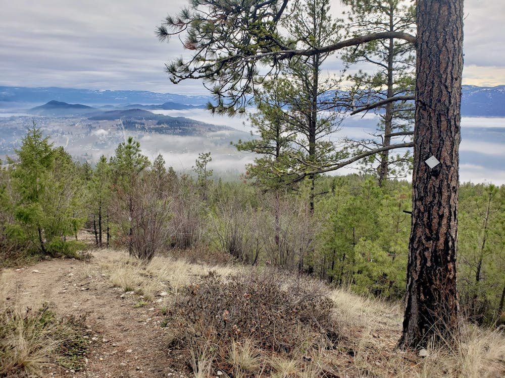
Drop steeply off the summit, heading south, and descend to reach the Paintbursh Trail. Follow this through pleasantly peaceful forests as the trail drops down towards the Northstar Lane parking lot. Just before reaching the parking lot, turn right and follow the Ridge Line Trail back up into the forests, and on to the Arrowleaf Trail. Stay on this as it descends back to meet the Summit Trail, which in turn leads you back to your car.
The hiking trails at Spion Kop are mapped on information boards dotted around the area and a colour coding system is used to designate them. As a result you can simply get yourself onto the right trail and then follow regular colour-coded markers to the next junction, and don't need to be constantly consulting FATMAP to keep you on track. Hiking doesn't get much easier or better than this!
Difficulty
Difficult
Hiking trails where obstacles such as rocks or roots are prevalent. Some obstacles can require care to step over or around. At times, the trail can be worn and eroded. The grade of the trail is generally quite steep, and can often lead to strenuous hiking.
Medium Exposure

The trail contains some obstacles such as outcroppings and rock which could cause injury.
Remoteness

Little chance of being seen or helped in case of an accident.
Best time to visit
Features
- Wildlife
- Picturesque
- Summit Hike
- Dog friendly
- Family friendly