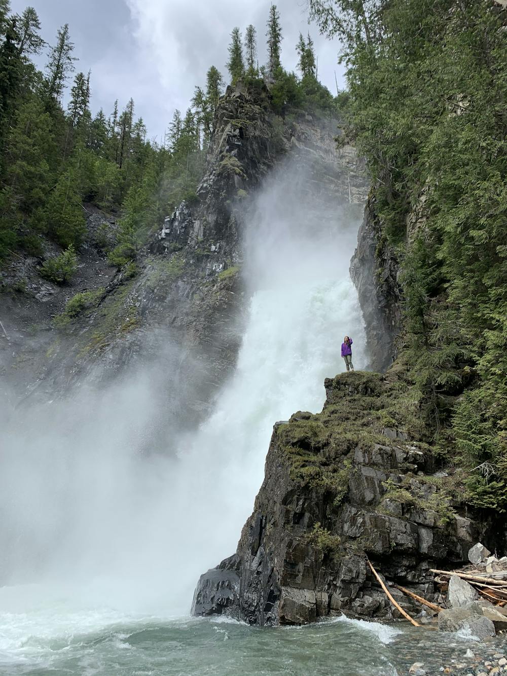
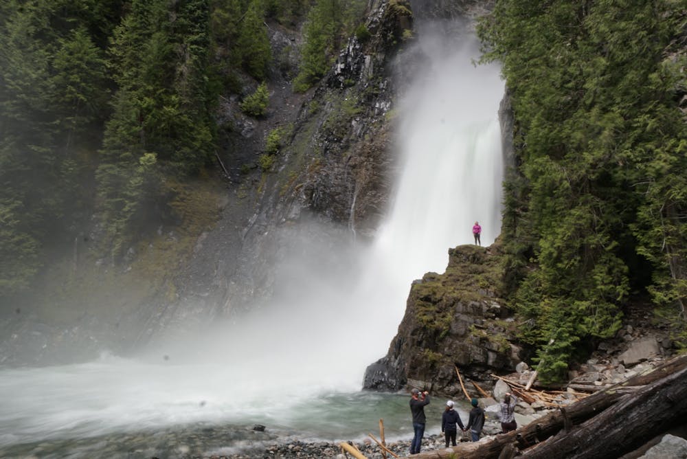
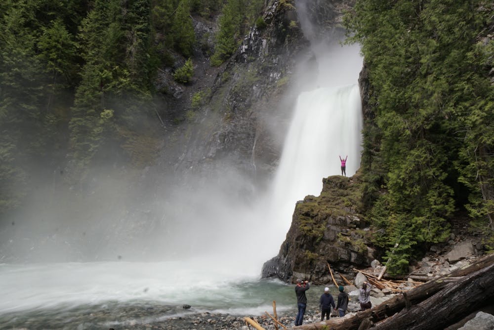
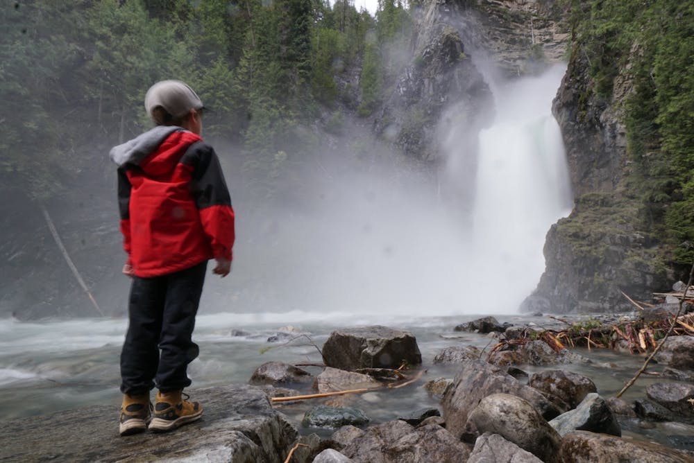
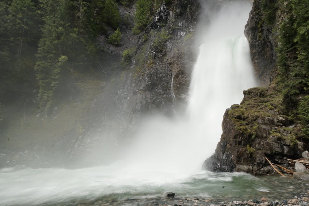
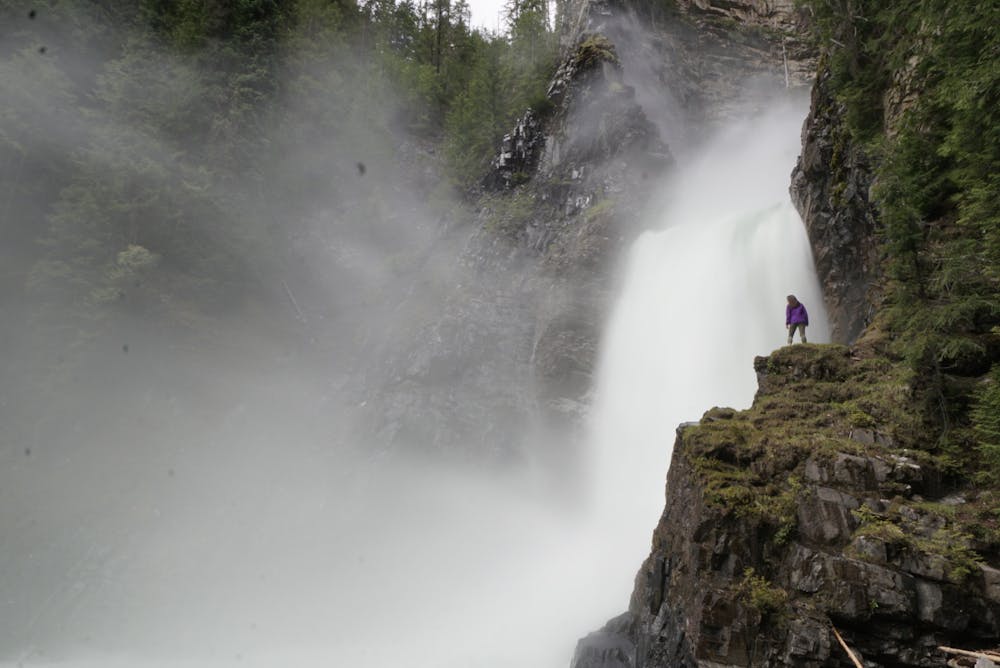
Wilson Creek Falls
A nice little walk through the forest and down a trail into the valley bottom where you are met with a giant waterfall.
Hiking Moderate
- Distance
- 2.8 km
- Ascent
- 126 m
- Descent
- 126 m
- Duration
- 0-1 hrs
- Low Point
- 788 m
- High Point
- 861 m
- Gradient
- 7˚

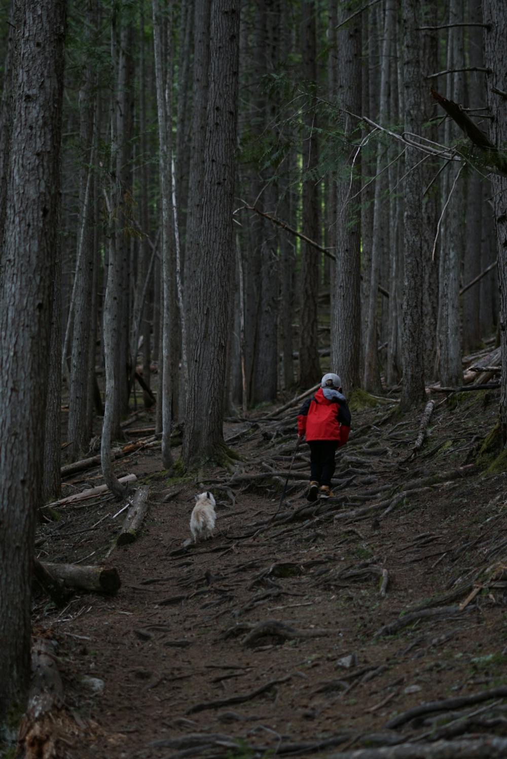
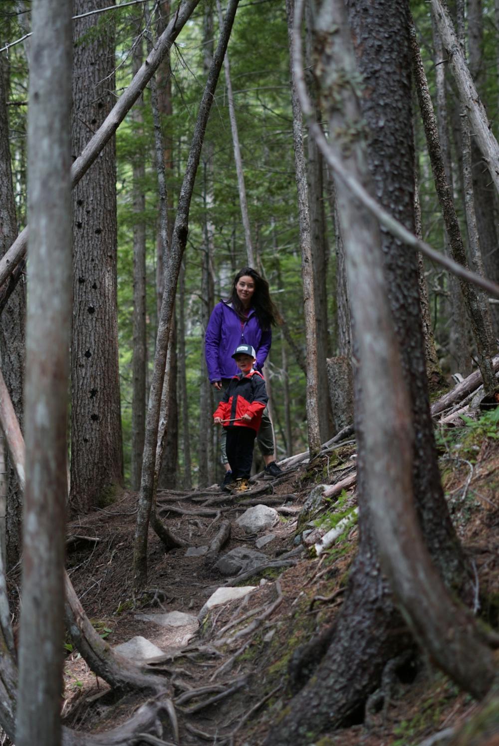
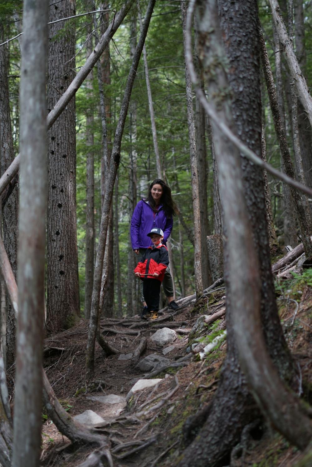
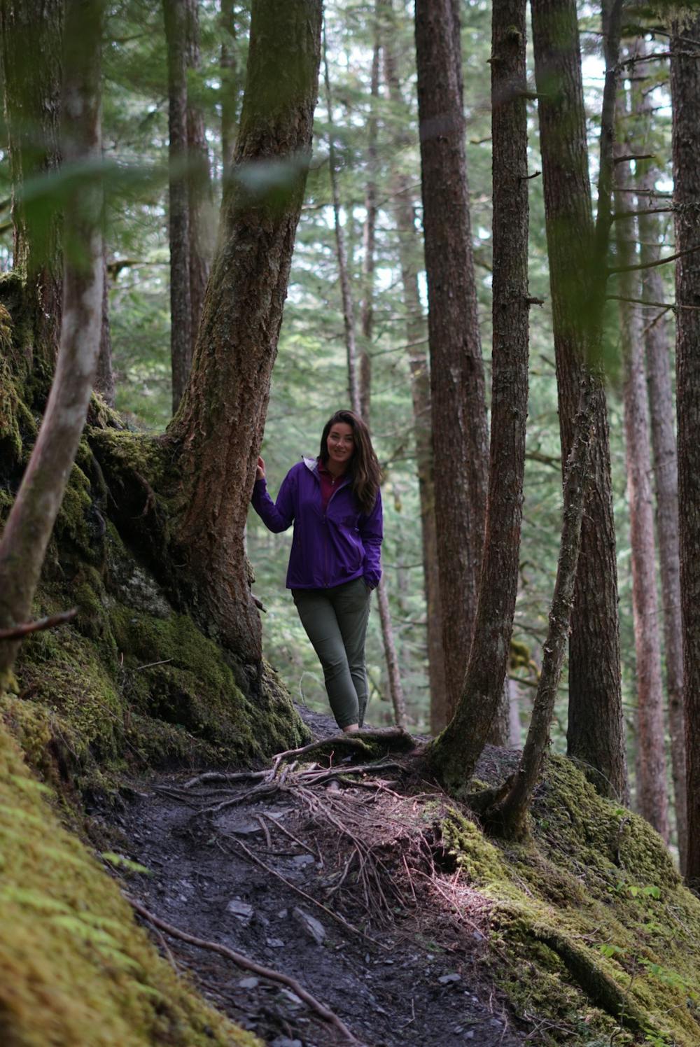
Once up the gravel road which is almost the worst part of the hike. You can choose to park at the bottom or drive up the rough road. You will see a nice trail that leads through the trees and over a few creeks. It will then switch back down and continue down into the river valley. There are a few steeper sections and some areas that you will want to pay attention to your footing. You will start to hear the roar of Wilson Creek falls. The trail ends with a bunch of rock and wood debris. This where you can enjoy the view from the edge of the trail or progress at your own risk beyond this point. You can find some nice rocks to sit on and enjoy lunch. You will be fortunate to only see a few people along this hike and sometimes get the whole place to yourself.
- •
- •
- •
- •
- •
- •
- •
- •
- •
- •
Difficulty
Moderate
Hiking along trails with some uneven terrain and small hills. Small rocks and roots may be present.
High Exposure

Some trail sections have exposed ledges or steep ascents/descents where falling could cause serious injury.
Remoteness
Little chance of being seen or helped in case of an accident.
Best time to visit
Features
- Wildlife
- Picturesque
- Dog friendly
- Water features
- Family friendly
- Forestry or heavy vegetation