Missing Link Figure-8

A great progression ride that's easy to access near the entrance to Cumberland Forest.
Difficult Mountain Biking
- Distance
- 4.6 km
- Ascent
- 134 m
- Descent
- 134 m
A pedal-forward trail ride into the Eastern Bloc.
Mountain Biking Severe

This pedal-forward mountain bike ride in Cumberland Forest traverses one of the oldest tech trails in the forest and then heads over to the little-ridden Eastern Bloc area of the trail system.
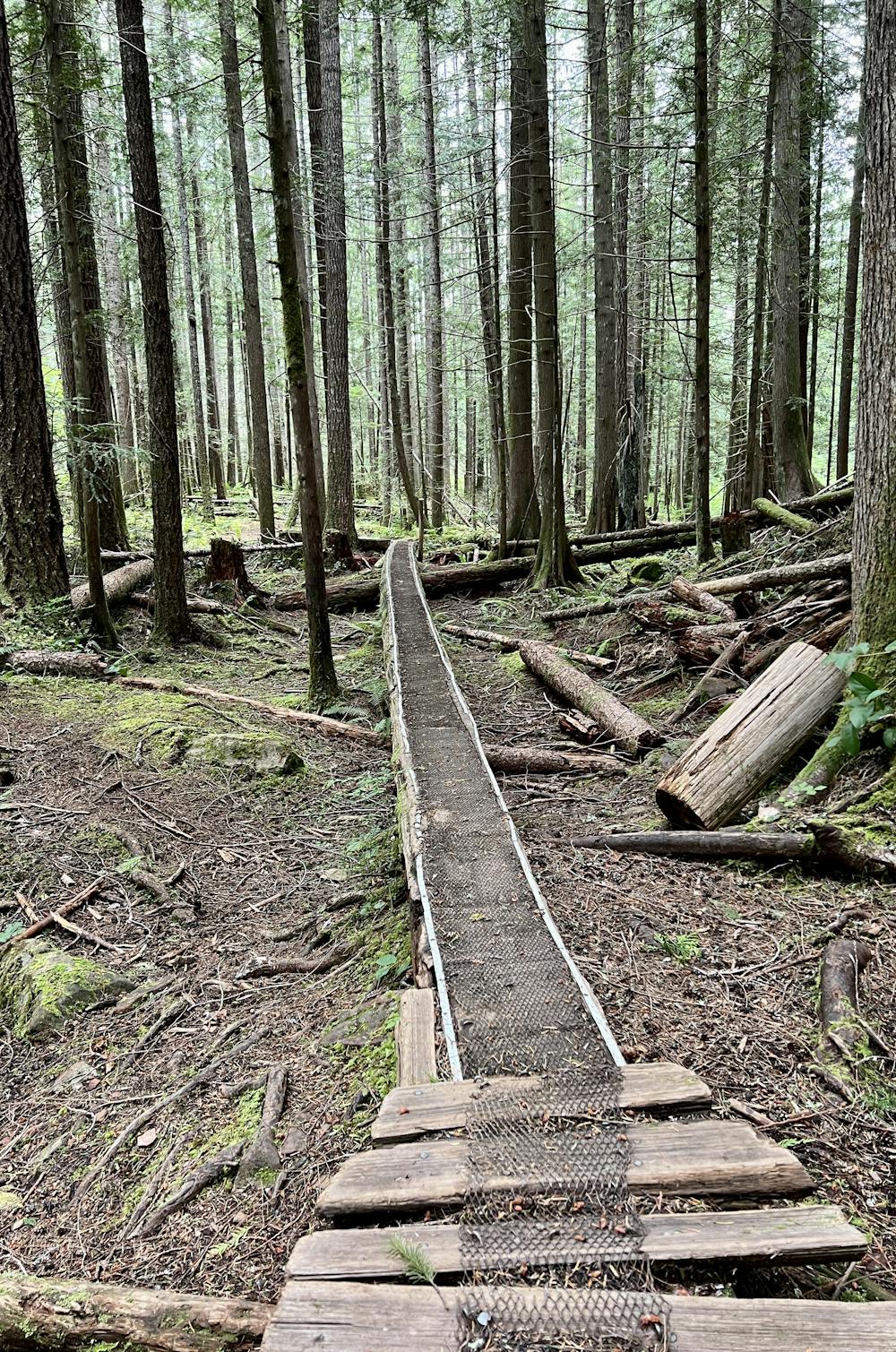

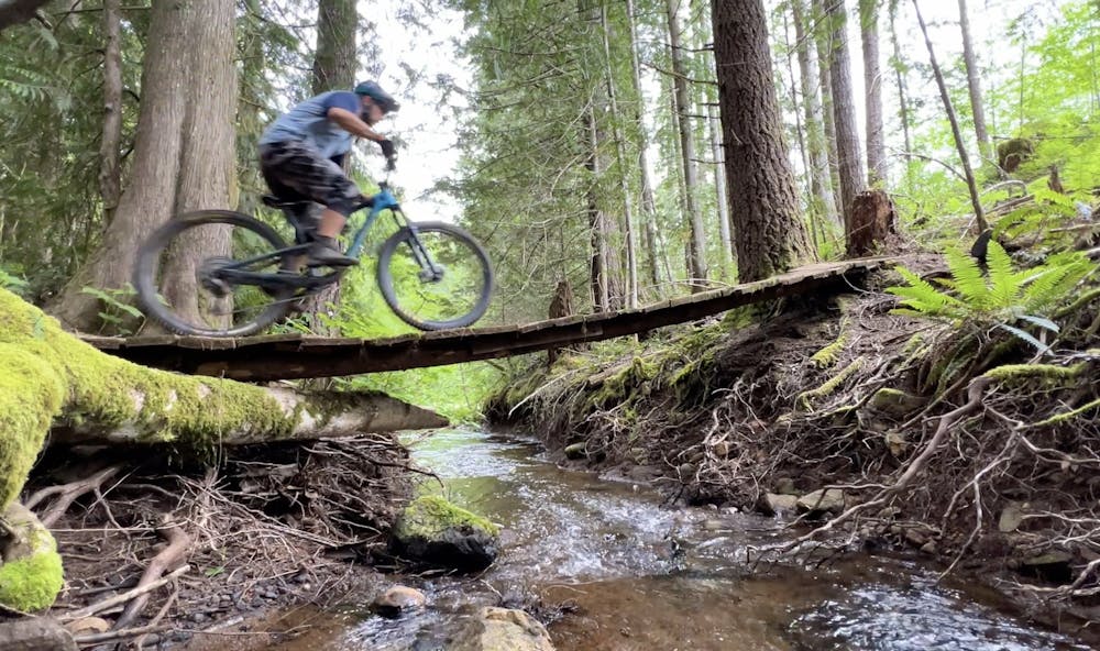
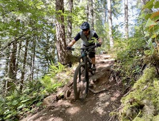
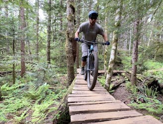
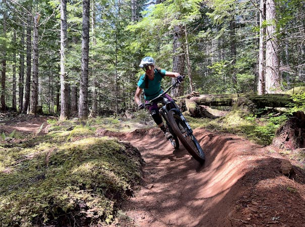
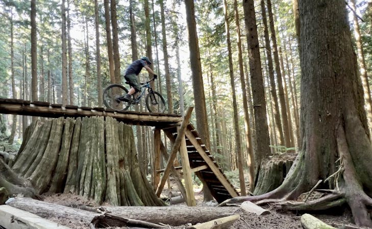
The ride begins by ascending The Pig, which is one of the oldest tech trails in the Cumberland Forest. On The Pig, you'll climb up and over slick root webs and discover long log skinnies hidden in the forest that are guaranteed to challenge your balance skills. All of the skinnies can be bypassed, but they do provide an entertaining challenge early in the ride.
From The Pig, you'll continue climbing up the even more technical Short and Curly trail to access Entrails and Rugburn. The Pig and Short and Curly are the most difficult trails of the entire ride, and it only gets easier from here. They are largely responsible for the "Severe" FATMAP rating assigned to this ride.
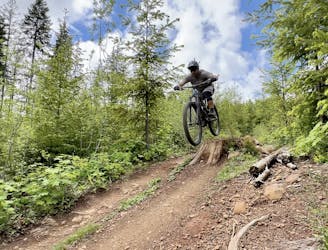
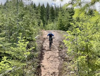
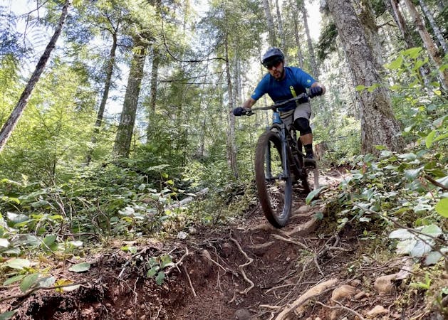
The character of this route is up-and-down the entire way, so enjoy the flowy down bits on Rugburn and, eventually, Upper Crafty Butcher to Double Pumper. Double Pumper especially is a fun, flowy down, but after that, you're officially in the Eastern Bloc.
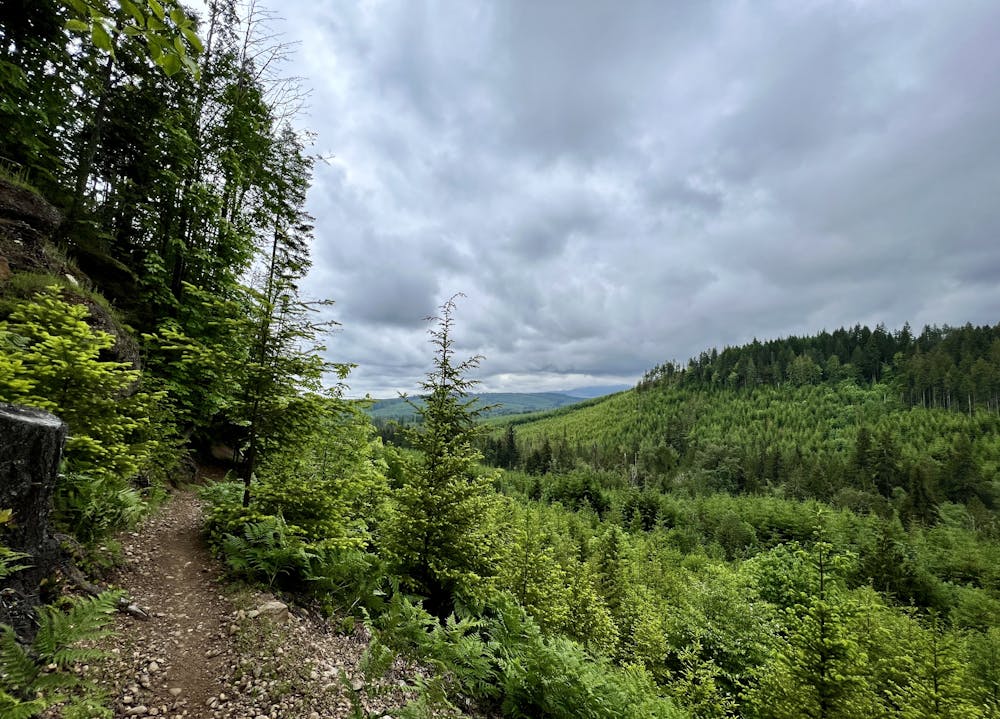
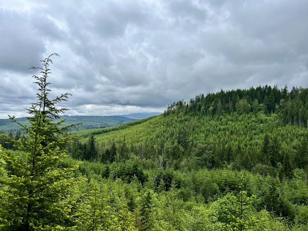
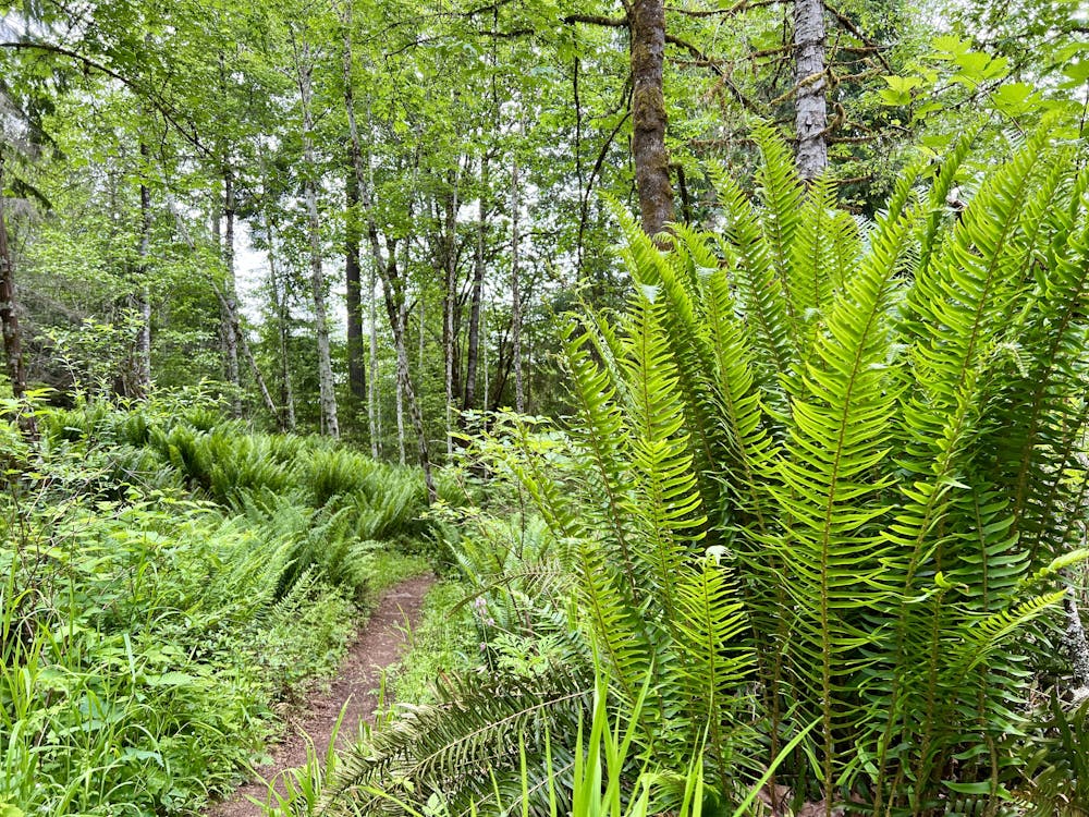
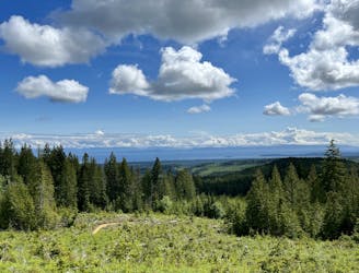
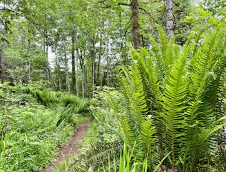
The Eastern Bloc comprises the little-ridden eastern side of the trail system and it's renowned for short, punchy climbs and descents that are over all too soon. This area is still home to some gorgeous singletrack, but it's decidedly more cross-country in nature. Even still, beautiful views off of some of these trails combined with sidehill singletrack and sections of deep, dark forest and massive ferns make for a fantastic trail ride with far fewer people to contend with.
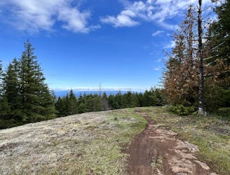
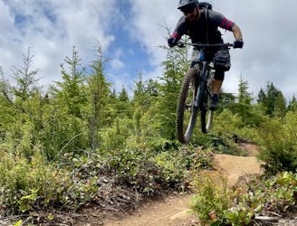
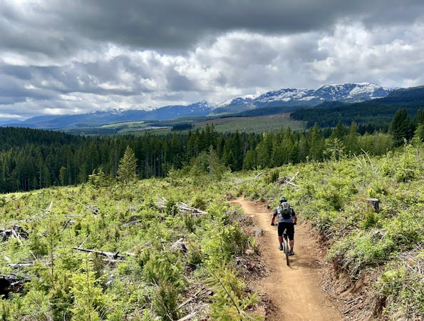
Top Hat and Iron Curtain are two of the best descents in the last half of the loop, with Top Hat descending from a bald high point, connecting on a dirt road, and then dropping again on Iron Curtain. The descents here are a bit more natural than those in the core of the trail system, but they are still quite intermediate-friendly. It's possible to form a more intermediate-friendly version of this route by bypassing the two black trails to begin.
Once off of Iron Curtain, you can follow twisty up-and-down singletrack to get back to the trailhead (as mapped), or simply pedal out easy on the mostly-flat gravel road.
Severe
Widely variable, narrow trail tread with steeper grades and unavoidable obstacles of 15in/38cm tall or less. Obstacles may include unavoidable bridges 24in/61cm wide or less, large rocks, gravel, difficult root sections, and more. Ideal for advanced-level riders.

The trail contains some obstacles such as outcroppings and rock which could cause injury.
Away from help but easily accessed.
A great progression ride that's easy to access near the entrance to Cumberland Forest.
Difficult Mountain Biking
1 m away
A fantastic single black leads into a more challenging double black trail.
Extreme Mountain Biking
1 m away
A flowy loop that accesses two of the best views in Cumberland Forest.
Difficult Mountain Biking
1 m away
This loop into the Eastern Bloc leads to the best viewpoint in all of Cumberland Forest!
Difficult Mountain Biking
1 m away
One of Cumberland's most famous double black diamond runs.
Extreme Mountain Biking
1 m away
One of the most famous tech runs in Cumberland, this loop runs deep into the trail network.
Extreme Mountain Biking
1 m away

A great route for warming up to Cumberland's double black trails.
Extreme Mountain Biking
1 m away
Combine Cumberland's best flow trails into one big ride!
Difficult Mountain Biking
3 m away
A pedal-forward ride that traverses through the heart of the trail system and explores the Eastern Bloc.
Difficult Mountain Biking
4 m away
A fantastic link up of 5 of Cumberland's best trails.
Severe Mountain Biking
6 routes · Mountain Biking
4 routes · Mountain Biking
5 routes · Mountain Biking
10 routes · Mountain Biking