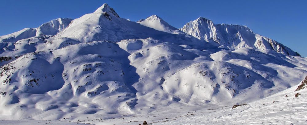
Cleaveland / Feather Traverse
A nice look with few technical challenges, and great views
Ski Touring Moderate
- Distance
- 17 km
- Ascent
- 1.6 km
- Descent
- 1.6 km
- Duration
- 1 day +
- Low Point
- 940 m
- High Point
- 1.8 km
- Gradient
- 32˚

This is a popular ski touring route which is generally considered to be moderate. It's very remote, it features medium exposure (e2) and is typically done between January and April. From a low point of 940 m to the maximum altitude of 1.8 km, the route covers 17 km, 1617 vertical metres of ascent and 1617 vertical metres of descent. You'll need rope, skins, crampons and glacier kit to complete it safely.
Description
A glacial circumnavigation of Cleveland and Feather Peak
Difficulty
Moderate
Slopes become slightly steeper at around 25-30 degrees.
Medium Exposure (E2)

As well as the slope itself, there are some obstacles (such as rock outcrops) which could aggravate injury.
Remoteness

Little chance of being seen or helped in case of an accident.
Best time to visit
Features
- Ski Safari
- Ski Mountaineering
Equipment required
- Rope
- Skins
- Crampons
- Glacier kit