2 km away
Garibaldi Neve and The Barrier
A classical glacial traverse in the Sea to Sky
Moderate Ski Touring
- Distance
- 37 km
- Ascent
- 1.7 km
- Descent
- 2.1 km
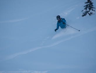
Well follow this general run on the way down
Ski Touring Easy

This is a popular ski touring route which is generally considered to be easy. It's not remote, it features low exposure (e1) and is typically done between November and April. From a low point of 1.4 km to the maximum altitude of 1.6 km, the route covers 828 m, 0 vertical metres of ascent and 136 vertical metres of descent. You'll need skins to complete it safely.

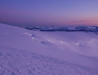
No overhanging avalanche terrain, stays bellow 25 degrees. I take no responsibility for this route, use at your own risk. Picture from the top of the run.
Easy
Wide gentle slopes at around 20 degrees or less.

Exposure is limited to that of the slope itself. Getting hurt is still likely if the slope is steep and/or the snow is hard.
Close to help in case of emergency.
2 km away
A classical glacial traverse in the Sea to Sky
Moderate Ski Touring
2 km away
Beginner Friendly Ski Touring
Easy Ski Touring
6 routes · Ski Touring