Flatiron East Face
A stunning journey to a beautiful ski face
Ski Touring Difficult
- Distance
- 11 km
- Ascent
- 1.2 km
- Descent
- 1.2 km
- Duration
- 5-6 hrs
- Low Point
- 1.2 km
- High Point
- 1.9 km
- Gradient
- 35˚

With views for days and some superb skiing, this is a classic Coquihalla tour. At the time of writing (early 2023) there was significant work going on at the Pass, so the parking situation going forward isn't clear - we parked on the north side of the highway and walked through an underpass to access the tour, but a new parking area might be created in future.
- •
- •
- •
- •
Description
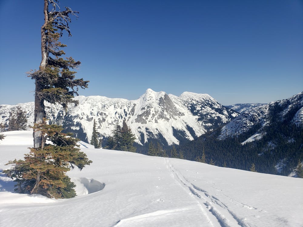
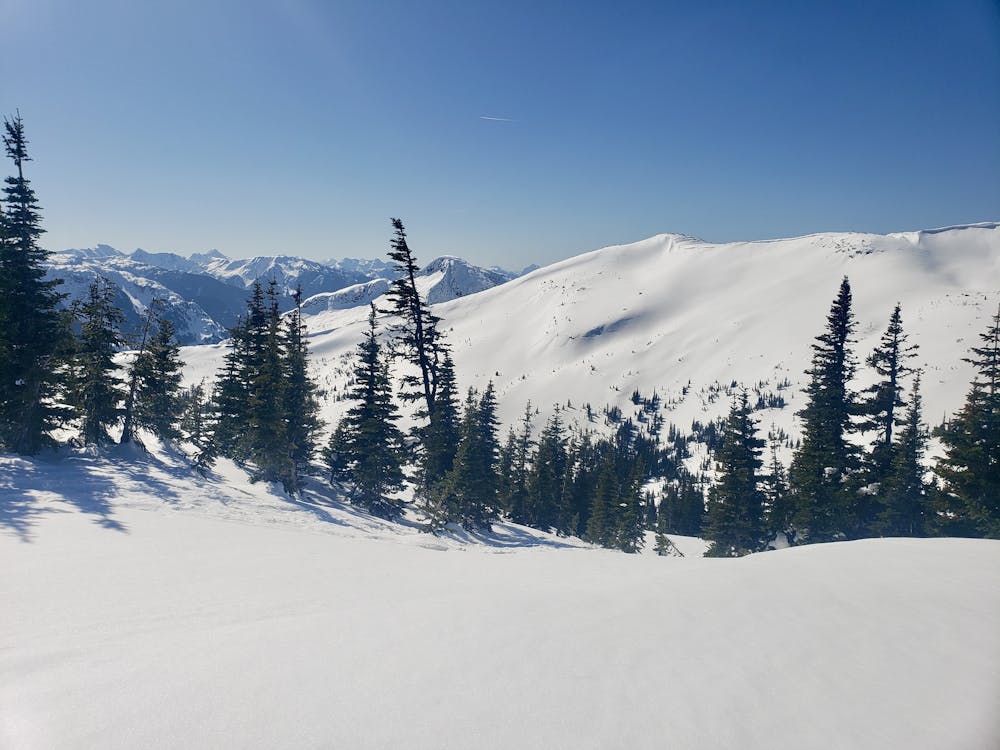
Regardless of where you park it's a short walk to the foot of the well-signposted Needle Peak Trail, which the initial part of this tour follows. In summer the trail is a well-trodden path and in winter it's still made clear by the reflective orange signs which are nailed to trees all along it. Work your way up, following the signs and taking the easiest possible line between them, to access the open and breathtakingly scenic ridge below Needle Peak's north face.
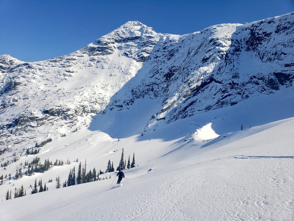
When the ridge meets Needle's rocky west ridge, rip skins and make a fun descent down into the broad valley beneath Flatiron Mountain's east face. Put skins on again and climb the face - joining a ridge for the final section of the ascent - to reach Flatiron's spectacular south ridge. It's possible to skin along the ridge and tag Flatiron's summit (which is marked by a conical weather station) but the best skiing lies at the southern end of the face. The line we've shown is amazing and takes you down a blast-able face then a fun gully and finally a beautiful section of tree skiing.
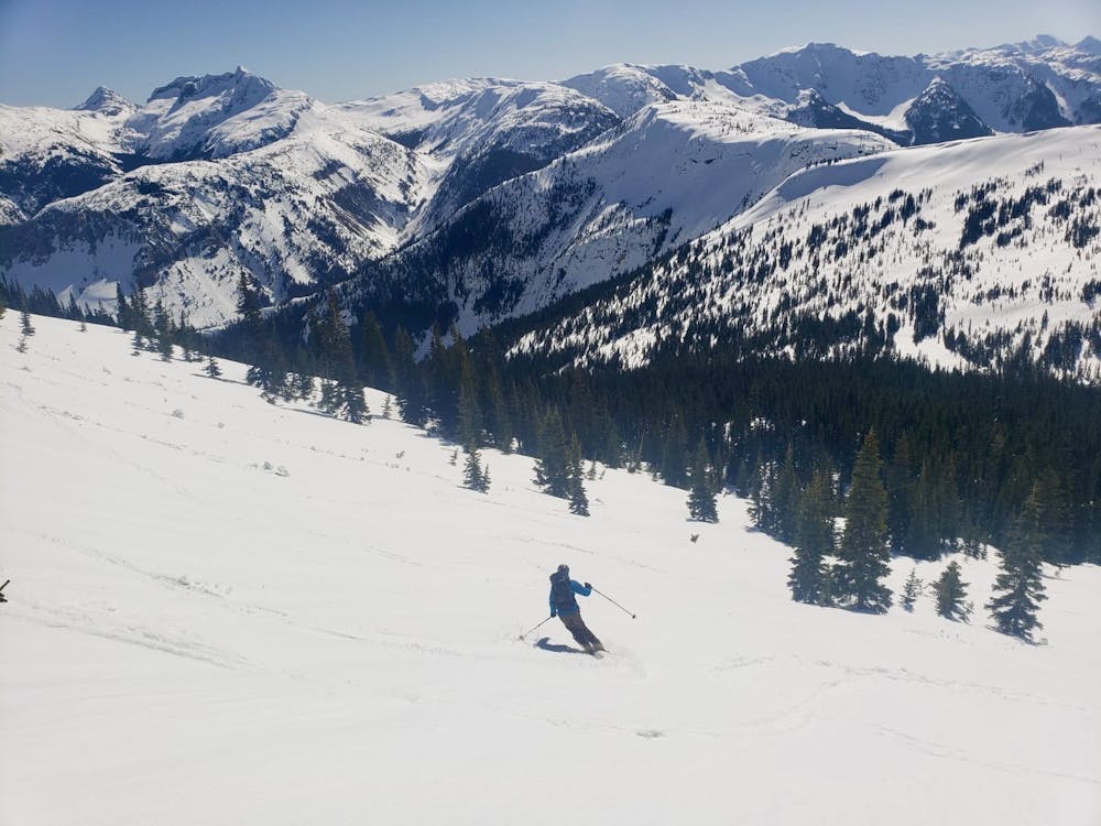
Apply skins for a final time and reascend back to the top of the first skin, right below Needle's west ridge. Take skins off and either follow the ascent route down or take the more adventurous option and follow the line here down to the creek north of Needle Peak. There are some large cliffs blocking access to the creek, but these can be skirted to the north via some fun - and occasionally tight - trees. If in doubt, keep pushing left as you descend to the creek and then, once at it, follow it all the way down to the Coquihalla. The upper section of the creek isn't really steep enough to ski down so you'll need to shuffle/pole/sidestep a bit, but lower down you can glide along without too much effort.
If you decide to take the more adventurous option and head down to the creek, there needs to be plenty of snow so that the creek is covered and not too open. As such, it's a better option later in the season than right at the start, doubly so because you won't be able to keep moving down the creek if it's covered in deep powder. Save it for a spring day when the snow is running fast and you're feeling adventurous!
Difficulty
Difficult
Serious gradient of 30-38 degrees where a real risk of slipping exists.
Medium Exposure (E2)

As well as the slope itself, there are some obstacles (such as rock outcrops) which could aggravate injury.
Remoteness

Little chance of being seen or helped in case of an accident.
Best time to visit
Features
- Bowl
- Face
- Alpine
- Tree Skiing
Equipment required
- Skins