Ronayne North Couloir
An interesting early season line before the roads snow in!
Ski Touring Difficult
- Distance
- 4.7 km
- Ascent
- 832 m
- Descent
- 833 m
- Duration
- 3-4 hrs
- Low Point
- 1.4 km
- High Point
- 2.2 km
- Gradient
- 51˚

The north side of Ronayne is accessed via the Tenas Creek Logging Road. Good timing is required to drive to the top of the road in early season when it hasn't become too snow covered but the ski line has enough snow to be skiable. Otherwise, it's sled access on the road.
Description
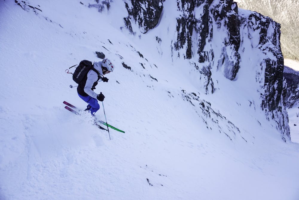
From the end of the road, head up the climbers left edge of the cutblock. Near the top, a faint trail heads south into the forest towards Tenas Creek. Follow the north side of the creek until a large boulder forms a bridge right below the main couloir. Climb the apron and then into the couloir. The climber's right fork is easier with less rocks. A smaller couloir gets you to the summit ridge.
You can descend either route, either reversing down the ascent or by the left side branch which is guarded by a cornice that is usually passable on the far skier's right side. Be aware of rock chokes on this side in early season.
Ronayne is a quick hit if you've got a decent truck or sled but that means you're also quickly in serious terrain. It's not the steepest line but a fall could be bad and there's definitely potential for wind slabs and cornice issues so choose conditions wisely. The destructive force of avalanches out of the couloir is visible as you cross the creek where trees have been blasted back uphill. More mellow slopes exist to the west however you still have significant exposure to avalanche along the approach.
Difficulty
Difficult
Serious gradient of 30-38 degrees where a real risk of slipping exists.
Medium Exposure (E2)

As well as the slope itself, there are some obstacles (such as rock outcrops) which could aggravate injury.
Remoteness
Away from help but easily accessed.
Best time to visit
Features
- Alpine
- Couloir
- Single Descent
- Ski Mountaineering
Equipment required
- Skins
- Ice axe
- Crampons