2.6 km away
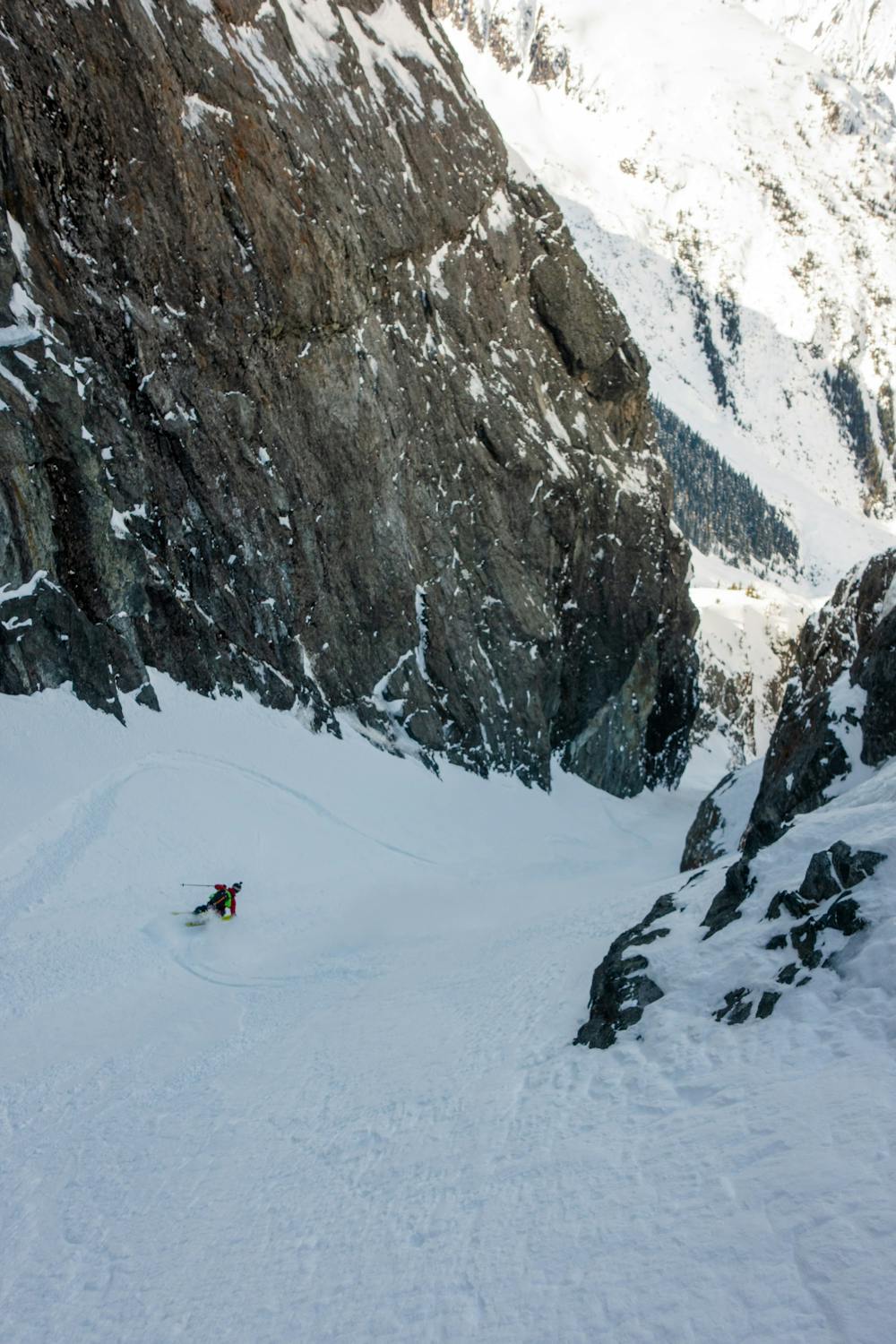
The Cook Wiggle
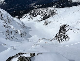
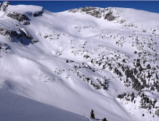
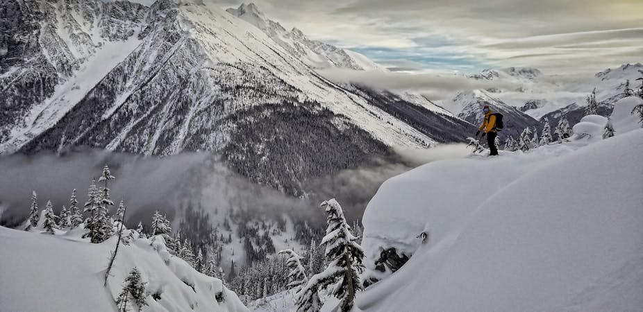
Steep ski line on the north face of Mt. Cook in Garibaldi Provincial Park
Severe Ski Touring
- Distance
- 501 m
- Ascent
- 0 m
- Descent
- 439 m
An epic adventure deep into the Garibaldi Provincial Park
Ski Touring Severe

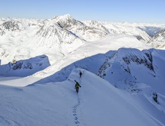
Mt Neal was named after the early 1900’s adventurer Neal Carter who was the first ascentionsist of many local classics like Wedge, Blackcomb, James Turner and many more. The Chasm Couloir sits half way down a north facing bowl, discreetly tucked away from view due to its angled nature on the shoulder of this historic peak. We believe this line has never been skied before. Likely not because of the difficulties of the line itself, but because of the inability to access garlibaldi park via helicopter. Plus the remoteness and lack of clear visibility of the line without the aid of a 3D mapping tool like FATMAP.
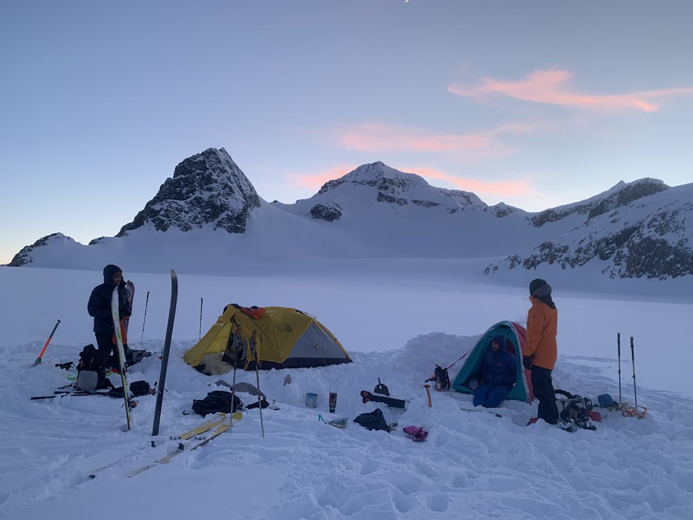
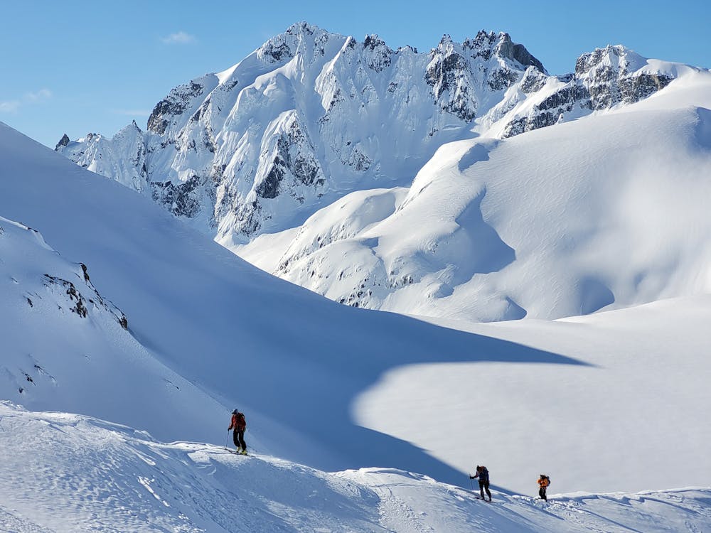
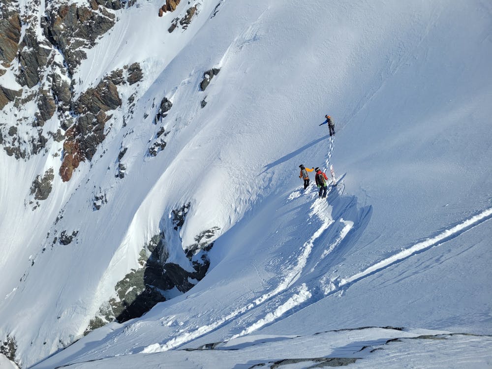
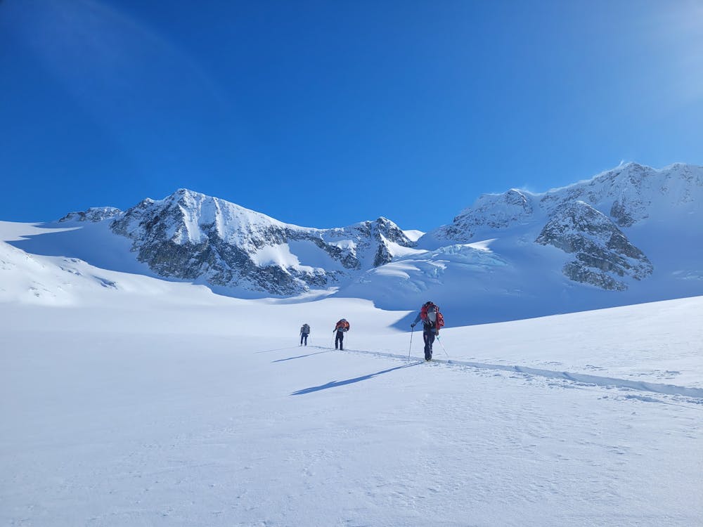
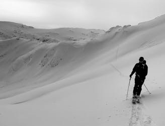
We had three days of beautiful weather and low avalanche condtions in the alpine ahead of us. We took our time to our basecamp on the Weart Glacier where we spent a beautiful night under the stars. Day two started under headlamp so we could arrive at Mt Neals East facing col as early as possible. After skiing the Needles Glacier, we had the option of either a low angle approach to the col around the south and east side of Mt Neal but with substantially more distence. Or cross the shorter and more direct East and North face. Given the exposure it would give us to the aspect we were looking to ski and the current avalanche conditions, we chose the latter.
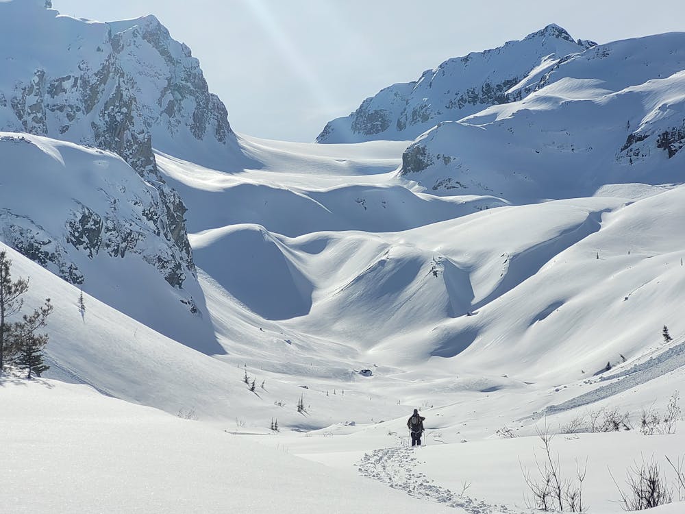
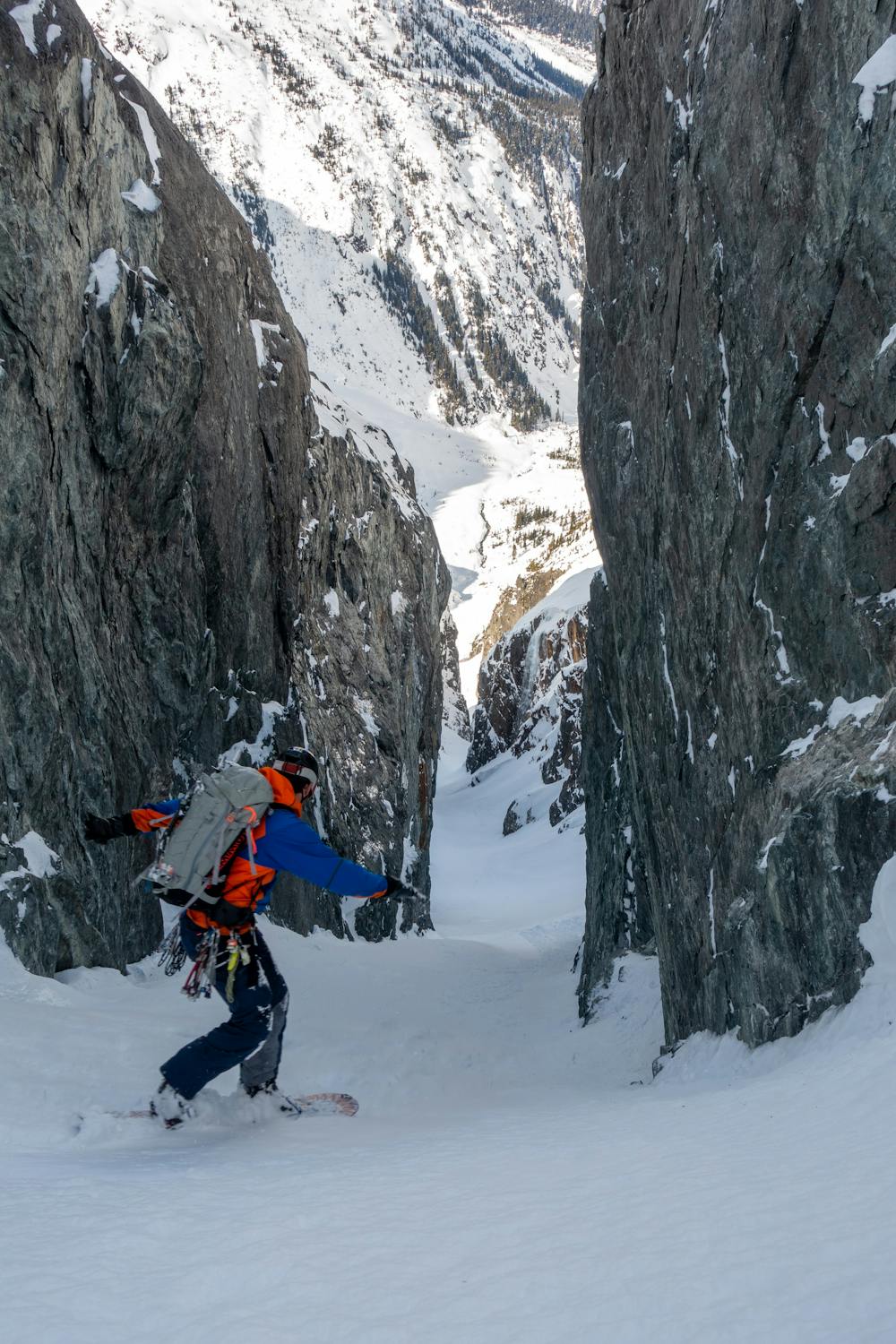
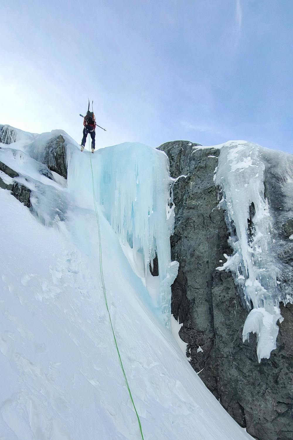
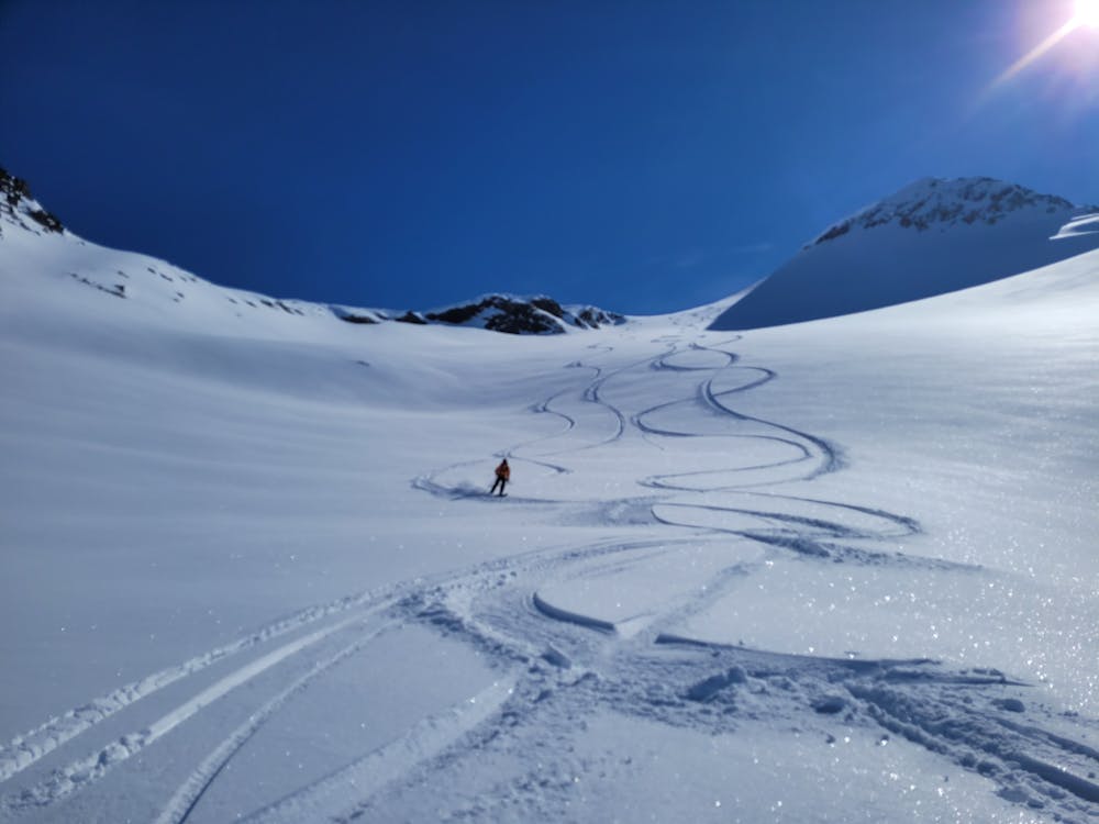
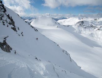
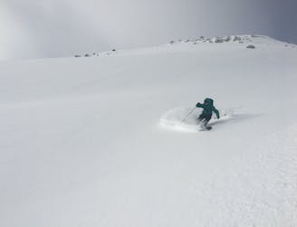
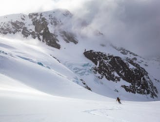
Once we arrived at the East facing col, the suns warming had heated the snow more than we had anticipated. With a looming 850m cliff face below, we deemed that approach inaccessable. As a backup we opted for an alternative scramble route up a rocky south facing ridge to the summit of Mt Neal. This proved to be successful. From the summit, we skied a short North face into a beautiful low angle powder bowl right into our unknown Chasm Couloir. Guarding the Couloir was an unknown entrance. So we brought an assortment of gear to tackle any sort of rappel. In the end we found thick ice to make a V-thread. From this we rapelled over a short waterfall to the head of the Couloir. Having approached a similar aspect, we expected to find excellent quality snow. The Couloir held deep snow that allowed us to open up turns up untill the apron which had smatterings of avi debris. The exit was a straight shot back to camp up a deep, unnamed valley past the East facing vertical walls on the backside of Oasis Mountain.
The Chasm Couloir provided so many unique challenges to overcome and gave us opportunity to deal with problems as they arose, like alternative routes and unknown rappels. It was a truly unique experience in our local mountain range.
Severe
Steep skiing at 38-45 degrees. This requires very good technique and the risk of falling has serious consequences.

As well as the slope itself, there are some obstacles (such as rock outcrops) which could aggravate injury.

Little chance of being seen or helped in case of an accident.
2.6 km away
Steep ski line on the north face of Mt. Cook in Garibaldi Provincial Park
Severe Ski Touring
5.5 km away
A Whistler classic steep ski line not to be underestimated!
Difficult Ski Touring
8.9 km away
Entry Level Steep Skiing
Severe Ski Touring
9 km away
An excellent loop through the Blackcomb backcountry with no glacier travel required.
Moderate Ski Touring
9 km away
An excellent first glacier travel experience in the Blackcomb backcountry
Moderate Ski Touring
9.1 km away
An high value introduction to the Spearhead and Phalanx Glaciers
Moderate Ski Touring
9.2 km away
Whistler’s backcountry ski tour rite of passage, taking you through some of the most impressive ski terrain on the continent.
Difficult Ski Touring
7 routes · Ski Touring
4 routes · Ski Touring