5.4 km away
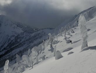
Qua Lake Trees
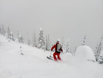
Excellent steep tree skiing which is possible in bad visibility
Severe Ski Touring
- Distance
- 7.1 km
- Ascent
- 908 m
- Descent
- 907 m
The longest descent in the Whitewater slackcountry makes for an epic run.
Ski Touring Difficult

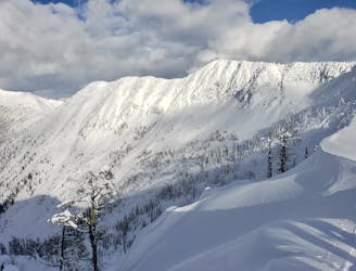
Standing on top of Ymir peak, you will be looking down on a big bowl with 700 meters vertical elevation and endless ski line choices. On a bluebird day this is an epic descent!

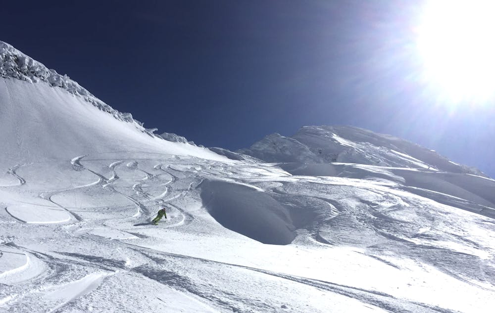
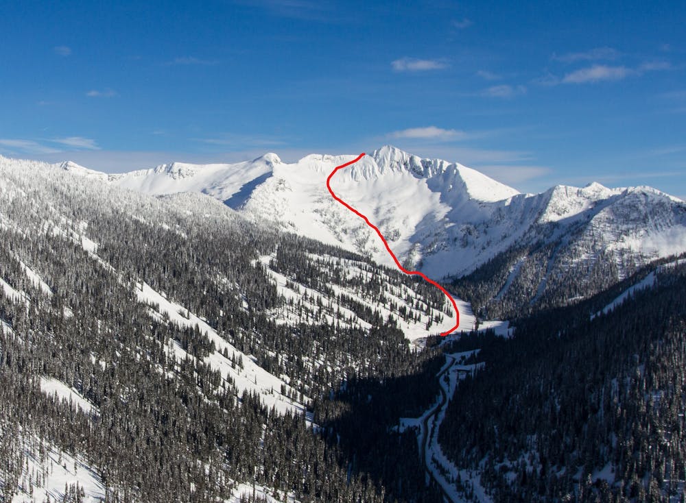
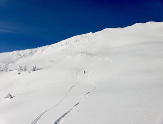
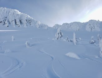
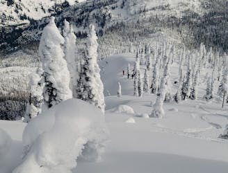
There is a big variety in the terrain: you can choose between mellow open slopes, steeper gullies, or gladed tree areas.
There aren't many cliffs or dangerous areas to watch out for. However, the terrain is not avalanche controlled, and avalanches of up to class 3 are quite frequent. That being said, you can still find a line through the trees and pick less steep slopes to reduce the avalanche exposure. The bowl is west facing, which means the snow might see some sunlight during the afternoon.
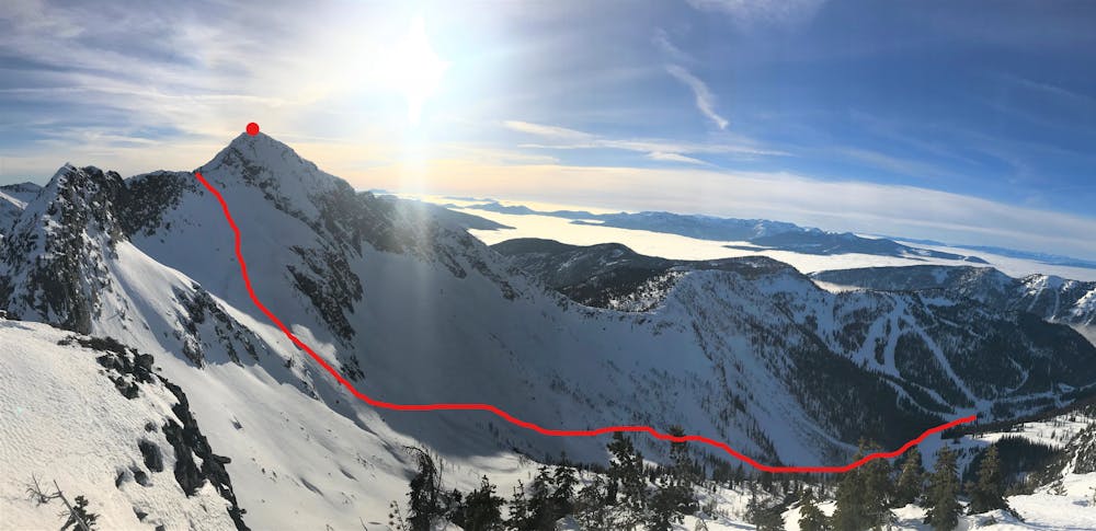
Start by taking the Summit chairlift and go left at the top. Follow the Catch basin ski track approximately 400 meters until you reach the beginning of the skin track.
The difficulty level of the skin track is easy to intermediate depending on the current snow conditions, It's an approximately two-hour journey, taking you through trees and up to a saddle. The saddle provides an alternative drop-in point in case you want a shorter day. From the saddle, the track gets a bit steeper until you reach Ymir peak, which will be the end of the ascent.
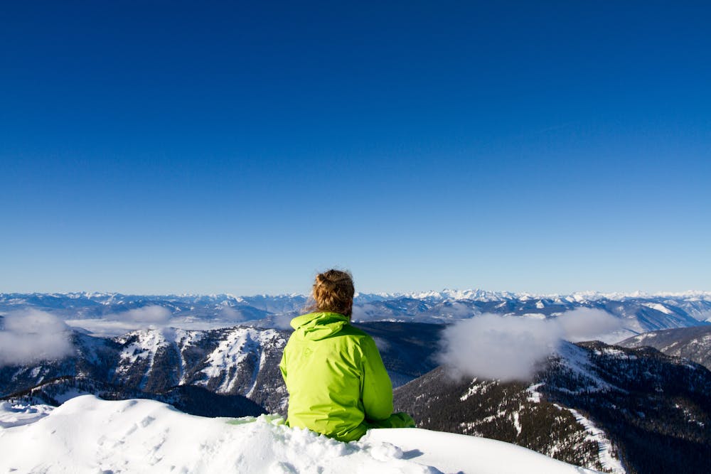
Once you reach Ymir Peak, stop for a longer snack break and enjoy the 360-degree view of the Selkirk Range before starting the descent.
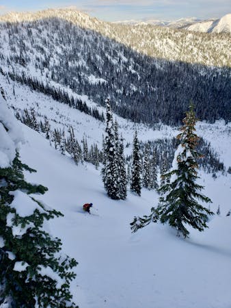
Start the descent by traversing around the peak on the east side. Once on the ridge facing west, keep skier's right to stay clear of the cliff band. When past the cliffs you can ski pretty much everything you see. The choices are many and wherever you choose to ski you will be rewarded!
Keeping skier's left will take you to terrain that's in relatively consistent shade. Keeping right will take you on mellower slopes with less tree cover. Following the fall line will take you through gladed trees and steeper chutes.
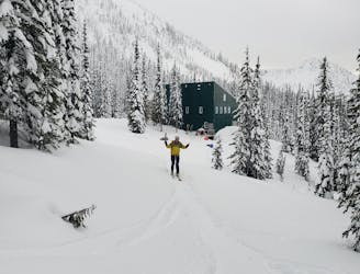
By the end of the run, you'll reach a flat section where some pole pushing is required until you get back in-bounds. Head down to the lodge and treat yourself to an infamous Glory Bowl!
Difficult
Serious gradient of 30-38 degrees where a real risk of slipping exists.

In case of a fall, death is highly likely.
Little chance of being seen or helped in case of an accident.
5.4 km away
Excellent steep tree skiing which is possible in bad visibility
Severe Ski Touring
5.4 km away
Alpine-esque terrain down a stunning open bowl
Difficult Ski Touring
5.4 km away
An epic journey around a wild peak which takes in some exceptional tree skiing
Difficult Ski Touring
5.4 km away
A fun little trip up the scenic peak behind the Ymir Lodge
Difficult Ski Touring
5.4 km away
A beautiful steep face which can lapped all day
Difficult Ski Touring
5.4 km away
A logical and remote-feeling loop around a prominent peak
Difficult Ski Touring
5.4 km away
A fabulous journey culminating in a long descent
Difficult Ski Touring
7 routes · Ski Touring