1.1 km away
Hanes Valley Loop
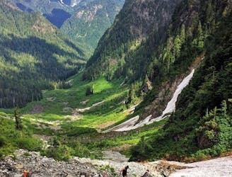
Complete loop of Lynn Valley and Hanes Valley.
Difficult Trail Running
- Distance
- 25 km
- Ascent
- 1.6 km
- Descent
- 1.6 km
out + back on the BP main sections.
Trail Running Moderate

This is a popular trail running route which is generally considered to be moderate. It's not remote, it features low exposure and is typically done between March and November. From a low point of 152 m to the maximum altitude of 709 m, the route covers 26 km, 1509 vertical metres of ascent and 1484 vertical metres of descent.

Parts of the BP
Moderate

The path is on completely flat land and potential injury is limited to falling over.
Close to help in case of emergency.
1.1 km away
Complete loop of Lynn Valley and Hanes Valley.
Difficult Trail Running
5.7 km away
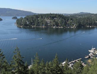
Quick trail run along Deep Cove to the Quarry Rock
Moderate Trail Running
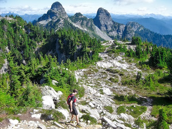
6.1 km away
THE classic Vancouver hike!
Difficult Trail Running
3 routes · Trail Running

4 routes · Trail Running

7 routes · Hiking · Trail Running